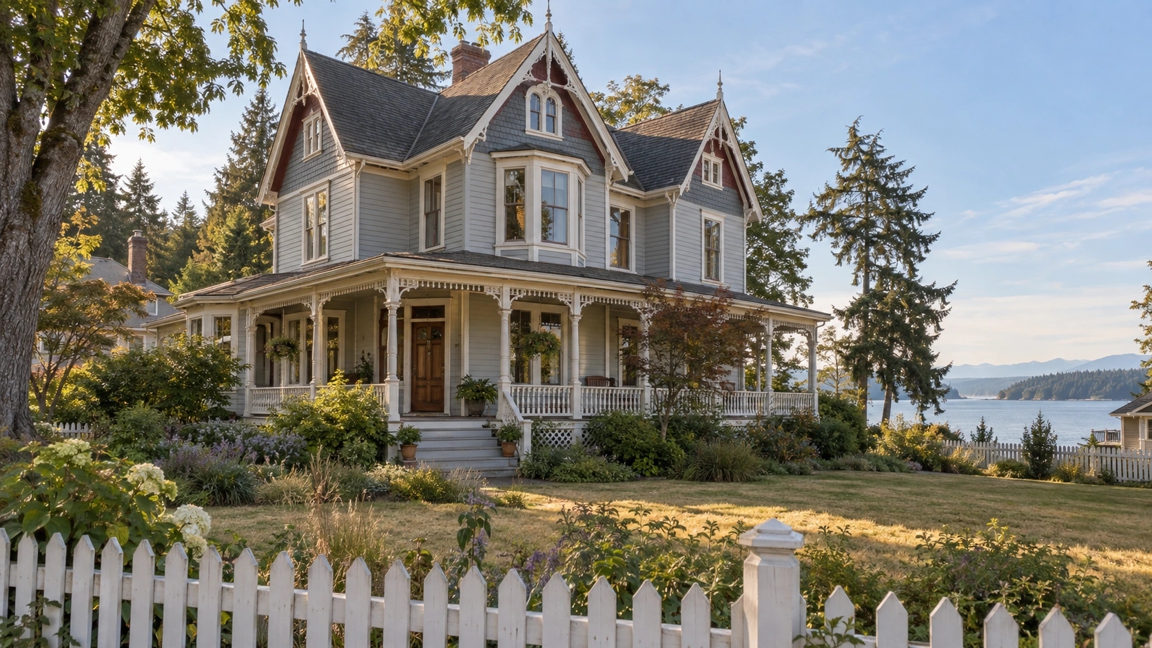
Real estate tips and guides for Cloverdale, Langley and South Surrey

Cloverdale, Langley & South Surrey, BC

Everything I've written for buyers and sellers in Cloverdale, Langley and South Surrey — market updates, buyer and seller tips, and guides to the neighbourhoods I work in. If you've got a question this doesn't answer, ask me directly and I'll help you find it.

RSS

What Homes Cost in Elgin Chantrell, South Surrey, BC

Elgin Chantrell, South Surrey, BC has no published benchmark price of its own and never has. The Fraser Valley Real Estate Board reports South Surrey & White Rock as one zone covering the City of White Rock and all eight Surrey sub-areas. What can be known is the housing mix here and what it does to a budget.

Start with what nobody publishes

Most pages answering this question open with a number, and that number is almost always an estimate wearing the clothes of a statistic.

The Fraser Valley Real Estate Board publishes MLS® Home Price Index benchmarks for a fixed list of reporting zones. South Surrey & White Rock is one of them — a single zone, undivided. There is no benchmark for any neighbourhood inside it, including this one, and there never has been. So there is no sub-area figure below, because producing one would mean inventing it: not a range, not an adjusted number, not a "typically around". What follows is the published zone data with its date attached, an honest account of how badly it fits these streets, and the part that actually moves a budget here.

What the published benchmarks actually cover

These are the published MLS® HPI benchmark prices for the South Surrey & White Rock zone, from the Fraser Valley Real Estate Board's August 2026 statistics package. They are zone-wide — the City of White Rock plus all eight Surrey sub-areas, blended into one figure per segment.

SegmentBenchmark1-year change
Composite$1,010,000−7.2%
Detached$1,649,200−7.5%
Townhouse$820,300−11.1%
Apartment$550,800−6.2%

August 2026 is the most recent reporting month the board has published, so an August figure quoted to you does not exist yet. This zone sits at the top of the board's table on both composite and detached — $1,010,000 composite against Cloverdale's $930,900, Langley's $948,600, Surrey-Central's $912,700 and North Surrey's $640,800 — and its townhouse segment, at −11.1%, is the weakest-performing townhouse segment in that table.

For the market those figures sit inside: the Fraser Valley recorded 941 MLS® sales in August 2026, up 1% year over year, at a sales-to-active-listings ratio of 10%, against the 12% to 20% the board describes as balanced. Prices are down across every zone and property type. That is a condition, not a deadline.

Why the zone figure is a poor proxy for these streets in particular

This is the most useful thing this post can tell you, and the part every competing page skips.

An HPI benchmark is built from the stock that actually trades across a zone. The South Surrey & White Rock zone contains waterfront apartments, low-rise condo stock, townhouse complexes and serviced detached subdivisions on standard suburban lots, and those are the great majority of what changes hands. The typical property in Elgin Chantrell, South Surrey, BC is none of those. It is a large detached house on a half-acre-plus lot, frequently treed or backing onto greenbelt, built through the 1980s and 1990s, sometimes on land measured in acres rather than square feet.

An index built largely on serviced suburban stock is not measuring the same asset as an estate property on half an acre or more — land quantity, servicing, permitted use and maintenance profile all differ. So the zone number is not this area's number plus a premium, and not this area's number minus a discount either. It is not measuring the same thing, in either direction, and no adjustment turns one into the other.

Treat the $1,649,200 detached benchmark for what it is: a reading on which way the wider market across the City of White Rock and the eight Surrey sub-areas is moving. Useful for direction, unreliable for valuing a specific property here. Anyone quoting a precise Elgin Chantrell average, or a lot-size-adjusted version of the zone number, is quoting arithmetic they did themselves.

The housing mix that sets your budget here

The land is a large share of the value

The stock in Elgin Chantrell, South Surrey, BC is predominantly single-family detached — large houses, some on gated or acreage-sized lots, with lot sizes running from about half an acre to several acres. Elgin Pointe is one of the named gated communities inside it.

That reorders the budget conversation. In a serviced subdivision you are largely buying a house and the lot is a modifier; here the land is frequently the larger share of the value and the house is the modifier. Two properties a few hundred metres apart off Crescent Road can present almost identical square footage indoors and differ substantially in what they cost, because one sits on half an acre of level cleared ground and the other on two acres of it. Forest adjacency does the same work: a lot backing onto trees rather than onto another fence is priced differently from an otherwise identical house mid-block.

The stock is decades old, and that belongs in the budget

Development here happened primarily through the 1980s and 1990s. The landscaping has grown in and there is no next phase waiting at the end of the street — but a house built in 1988 or 1994 at this scale carries a roof, windows, drainage, heating and a service panel all decades into their working lives. Read the inspection properly and price the next ten years of maintenance into an offer rather than discovering it in year two. On a house this size, the gap between renewed systems and unrenewed ones is a five-figure line, and it shows up in no index.

There is very little else to buy

The dominant form here is a detached house on a large private lot. Some strata-titled properties exist in the mix, but they are the exception rather than a parallel market. So the $820,300 townhouse benchmark and the $550,800 apartment benchmark, as of August 2026, describe product that mostly sits elsewhere in the zone — in the City of White Rock and the denser Surrey sub-areas. A buyer whose budget lands near either figure is looking at a different part of South Surrey, BC, and waiting does not change that: the inventory does not exist to be waited for.

Zoning and land status are parcel-specific

Larger parcels in this part of South Surrey, BC can carry conditions a standard suburban lot does not, and some land on the peninsula sits inside the Agricultural Land Reserve. What a specific parcel permits is settled by the City of Surrey's zoning, by the Agricultural Land Commission where ALR status applies, and in writing by a real estate lawyer before subjects come off. It can change what a property is worth to a particular buyer.

Where it sits, and what location does to the number

Neighbourhood profiles place Elgin Chantrell, South Surrey, BC roughly between King George Boulevard on the east and 140 Street on the west, south to about 20 Avenue, west again toward 128 Street, and north to Crescent Road. Treat those as directional: no City of Surrey planning map draws this boundary, so whether a listing is "in" it can depend on which brokerage drew the line. Buy the parcel and its zoning, not the marketing label.

Two location factors reliably show up in what a property here trades for. The first is Crescent Park — over 128 acres of mature second-growth forest with trails, streams and meadows, sitting inside the neighbourhood rather than at its edge. Access to it is a priced amenity, and a large part of why buyers choose these streets.

The second is arterial position. King George Boulevard is the north–south spine on the eastern side and carries most trips out of the area; Crescent Road runs west toward the water. Convenient access and road exposure are the same fact from two sides, and both land in the price. There is no SkyTrain in this part of South Surrey, BC and no retail strip inside the neighbourhood, so a vehicle belongs on the carrying-cost side of a budget.

Who buys here and why

Buyers who focus on Elgin Chantrell, South Surrey, BC are shopping for land and privacy more than for a house type, because the stock is overwhelmingly large detached homes on half-acre-plus lots with very little townhouse or apartment inventory to fall back on.

In practice that means people who have already decided the lot is the point: buyers who want a private, treed property with a large forested park inside the neighbourhood, are content to drive for groceries and everything else, and are comfortable with upkeep, because half an acre of lawn, hedging and mature trees is a standing commitment in weekends or in what you pay someone else.

What surprises them is the variability. In a subdivision, three houses on one street price within a narrow band. Here they may not, because usable land, tree cover, road exposure, gated access and how much of the house has been renewed since the 1990s all pull in different directions on one block.

What actually sets the price on a specific property

The variables that move the number here are not the ones that move it in a subdivision.

Usable land, not just lot size. Total acreage is the headline; how much is level, dry and cleared is the price.

Tree cover and greenbelt position. Mature trees cut both ways — privacy on one side, maintenance and light on the other.

What has been renewed since the build. On 1980s and 1990s stock at this scale, roof, windows, drainage and mechanical systems are the swing factor between two houses of the same size.

Zoning and land status on that exact parcel. Confirmed for the legal description, never assumed from a neighbour's setup.

Arterial position. Access to King George Boulevard and Crescent Road is convenience and exposure at once.

None of those appear in a zone-wide benchmark. All of them appear in comparable sales of similar properties on similar lots, which is what a real valuation is built from.

Getting a real number

If you want to know what a specific property here is worth, that is a conversation about recent comparable sales on comparable lots — on land this variable, the only version of the question worth answering. In the meantime you can browse Elgin Chantrell homes for sale, or widen it to South Surrey and White Rock, BC homes for sale, which covers every neighbourhood in the zone.

Frequently Asked Questions

Is there a published benchmark price for Elgin Chantrell, South Surrey, BC?

No. The Fraser Valley Real Estate Board publishes MLS® Home Price Index benchmarks for the South Surrey & White Rock zone as a whole — one zone covering the City of White Rock and all eight Surrey sub-areas — and has never broken out a benchmark for any neighbourhood inside it. Any precise figure quoted to you for this area is someone's estimate, not a published statistic.

What were the August 2026 zone benchmark prices covering Elgin Chantrell, South Surrey, BC?

As of August 2026, the FVREB benchmarks for the South Surrey & White Rock zone are $1,649,200 detached, down 7.5% year over year; $1,010,000 composite, down 7.2%; $820,300 townhouse, down 11.1%; and $550,800 apartment, down 6.2%. Those are zone-wide figures spanning the City of White Rock and all eight Surrey sub-areas together. Board-wide, the Fraser Valley recorded 941 MLS® sales in August 2026, up 1% year over year, at a sales-to-active-listings ratio of 10% against a balanced range of 12% to 20%.

Why is the zone benchmark a poor guide to an estate property in Elgin Chantrell, South Surrey, BC?

Because the index is built largely from the serviced suburban stock that trades across the zone — apartments, townhouses and detached houses on standard subdivision lots — while the typical property here is a large detached home on a half-acre-plus lot built through the 1980s and 1990s. An index built on the first is not measuring the second, in either direction: not the zone number plus a premium, and not the zone number minus a discount.

Can you buy a townhouse or an apartment in Elgin Chantrell, South Surrey, BC?

Rarely. The area is predominantly single-family detached, with some strata-titled properties in the mix rather than a parallel townhouse or apartment market. The $820,300 townhouse and $550,800 apartment benchmarks as of August 2026 describe product that mostly sits elsewhere in the zone, so a budget landing near either figure points to another part of South Surrey, BC or to the City of White Rock.

What makes two similar-looking properties in Elgin Chantrell, South Surrey, BC sell for different amounts?

Usable land rather than total lot size, tree cover and greenbelt position, how much of a 1980s or 1990s house has been renewed, what the zoning permits on that exact parcel, and position relative to King George Boulevard and Crescent Road. None appear in a zone benchmark; all appear in comparable sales of similar properties on similar lots.

How does the housing mix here position the area against the rest of the FVREB South Surrey & White Rock zone?

The zone is the most expensive of the Fraser Valley board's zones on both composite and detached benchmarks, and contains everything from waterfront apartments to new-build subdivisions. Elgin Chantrell, South Surrey, BC sits at the low-density end of that range: large detached houses on half-acre-plus lots, built through the 1980s and 1990s, with Crescent Park's 128 acres of forest inside the neighbourhood. An area made almost entirely of that product holds less inexpensive stock than the zone average implies — a statement about inventory, not a price quote.

Related Reading

About the Author

Caroline Jeklin received the Royal LePage President's Gold Award in 2025, placing her in the top 6–10% of agents in her local marketplace. She is a REALTOR® with Royal LePage Wolstencroft Realty, working from Cloverdale, Surrey, BC across the wider Fraser Valley, and between 2021 and 2026 she has been part of 57 transactions ranging from $302,000 to $4,200,000, as of August 2026. She wrote this one because an area with no published benchmark, and a housing type the zone index barely represents, is where invented numbers do the most damage. Read more about Caroline Jeklin, or reach her directly at 604-319-5052 or caroline@carolinejeklin.com.
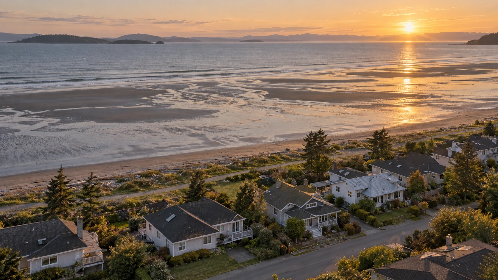
Read

What Homes Cost in Crescent Beach and Ocean Park, South Surrey, BC

No benchmark price is published for Crescent Beach, South Surrey, BC or for Ocean Park, South Surrey, BC. Both sit inside one MLS® listing area in the City of Surrey, BC, and that single label is doing a lot of quiet work — it blends a low-lying beach settlement on Boundary Bay with a bluff-top neighbourhood above it.

Why one listing area covers two different communities

The Fraser Valley Real Estate Board's listing area for this part of the Semiahmoo Peninsula is called Crescent Bch Ocean Pk. One string, one search field, one set of results.

Underneath it are two communities that do not resemble each other much.

Crescent Beach, South Surrey, BC is the low-lying beach settlement on Boundary Bay, bounded by water on three sides and by Beecher Street and Bayview Street to the south, reached by exactly two roads — Crescent Road and McBride Avenue — both crossing the BNSF Railway onto the peninsula.

Ocean Park, South Surrey, BC sits on the bluff above and behind it, running east to the boundary with the City of White Rock, BC, with tree-lined streets, larger detached homes, a City of Surrey development permit area guiding its housing character, and beach-access streets — Sullivan Street, Target Street — dropping toward the water.

That matters to a price question, not just a lifestyle one. Any average or "typical price" attached to this area was calculated across both: a small older cottage two blocks from the tide line and a custom bluff-top house on a large lot land in the same bucket, and the number that comes out describes neither. It is the single most useful thing to understand before you set a budget here.

What the Fraser Valley Real Estate Board actually publishes

The Fraser Valley Real Estate Board publishes its MLS® Home Price Index for a fixed list of reporting zones. The smallest one covering this area is the South Surrey & White Rock zone, and it has never been broken down further — no benchmark for Crescent Beach, South Surrey, BC, none for Ocean Park, South Surrey, BC, and none for any of the eight South Surrey sub-areas or for White Rock individually.

That is the state of the published data, and it has always been that way. So there is no sub-area figure here. Not an estimate, not an adjusted number, not a range, not a "typically around". A number invented for these streets would be worse than no number, because you would plan against it.

What is published, as of August 2026, is this. These are zone-wide figures spanning the City of White Rock and all eight South Surrey sub-areas — not a number for Crescent Beach or Ocean Park.

SegmentBenchmark, August 20261-year change
Composite$1,010,000−7.2%
Detached$1,649,200−7.5%
Townhouse$820,300−11.1%
Apartment$550,800−6.2%

August 2026 is the most recent month the board has reported; a September figure for this zone does not exist yet.

Three pieces of context make that table more readable. South Surrey & White Rock is the most expensive of the board's zones — its composite of $1,010,000 sits above Langley at $948,600, Cloverdale at $930,900, Surrey-Central at $912,700 and North Surrey at $640,800 — and its detached benchmark of $1,649,200 is the highest in the table, and the only one of the board's benchmarks to rise month over month. Its townhouse segment, down 11.1% year over year, is the weakest townhouse segment anywhere in that table. And board-wide in August 2026 the Fraser Valley recorded 941 MLS® sales, down 14% from July but up 1% year over year, on a sales-to-active-listings ratio of 10% against a balanced range of 12% to 20% — a buyer's market by the board's own definition. I am naming the condition, not a deadline.

Why the gap between that table and your street is unusually wide

A zone benchmark tracks direction over time across a large, mixed pool of housing, and it does that well. It cannot describe a specific home on a specific street — and here, two layers of blending stack on top of each other. The zone spans a separate municipality and eight Surrey sub-areas: a waterfront cottage, a bluff-top custom home, a corridor apartment and an estate lot all sit inside that composite. Then the MLS® area beneath it blends two communities again. Most price questions get answered one level too coarse. Here they get answered two.

Which is why the honest answer is a description of the mix, plus comparable sales on the actual block. The first part is below; the second is a conversation about an address.

The housing mix, and what it does to a budget

Ocean Park, South Surrey, BC

Predominantly larger character and custom detached homes on tree-lined streets, with a small commercial strip along Beecher Street and the Ocean Park Village Shopping Centre covering everyday errands. Because it is detached product, the composite benchmark of $1,010,000 — a blend that includes the zone's townhouse and apartment inventory — is the least relevant line on the table for a buyer here. The detached benchmark of $1,649,200 describes the kind of home being sold, and even that is zone-wide across White Rock and eight sub-areas, not local.

One practical note that turns up after an accepted offer more often than before one: if you are buying with a plan to alter, extend or rebuild, confirm that development permit area's requirements for the specific property with the City of Surrey before subjects are removed. It is a phone call, and it occasionally changes what a lot is worth to you.

Crescent Beach, South Surrey, BC

Smaller-lot, older waterfront and near-waterfront housing on a peninsula with no direction to expand, which is why the lots are small and the stock is old — physical constraint, not planning preference.

Two things follow for a budget. Older near-waterfront housing carries older roofs, windows, drainage and service panels, so the next decade of maintenance belongs in your offer rather than in your second year. And the land itself is low-lying — a fact about the ground, not a criticism of the community, and one that belongs in due diligence: the City of Surrey for what applies to the property, a qualified inspector for the building, your insurer for what is covered.

What is not published for either community

Worth saying plainly, because several pages will tell you otherwise. There is no published detached, townhouse and apartment percentage split for this MLS® listing area, no published average lot size and no published construction decade for either community. Anyone quoting one of those has estimated it without saying so. The qualitative picture is solid: both communities are predominantly detached, in two different forms. That is enough to reason about a budget with. A fabricated percentage is not.

Who buys here and why

Buyers who focus on Ocean Park, South Surrey, BC are generally after a larger character or custom home on a bluff-top lot with conventional road access and a small village centre in walking distance, while buyers who focus on Crescent Beach, South Surrey, BC are choosing a small, physically contained beach community on Boundary Bay and taking the rail crossing as a permanent feature of getting home. They are shopping one MLS® listing area and two genuinely different decisions.

The mix selects for that. With almost nothing in the way of entry-level product in either community, the people who look here want a detached house near the water and have already decided the setting is what they are paying for. That includes buyers right sizing out of a larger Fraser Valley property — though on the Ocean Park side the product runs big, and that search sometimes takes longer than expected.

What this area does not offer is a low-cost way in. The zone's townhouse benchmark of $820,300 and apartment benchmark of $550,800 as of August 2026 describe inventory that mostly sits elsewhere in South Surrey, BC and in the City of White Rock, BC, not on these streets.

What sets the price of one home over another

Once you are looking at real listings rather than area figures, a handful of things move the number far more than any benchmark:

Which of the two communities it is in. As above. This is the variable the MLS® area label hides, and it is usually the largest one.

Position relative to the water. On the bay, a short walk from it, or on the bluff above it are three different propositions, priced as three different things.

Access. Everything in Crescent Beach, South Surrey, BC comes in and out over Crescent Road or McBride Avenue, both crossing the BNSF Railway at grade — the trade that keeps it quiet, since through traffic has nowhere to go. Ocean Park, South Surrey, BC has conventional road connections east toward White Rock, BC and north into the rest of South Surrey, BC, and Highway 99 carries most trips beyond the peninsula. There is no SkyTrain serving either community and none planned.

Condition and vintage. In older near-waterfront stock, homes that have had roofs, mechanicals and exterior finishes done separate sharply from those that have not.

What is next to it. Blackie Spit Park at the north end of Crescent Beach, at the mouth of the Nicomekl River, is a recognized Important Bird Area on the Pacific Flyway. 1001 Steps Park, at the foot of 128 Street, is the bluff-to-beach descent on the Ocean Park side. Proximity to either shows up in what people will pay, and neither appears anywhere in a benchmark.

Getting a real number for a specific address

If you want to know what a particular home is worth, that is a question about recent comparable sales on those streets — adjusted for which community it sits in, how it relates to the water, its condition and its access. A zone-wide index tells you which direction the market is moving; it cannot value a house. That work takes me an afternoon and costs nothing. In the meantime you can browse Crescent Beach and Ocean Park homes for sale, or widen it to South Surrey and White Rock, BC homes for sale.

Frequently Asked Questions

Why do listing sites quote one average price for Crescent Beach and Ocean Park, South Surrey, BC?

Because the Fraser Valley Real Estate Board groups both under a single MLS® listing area, named Crescent Bch Ocean Pk. Any average calculated from that area blends older, smaller-lot beach housing on Boundary Bay with larger bluff-top character and custom homes. The resulting figure describes neither community accurately, which is why it should not be used to set a budget.

What are the published South Surrey & White Rock benchmark prices as of August 2026?

The Fraser Valley Real Estate Board's MLS® Home Price Index benchmarks for that zone in August 2026 are $1,010,000 composite, down 7.2% year over year; $1,649,200 detached, down 7.5%; $820,300 townhouse, down 11.1%; and $550,800 apartment, down 6.2%. Those are zone-wide figures covering the City of White Rock, BC and all eight South Surrey sub-areas together.

Does a home in Crescent Beach, South Surrey, BC cost more than one in Ocean Park, South Surrey, BC?

There is no published figure that answers that, because neither community has a benchmark of its own and both sit inside the same MLS® listing area. What can be said is that they hold different housing: older, smaller-lot waterfront and near-waterfront stock on the beach side, and larger character and custom detached homes on the bluff. Comparing two specific properties is the only reliable way to compare the two.

Is there a published detached, townhouse and apartment split for Crescent Beach and Ocean Park, South Surrey, BC?

No. No verified percentage split is published for this MLS® listing area, and neither is an average lot size or a construction decade for either community. What is verifiable is that both are predominantly detached, in two different forms — older smaller-lot housing on the beach side and larger character homes on the bluff. Any percentage you are quoted for this area is an estimate.

How much of the South Surrey & White Rock decline applies to a detached home in Crescent Beach or Ocean Park, South Surrey, BC?

That cannot be answered precisely, because the 7.5% detached decline reported for August 2026 is measured across the whole zone rather than these two communities. It is still the most relevant published line for this area, since both communities are predominantly detached, and it is more useful here than the composite benchmark of $1,010,000, which blends in townhouse and apartment inventory that mostly sits elsewhere in the zone.

What actually sets the price of one home over another in Crescent Beach or Ocean Park, South Surrey, BC?

Which of the two communities it sits in, its position relative to Boundary Bay, its condition and vintage, and its access. Everything in Crescent Beach comes in over Crescent Road or McBride Avenue, both crossing the BNSF Railway at grade, while Ocean Park has conventional road connections and Highway 99 beyond. None of those variables appear in a benchmark, and all of them appear in comparable sales on the block.

Related Reading

About the Author

Caroline Jeklin received the Royal LePage President's Gold Award in 2025, placing her in the top 6–10% of agents in her local marketplace. She is a REALTOR® with Royal LePage Wolstencroft Realty, working from Cloverdale, Surrey, BC across the wider Fraser Valley, licensed in 2021 and part of 57 transactions between 2021 and 2026, ranging from $302,000 to $4,200,000, as of August 2026. She wrote this one because an MLS® area that covers two very different communities produces averages that read like precision and are not, and a buyer deserves to know which number is describing their house. Read more about Caroline Jeklin, or reach her directly at 604-319-5052 or caroline@carolinejeklin.com.
Read

What Homes Cost in White Rock, BC

White Rock, BC has no benchmark price of its own and never has. The Fraser Valley Real Estate Board reports it inside a zone that also covers eight South Surrey sub-areas. What can be answered honestly is that zone figure, the housing mix on this 5.17 square kilometre hillside, and what the age of the stock does to a budget.

Start with what is not published

Most pages answering this question hand you a single number for the city. It is worth knowing where that number comes from.

The Fraser Valley Real Estate Board publishes MLS® Home Price Index benchmarks for a fixed list of reporting zones. One of them is South Surrey & White Rock — a single reporting unit covering the entire City of White Rock plus all eight South Surrey sub-areas beside it. The board has never broken the city out on its own, and none of those eight sub-areas is reported separately either. There is no published benchmark for White Rock, BC, no historical one, and no month in which there was. The gap is in the data, and it applies to every neighbourhood on this peninsula.

So no city-only figure appears below. Not a range, not an "adjusted" number, not a "typically around". An invented number is worse than an honest blank, because a buyer will plan against it and a lender will not. What follows is the published zone figure with its date attached, and then the thing that actually determines what a home here costs: what got built, when, and what that means before an offer.

What the board actually publishes, August 2026

These are the MLS® HPI benchmark prices from the Fraser Valley Real Estate Board's August 2026 statistics package, for the zone as a whole. They are zone-wide figures, spanning the City of White Rock and all eight Surrey sub-areas together — not figures for these streets.

SegmentBenchmark1-year change
Composite$1,010,000−7.2%
Detached$1,649,200−7.5%
Townhouse$820,300−11.1%
Apartment$550,800−6.2%

Three things in that table are worth reading slowly.

The date. August 2026 is the most recent month the board has reported. Any August figure quoted for this area does not exist.

The zone is the board's most expensive. At $1,010,000 composite it sits above Langley at $948,600, Cloverdale at $930,900, Surrey-Central at $912,700 and North Surrey at $640,800, and its $1,649,200 detached benchmark is the board's highest as well. Buyers arriving from elsewhere in the Fraser Valley should expect that gap.

The townhouse line is the weakest townhouse segment on the board. Down 11.1% over the year, the zone's townhouse segment has fallen further than any other townhouse segment the board reports — further than Cloverdale at −6.4%, Surrey at −5.9% and Langley at −5.0%.

For the market these sit inside: the Fraser Valley recorded 941 MLS® sales in August 2026, up 1% year over year, at a sales-to-active-listings ratio of 10%. The board considers 12% to 20% balanced, with prices declining across every zone and property type. That describes the condition, not a deadline.

The housing mix that sets a budget here

This matters more than the zone average, because that average describes a mix this city does not have.

White Rock, BC is small, built out and vertical by the standards of everything around it — Semiahmoo Bay up to North Bluff Road at 16 Avenue, bounded by Bergstrom Road at 136 Street on the west and Stayte Road at 160 Street on the east, inside 5.17 square kilometres. There is no greenfield left, so anything new replaces something already standing.

The result is a market weighted toward apartments. On listing-site snapshots — a picture of what happens to be for sale on a given day, not board data and not a count of what exists — apartments make up the largest share of active inventory here, detached houses most of the remainder, and townhouses only a small slice. That is directional, not statistical, and the direction is the useful part: a buyer shopping this city is mostly shopping apartments.

Concrete and low-rise buildings with ocean views cluster near Marine Drive and the streets immediately above it. Older detached character homes sit further up the hill, on lots subdivided to the standards of their own era rather than today's.

That mix has a direct budget consequence. In a market made mostly of apartments, the zone composite of $1,010,000 — blending detached, townhouse and apartment sales across nine areas — is the least useful line on the table for most buyers here. The apartment benchmark of $550,800 describes the segment most of this city's sales sit in, and even that is a zone figure, not a local one. On the hillside the reverse holds: detached stock sits in the segment carrying a $1,649,200 zone benchmark, in a city where the lots are finite and were drawn decades ago.

Why building age is the price question nobody writes about

This is what almost every page about this market leaves out, and it changes what an apartment is worth more than any average will.

A large share of the low-rise apartment stock in White Rock, BC dates from the 1960s and 1970s, with older buildings behind that and newer concrete construction nearer the water. That describes the stock; it is not a criticism. Plenty of these buildings are well run, well reserved and on the best land in the city.

But age drives the questions that decide whether a unit is priced correctly:

The depreciation report. It projects the cost and timing of major component replacement. Its numbers, and how recently it was updated, tell you what is coming.

The contingency reserve fund. Its balance, measured against what the depreciation report says is due, is the difference between a planned replacement and a special levy.

Special levies — passed, proposed or discussed. An approved levy is a known cost. One still being talked about is a cost that has not arrived yet, and the minutes are where it shows up first.

Envelope history. When the building was rain-screened, if it was, and what the warranty situation is.

Component ages. Roof, windows, piping, elevator, boiler — these come due together in buildings of a common vintage.

None of that is legal or financial advice, and no blog post can assess it for a particular building. The registered strata documents are the source, and a lawyer or notary reads the legal implications. What is fair to state plainly: in a market this apartment-heavy and this old, two units with the same square footage, view and asking price can be worth materially different amounts once the documents are read. That difference is invisible in every benchmark ever published.

How this city sits against the rest of the zone

The zone benchmark blends White Rock, BC with eight Surrey sub-areas holding large-lot estate housing, golf-course communities, acreage and new-build subdivisions. This city contributes apartments and hillside detached homes, and almost none of the new detached product built inland. So the zone composite, read as a proxy for an apartment here, is a figure lifted by housing types that mostly are not in this city; read as a proxy for a hillside detached home, it is one pulled down by apartments that mostly are. That is arithmetic about what gets blended, not a claim about a local premium or discount.

Who buys here and why

Buyers who focus on White Rock, BC are, more often than not, shopping an apartment, because apartments are what most of this market is made of — and a large share of them are right sizing out of a detached house and yard somewhere else in the Fraser Valley. The mix is what selects for that: a small, built-out city with no room left to develop produces apartments and older hillside detached homes rather than the newer subdivision product that draws growing families across the line into Surrey.

The everyday infrastructure fits that read. White Rock Centre, the on-street bus exchange on the city's boundary with Surrey, is the southernmost transit hub in Metro Vancouver, with Route 351 running to Bridgeport Station via Highway 99. Peace Arch Hospital is inside the city. The White Rock Promenade runs between Bay Street and Finlay Street, with Semiahmoo Park where the beachfront ends and the White Rock Pier reaching roughly 500 metres into Semiahmoo Bay. Walkable waterfront, a hospital, a bus exchange and low-maintenance apartments is a coherent product, priced as one.

It fits less well where a budget depends on new construction, a large flat lot, or a suited home with rental income. That product is inland, in the Surrey sub-areas.

What actually sets the price on a specific home

Once real listings are on the table, five things move the number more than any zone average:

Strata or freehold. Apartment versus detached is not a preference here. It is two markets, two benchmarks and two entirely different due-diligence processes.

Building age and strata finances. As above — frequently the largest single swing factor on an apartment in this stock.

Elevation and outlook. The grade between the beach and North Bluff Road at 16 Avenue is real, and a view unobstructed today may depend on what can be built in front of it — a question for the city's own zoning and development records, asked about the specific site.

Distance to the promenade on foot. Walkability to Marine Drive is why a great deal of this stock trades at all, and it falls off block by block.

Condition. In a stock of consistent vintage, homes that have had kitchens, mechanicals and windows done separate sharply from those that have not.

None of that appears in a benchmark. All of it appears in comparable sales on the building or block.

Getting a real number

A figure for a particular home comes from recent comparable sales in that building or on those streets, read alongside the strata documents where there are any — not from a zone-wide index. Current inventory is browsable at White Rock homes for sale, or across the whole zone at South Surrey and White Rock, BC homes for sale. Pulling comparables for a specific address is a conversation, not a blog post.

Frequently Asked Questions

What is the FVREB benchmark price for the South Surrey & White Rock zone right now?

As of August 2026, the Fraser Valley Real Estate Board's MLS® Home Price Index benchmarks for the South Surrey & White Rock zone were $1,010,000 composite, down 7.2% year over year; $1,649,200 detached, down 7.5%; $820,300 townhouse, down 11.1%; and $550,800 apartment, down 6.2%. Those are zone-wide figures covering the City of White Rock together with all eight South Surrey sub-areas. The board publishes no figure for any one of them alone.

Why does the age of an apartment building in White Rock, BC change what a unit is worth?

Because a large share of the low-rise apartment stock here dates from the 1960s and 1970s, and building age drives costs already scheduled but not yet spent. The depreciation report, the contingency reserve fund balance, any special levy passed or under discussion, the rain-screening history and the ages of roof, windows, piping and elevator all sit in the registered strata documents. Two units with the same size, view and asking price can be worth quite different amounts once those are read, and a lawyer or notary reads the legal implications.

Is White Rock, BC more expensive than the rest of the Fraser Valley?

The zone it sits in is the most expensive the Fraser Valley Real Estate Board reports. As of August 2026 its composite benchmark of $1,010,000 was above Langley at $948,600, Cloverdale at $930,900, Surrey-Central at $912,700 and North Surrey at $640,800, and its detached benchmark of $1,649,200 was the board's highest. That compares zones, not cities — no city-level benchmark is published for White Rock.

Are prices in White Rock, BC rising or falling?

Falling, on the published figures. Every segment of the South Surrey & White Rock zone benchmark was down year over year as of August 2026, from −6.2% on apartments to −11.1% on townhouses. Board-wide, the Fraser Valley recorded 941 MLS® sales that month, up 1% from a year earlier, at a sales-to-active-listings ratio of 10% against a balanced range of 12% to 20%.

Why has the townhouse segment covering White Rock, BC fallen further than any other?

The reason is not published, but the fact is. At −11.1% over the year to August 2026, the South Surrey & White Rock townhouse benchmark of $820,300 is the weakest-performing townhouse segment in the Fraser Valley Real Estate Board's entire zone table, against Cloverdale at −6.4%, Surrey at −5.9% and Langley at −5.0%. Townhouses are also the smallest slice of what trades inside the City of White Rock.

How do I find out what a specific home in White Rock, BC is worth?

Through comparable sales in that building or on that block, adjusted for elevation and outlook, walking distance to Marine Drive and the promenade, condition, and — for an apartment — what the strata documents say about finances and deferred work. A zone benchmark shows which direction the market is moving. It cannot value a home, and on this stock it cannot see the variable that most often decides the price.

Related Reading

About the Author

Caroline Jeklin received the Royal LePage President's Gold Award in 2025, placing her in the top 6–10% of agents in her local marketplace. She is a REALTOR® with Royal LePage Wolstencroft Realty, licensed in 2021, working across the Fraser Valley, and between 2021 and 2026 she has been part of 57 transactions ranging from $302,000 to $4,200,000, as of August 2026. She wrote this one because a city with no published benchmark of its own attracts invented numbers, and on stock this old the strata documents move a price more than any average does. Read more about Caroline Jeklin, or reach her directly at 604-319-5052 or caroline@carolinejeklin.com.
Read

Living in Hazelmere, South Surrey, BC: What It's Actually Like

Hazelmere, South Surrey, BC is the semi-rural corner of the South Surrey peninsula, inside the City of Surrey, BC, sitting east of Highway 99 near the United States border. Expect farms and acreage properties rather than subdivision streets, two golf courses close at hand, one elementary school, and a routine built entirely around a vehicle.

What this corner of South Surrey, BC is actually like

Hazelmere, South Surrey, BC is a semi-rural pocket of the City of Surrey east of Highway 99, settled as Hall's Prairie in 1878 as one of Surrey's first farming areas, and still made up largely of farms and acreage properties rather than subdivision lots.

That history is not decoration. It is the reason the area looks the way it does today. Where most of South Surrey, BC was subdivided and built out over the last forty years, this pocket stayed in large parcels, and the result is a landscape of fields, tree lines and long driveways instead of a street grid with a sidewalk on both sides.

The second thing to understand is the quiet, and how literal it is. There is no retail high street here, no village core, no cluster of coffee shops. Neighbourhood profiles describe development and industry as beginning to move into the area, so the stock is not frozen in place — but the character today is still rural-acreage, and a buyer should look at it as it is rather than as it might be in a decade.

The third thing is that everything is a drive. Groceries, services, schooling past elementary and most of the peninsula's amenities sit outside the area. That is a genuine trade, and better said plainly than discovered on a third weekend of looking.

The land and what sits on it

This is acreage country. Hazelmere, South Surrey, BC is described as comprised mostly of farms and acreages, and that description — rather than a housing-mix percentage — is the honest version of the answer.

There is no verified count or percentage of acreage properties versus newer development for this area, and I won't publish an estimate dressed up as a figure. What I can tell you is what the properties are: large parcels, agricultural and rural-residential in character, with houses set well back from the road, and a working-land history still visible from the roadside.

Two things follow from that, and they are the difference between a smooth purchase and an expensive surprise:

Land in and around this part of South Surrey, BC can sit inside the Agricultural Land Reserve. Whether a specific parcel is in the ALR, what the ALR permits on it, and how any farm classification applies are questions for the Agricultural Land Commission, the City of Surrey and a real estate lawyer. Those bodies give you a defensible written answer. A listing description does not, and neither does a blog post — including this one.

Servicing on a rural parcel is property-specific. Water supply, wastewater, access and utilities on a large rural lot are not the same as on a serviced suburban lot, and the answers belong to the property, not the neighbourhood. Confirm them for the specific address, through the City of Surrey and the professionals you retain, before you rely on them.

Those two points are the ones most writing about this area skips, and they determine what a buyer can actually do with a property after closing.

Where it sits, and why the boundary is fuzzy

Hazelmere, South Surrey, BC sits east of Highway 99, close to the United States border, with road access west and north toward White Rock, BC, Crescent Beach and the peninsula's main commuter routes.

That is deliberately the level of precision I'll give, because no City of Surrey planning document draws this neighbourhood's boundary with named streets. The edges are described by the real-estate industry rather than defined by the municipality, so two brokerages can disagree about whether a given property is "in" the area at all. If the boundary matters to your decision — and on a rural parcel it often does, because it affects nothing legally but affects comparables considerably — the parcel's own legal description and the City's zoning map are the sources to use, not a neighbourhood profile.

Schools

Halls Prairie Elementary School is described as the only school in the community, and it carries a long history: it stands on the site of an original schoolhouse that opened in 1884. Older students are bused out of the area to Earl Marriott Secondary School.

I'm naming those, not ranking them. And there's a caution that matters more here than in most areas: Surrey catchments are assigned by address, not by neighbourhood name, and they change. On large parcels spread across a semi-rural area, two properties a few minutes apart can sit in different catchments. If schooling is part of the decision, confirm the current catchment for the specific property with Surrey Schools before you write an offer. That's a five-minute check, and occasionally it changes which property a family buys.

What's actually here

The named fixtures in Hazelmere, South Surrey, BC are recreational and agricultural rather than commercial. The Hazelmere Golf and Tennis Club opened in 1962 and is the area's best-known fixture. The neighbouring Peace Portal Golf Course sits close by, which means two courses are within a short drive of most addresses here — unusual density for something that normally requires a highway trip.

Beyond golf, the named local fixtures are Hall's Prairie Country Market Day and Hazelmere Organic Farm. That is the honest inventory. If you are picturing a walkable set of shops and restaurants, that is a different part of the peninsula, and there are several of them.

Getting around

There is no SkyTrain anywhere in South Surrey, BC, and none is planned for this area.

Highway 99 is the spine, running north toward Metro Vancouver and south to the border. Access to White Rock, BC, Crescent Beach and the rest of South Surrey, BC is by road, and the trips are short by distance but entirely vehicle-dependent.

On buses: I won't name a route number here, because none is confirmed by TransLink for these roads, and a wrong route number is worse than none. Check TransLink's own map for the specific address if transit is part of your plan. A semi-rural area of large parcels is not where transit coverage is strongest anywhere in Metro Vancouver, and a vehicle per adult is the realistic assumption.

Who this area suits

It suits a buyer specifically looking for acreage and a rural setting inside the City of Surrey, BC, rather than one who lands here while shopping for a house and finds the lot happens to be large.

It suits people who want golf close by, and who are comfortable that the rest of the week's errands happen elsewhere.

It suits households with a vehicle per adult and no reliance on transit.

It suits buyers prepared to do property-level due diligence — zoning, ALR status, servicing — through the City of Surrey, the Agricultural Land Commission and their own lawyer, and who treat that work as part of the purchase rather than a formality at the end.

It is a weaker fit for someone who wants new-build subdivision product, for a buyer who wants walkable village or waterfront living, or for anyone who needs a short transit commute.

The honest trade-offs

Everything is a drive. No retail core, no walkable services, secondary school outside the area.

Due diligence is heavier than on a suburban lot. ALR status, zoning and servicing are property-specific questions with professional answers, and they take time to get properly.

The boundary is industry-drawn, not municipal. Which parcels count as being in this area depends on who drew the map, which makes comparables harder to assemble than in a subdivision.

Thin public information. There is genuinely less published data about this pocket than about the rest of the peninsula — no municipal boundary map, no verified housing-mix split, no published benchmark. That is a real feature of buying here, not a gap I'm papering over.

Change is on the table. Development and industry are described as beginning to move into the area. What that means for any specific parcel is a zoning and planning question, not a prediction worth making in a blog post.

What the numbers can and can't tell you here

There is no published benchmark price for Hazelmere, South Surrey, BC. That isn't an oversight — the Fraser Valley Real Estate Board publishes MLS® Home Price Index benchmarks by zone, and this area has never been one of them. This was checked directly against the board's own zone list rather than assumed. Anyone quoting you a precise Hazelmere average is estimating without saying so, or repeating a listing-aggregator figure that carries no board authority.

What is published is the South Surrey & White Rock zone, and those figures span the City of White Rock plus every South Surrey neighbourhood — the waterfront condos, the townhouse pockets, the new-build subdivisions and this semi-rural corner, all in one number. As of August 2026, the FVREB zone-wide benchmarks were: composite $1,010,000, down 7.2% year over year; detached $1,649,200, down 7.5%; townhouse $820,300, down 11.1%; apartment $550,800, down 6.2%. Board-wide, the Fraser Valley sales-to-active-listings ratio was 10% in August 2026 — below the 12–20% range the board describes as balanced — on 941 MLS® sales, up 1% year over year.

Here is the part that matters for this area specifically. A zone benchmark built largely on serviced suburban housing is a particularly poor proxy for an acreage property. The benchmark tracks a notional typical home, and nothing about a large rural parcel is typical of the stock that sets that number. Read the zone figures as market direction — prices are down across every segment of this zone over the year — and not as a valuation of anything here.

If you want a real number for a real property, that is a conversation about specific comparable sales, and on parcels this variable it is the only version of the question worth answering. You can browse Hazelmere homes for sale, or widen it to South Surrey and White Rock, BC homes for sale, and I'm glad to walk you through what's actually available.

Frequently Asked Questions

Who is Hazelmere, South Surrey, BC actually a good fit for?

Buyers specifically looking for acreage and a rural setting inside the City of Surrey, BC, who want golf close by and are comfortable driving for everything else. It suits households with a vehicle per adult and no reliance on transit. It's a weaker fit for anyone who wants new-build subdivision product, walkable village or waterfront living, or a short transit commute.

What kind of properties are in Hazelmere, South Surrey, BC?

Predominantly farms and acreage properties. This is one of Surrey's original farming areas, settled as Hall's Prairie in 1878, and the large-parcel character has largely stayed intact while the rest of the peninsula subdivided. There is no verified percentage split of acreage versus newer development for this area, so any precise mix figure you're quoted is an estimate rather than a published number.

How do I find out whether a property in Hazelmere, South Surrey, BC is in the Agricultural Land Reserve?

Ask the Agricultural Land Commission, the City of Surrey and a real estate lawyer, for the specific parcel. ALR status, what it permits, and any farm-classification question are legal and zoning matters that need a written answer from the bodies that decide them. A listing description isn't a source for it, and neither is a blog post.

Which schools serve Hazelmere, South Surrey, BC?

Halls Prairie Elementary School is described as the only school in the community, standing on the site of a schoolhouse that opened in 1884, and older students are bused to Earl Marriott Secondary School. Surrey catchments are assigned by address rather than by neighbourhood, so confirm the current catchment for the specific property with Surrey Schools before you make an offer.

Is there a published benchmark price for Hazelmere, South Surrey, BC?

No. The Fraser Valley Real Estate Board publishes benchmarks by zone, and this area has never been one of them. The published figures are for the South Surrey & White Rock zone as a whole: as of August 2026, composite $1,010,000, down 7.2% year over year, and detached $1,649,200, down 7.5%. A zone benchmark built largely on serviced suburban housing is a particularly poor proxy for an acreage property.

Where exactly is Hazelmere, South Surrey, BC?

East of Highway 99, close to the United States border, with road access toward White Rock, BC, Crescent Beach and the peninsula's commuter routes. There is no City of Surrey planning document that draws the neighbourhood's boundary with named streets, so the edges are described by the real-estate industry rather than defined by the municipality. For a specific property, use the parcel's legal description and the City's zoning map.

If a specific school is driving your search, you can find homes by school catchment rather than by neighbourhood — catchment boundaries don't always follow the lines you'd expect, and two homes a few blocks apart can be assigned to different schools.

Related Reading

About the Author

The properties in this part of South Surrey, BC are the kind where the answer to "what is it worth" depends entirely on the parcel, which is why Caroline Jeklin would rather pull comparable sales than quote an area average. She is a REALTOR® with Royal LePage Wolstencroft Realty, licensed since 2021, and she received the Royal LePage President's Gold Award in 2025, placing her in the top 6–10% of agents in her local marketplace. Between 2021 and 2026 she has been part of 57 transactions across the Fraser Valley, from $302,000 to $4,200,000, as of August 2026. Her approach is to understand what you're actually trying to do first, tell you honestly where a question belongs to someone else — a lawyer, a notary, a mortgage broker — and never push. Read more about Caroline Jeklin, or reach her directly at 604-319-5052 or caroline@carolinejeklin.com.

Read

Living in Pacific Douglas, South Surrey, BC: What It's Actually Like

Pacific Douglas, South Surrey, BC is a newer neighbourhood of South Surrey, in the City of Surrey, BC, tucked against the Canada–US border between the Peace Arch and Pacific crossings. Expect recent detached homes, townhomes and low-rise condos, direct Highway 99 access, and amenities that are still being planned rather than already built.

What Pacific Douglas, South Surrey, BC is actually like

Pacific Douglas, South Surrey, BC is one of the city's newest built-out areas, sitting east of Highway 99 and north of the Canada–US border, where most of what you see on the street was built recently rather than grown in over decades.

That is the honest headline. This part of South Surrey, BC was historically rural and has been developed comparatively recently, so the streetscape reads as new: newer roofs, newer landscaping, newer strata buildings, blocks laid out all at once rather than filled in over fifty years. If you have been looking at Ocean Park, South Surrey, BC or Sunnyside Park, South Surrey, BC and finding them settled and mature, this is the opposite end of that spectrum.

It is also a small, defined pocket rather than a sprawling district. The City of Surrey's own planning area here — the Douglas Neighbourhood Concept Plan — covers roughly 61 hectares, about 150 acres, which is one reason the area feels quieter than its position on a major highway corridor might suggest.

The City of Surrey's own plan for this area

Most neighbourhood write-ups in South Surrey, BC lean on real-estate marketing pages, because for a lot of these sub-areas that is all that exists. Pacific Douglas, South Surrey, BC is one of the exceptions.

The City of Surrey plans this area under the Douglas NCP — a Neighbourhood Concept Plan, which is the City's formal document setting out land use, density and servicing for a specific area. The Douglas NCP covers roughly 61 hectares (150 acres), generally east of Highway 99, west of Highway 15, and north of the Canada–US border. That is a checkable boundary from the municipality itself, not a real-estate boundary drawn to suit a listing.

One name distinction matters here, because it trips up a lot of readers. Grandview Heights is the City of Surrey's much broader planning area — roughly 1,050 hectares, about 2,600 acres — and this neighbourhood sits inside it, alongside Morgan Creek, South Surrey, BC and Grandview Surrey, South Surrey, BC. So when a page says "Grandview Heights," it may be talking about the whole 2,600-acre planning swath rather than any one neighbourhood in it. The wider Grandview Heights and Douglas planning boundary runs roughly from 32 Avenue in the north to 0 Avenue and the border in the south, with 176 Street on the east and Highway 99 on the west.

So if you are reading development notices, rezoning applications or traffic studies for this part of South Surrey, BC, check which boundary the document uses. A plan for Grandview Heights is not necessarily a plan for these streets.

The housing stock

This is a new-build area, and the mix is broader than the detached-only picture people carry into South Surrey, BC: detached houses, townhomes and low-rise condominiums, often within the same few blocks.

Named developments in the area give you the clearest picture of the product:

  • Douglas Green Living (Panorama West Group) — 59 condominium units across two five-storey mid-rises, plus 33 townhomes.

  • Summerfield — a master-planned community with a single-family, townhouse and condominium mix.

  • The Crossing (Gramercy Homes) — townhomes.

  • Douglas Point — a gated community of rancher-style townhomes. It is the gated one; the neighbourhood as a whole is not gated, and anyone telling you otherwise is describing that single development.

  • South Point Walk — a mixed condominium and townhouse project.

The rancher-style townhome is worth flagging on its own. It is scarce across the Fraser Valley and it is what a lot of right-sizing buyers are actually after: main-floor living, without taking on a full detached lot and its maintenance.

New stock cuts the other way from the older neighbourhoods. You are not buying someone's 1978 roof and drainage. You are buying into strata corporations with short histories, warranty periods that will run out, and a neighbourhood where further construction is planned. Read the strata documents properly and ask what is still to be built nearby — and put those questions to your inspector, a strata-document reviewer and your lawyer or notary.

The border crossings, Highway 99, and getting around

The defining piece of geography here is the border. This neighbourhood takes its name from the Douglas border crossing, and it sits between the Peace Arch and Pacific crossings, with the Canada–US line as its southern edge. The Peace Arch Border Crossing connects Surrey, BC to Blaine, Washington.

Practically, that means two things. The crossings are close, measured in minutes rather than in a highway trip. And the roads that serve them are the roads you will use for everything else: Highway 99 runs along the western side, north toward Richmond and Vancouver and south to the border, and Highway 15 is the eastern route, connecting to the Pacific Highway crossing.

What that proximity means day to day depends on how often you actually cross. For a household that never does, it is a highway interchange like any other, and the more relevant question is the northbound Highway 99 commute at 7:30 on a Tuesday. Test that drive yourself rather than taking my word for it.

On transit: there is no SkyTrain in South Surrey, BC, and I won't quote a bus route that TransLink's own schedule doesn't confirm for these streets. Plan on driving, and check current TransLink service for the address you are considering.

Schools

Schools reported as serving this part of South Surrey, BC include South Meridian Elementary, Pacific Heights Elementary, Halls Prairie Elementary and Peace Arch Elementary, with Earl Marriott Secondary at the secondary level, and independent Southridge School in the area as well.

I am naming those, not ranking them, and the caveat matters: that list comes from an area profile rather than from the Surrey school district directly. Surrey catchments are drawn by address, not by neighbourhood, and they get adjusted as enrolment shifts — which in a growing area is exactly the situation. Confirm the current catchment for the specific property with Surrey Schools before you write an offer. It occasionally changes which house a family buys.

What is here, and what is not yet

The City of Surrey has announced plans for a new community centre and for park and trail improvements as this part of South Surrey, BC grows. Those are announced plans. There is no named, already-built park or trail of its own here yet, and the ones you'll see listed belong to neighbouring areas.

One amenity this neighbourhood does not have: the Pier and Promenade in the City of White Rock, BC belong to that city, a municipality separate from Surrey. They are a drive away and they are not this neighbourhood's amenity, whatever the listing copy implies.

For everyday shopping, the large retail nodes of South Surrey, BC — the Croydon Drive and 24 Avenue cluster up in Grandview Surrey, South Surrey, BC — are a short drive north on Highway 99 rather than a walk. If a walkable high street is a must-have, this is not that neighbourhood, and it is better to know now than after three weekends of viewings.

Who this area suits

It suits a buyer who wants recent construction and is comfortable that the amenity build-out is still under way rather than finished. It suits households that cross the border often enough for the location to matter, right-sizing buyers looking for a rancher-style or single-level townhome, and families who want new-build space and are willing to drive for most trips.

It is a weaker fit for someone who wants a mature streetscape, a walkable village core, or a nearby park they can name today. Those exist elsewhere in South Surrey, BC.

The honest trade-offs

Amenities are planned, not built. A community centre and trail improvements have been announced, and announced is not open. Buy for what is there now.

Ongoing construction. More development is planned in and around this area — trucks, noise and changing sightlines for some households. Ask what is approved on the blocks around any home you are seriously considering.

Car dependency. Everything above assumes a vehicle. No rapid transit, and the shopping is a drive.

New strata, short history. Newer buildings mean less deferred maintenance and also less operating history. The depreciation report, the contingency reserve fund and the warranty position are the documents to read, and that review is a professional's job, not a blog's.

What the numbers can and cannot tell you here

There is no published benchmark price for Pacific Douglas, South Surrey, BC, and there never has been. I checked this against the source rather than assuming it. The Fraser Valley Real Estate Board publishes benchmarks by zone, and the relevant zone is South Surrey & White Rock — a single zone spanning the City of White Rock and all eight Surrey sub-areas of South Surrey, BC. No sub-area within it is broken out.

What is published, for that whole zone, as of August 2026:

SegmentBenchmark1-year change
Composite$1,010,000−7.2%
Detached$1,649,200−7.5%
Townhouse$820,300−11.1%
Apartment$550,800−6.2%

Those are zone-wide figures covering White Rock and all eight Surrey sub-areas, not a number for these streets. South Surrey & White Rock is the most expensive FVREB zone on composite — ahead of Langley at $948,600, Cloverdale at $930,900, Surrey-Central at $912,700 and North Surrey at $640,800 — and its townhouse segment is the weakest performer in the board table at −11.1%. Board-wide, the sales-to-active-listings ratio was 10% in August 2026, below the 12–20% range considered balanced, on 941 MLS® sales, up 1% year over year.

A precise average quoted for this neighbourhood alone came from a listing aggregator's own arithmetic, not from the board, and it does not carry the same authority. What the housing mix tells you instead is useful: this is newer product across detached, townhome and low-rise condominium forms, which sits differently against a zone benchmark weighted by older detached stock elsewhere in South Surrey, BC and in White Rock, BC.

A real number on a real house is a comparable-sales conversation rather than a blog post. You can browse Pacific Douglas homes for sale, or widen it to South Surrey and White Rock, BC homes for sale — and I am glad to walk through what is on these blocks.

Frequently Asked Questions

Who is Pacific Douglas, South Surrey, BC actually a good fit for?

Buyers who want recent construction and are comfortable that the area's amenities are still being planned. It works for households that cross the Canada–US border often, for right-sizing buyers after a rancher-style or single-level townhome, and for families wanting new-build space who are fine driving. It is a weaker fit for anyone wanting a mature streetscape or a walkable village core.

What kind of homes are in Pacific Douglas, South Surrey, BC?

A mix of newer detached houses, townhomes and low-rise condominiums, often within the same few blocks. Named developments include Douglas Green Living, with 59 condominium units across two five-storey mid-rises plus 33 townhomes, Summerfield, The Crossing, South Point Walk, and Douglas Point, a gated community of rancher-style townhomes. Douglas Point is the gated development; the neighbourhood as a whole is not.

How close is Pacific Douglas, South Surrey, BC to the border crossings?

Very close. The neighbourhood is named for the Douglas border crossing and sits between the Peace Arch and Pacific crossings, with the Canada–US border as its southern edge. The Peace Arch Border Crossing connects Surrey, BC to Blaine, Washington. Highway 99 runs along the western side and Highway 15 connects to the Pacific Highway crossing.

Where exactly are the boundaries of Pacific Douglas, South Surrey, BC?

The City of Surrey plans this area as the Douglas Neighbourhood Concept Plan, covering roughly 61 hectares — about 150 acres — generally east of Highway 99, west of Highway 15, and north of the Canada–US border. It sits inside the City's much broader Grandview Heights planning area of roughly 2,600 acres, which also contains Morgan Creek, South Surrey, BC and Grandview Surrey, South Surrey, BC, so check which boundary a planning document uses.

Is there a published benchmark price for Pacific Douglas, South Surrey, BC?

No. The Fraser Valley Real Estate Board publishes benchmarks for the South Surrey & White Rock zone only, which spans the City of White Rock and all eight Surrey sub-areas of South Surrey, BC. As of August 2026 that zone's composite benchmark was $1,010,000, down 7.2% year over year, with detached at $1,649,200, townhouse at $820,300 and apartment at $550,800. Any precise figure quoted for this neighbourhood alone comes from a listing aggregator, not the board.

If a specific school is driving your search, you can find homes by school catchment rather than by neighbourhood — catchment boundaries don't always follow the lines you'd expect, and two homes a few blocks apart can be assigned to different schools.

Related Reading

About the Author

Getting the geography right is most of the work in a part of the Fraser Valley where three different names describe three different boundaries. Caroline Jeklin is a REALTOR® with Royal LePage Wolstencroft Realty, licensed since 2021, with 11 Google reviews from past clients. Between 2021 and 2026 she has been part of 57 transactions across the Fraser Valley, ranging from $302,000 to $4,200,000, as of August 2026. Because Pacific Douglas, South Surrey, BC has no published benchmark of its own, the useful version of the price question is comparable sales on the block and, for a strata, what the documents say — which is what she will pull and read with you. Read more about Caroline Jeklin, or reach her directly at 604-319-5052 or caroline@carolinejeklin.com.
Read

Living in Grandview Surrey, South Surrey, BC: What It's Actually Like

Grandview Surrey, South Surrey, BC is one of the newest parts of Surrey, BC — a formerly agricultural pocket of South Surrey that has filled in with new housing over roughly the past decade. Expect recent construction, a big-box and boutique retail node on Croydon Drive, and a car-first daily routine built around Highway 99.

Grandview Heights and Grandview Surrey, South Surrey, BC are not the same area

Sort this out first — almost nobody selling here bothers to.

Grandview Heights is the City of Surrey's broad planning-area name for a swath of South Surrey, BC running roughly 1,050 hectares — about 2,600 acres — with a General Land Use Plan on the City's website. It is an umbrella: Morgan Creek, South Surrey, BC and Pacific Douglas, South Surrey, BC both sit inside it as neighbourhoods, alongside Grandview Surrey itself.

Grandview Surrey is the narrower MLS® sub-area name — the one on the listing, the one a search filter uses, the one this post is about. Grandview Surrey, South Surrey, BC nests Grandview Surrey → South Surrey → Surrey → BC.

Why it matters: a page quoting "Grandview Heights" statistics or amenities is describing an area several times larger than the listings you're shortlisting — possibly a golf-course community or a border-adjacent new-build pocket rather than these streets. Check which name a claim is using. Often you can't tell, which tells you something on its own.

On boundaries: the broader Grandview Heights planning area runs from 16 Avenue in the south to 28 Avenue in the north, with Highway 99 as its western edge and the Agricultural Land Reserve to the east. North Grandview Heights sits north of 28 Avenue and south of 32 Avenue, west of Highway 15 and east of 156 Street. Those are planning boundaries, not MLS® boundaries.

What Grandview Surrey, South Surrey, BC is actually like

Grandview Surrey, South Surrey, BC is one of the newest-built parts of South Surrey — a formerly agricultural, low-density area that has changed markedly over roughly the past decade as substantial new housing went in.

That fact explains most of what you notice on a drive through. The streetscape reads recent, trees are young, and the homes on a block tend to share a decade rather than span five. The civic infrastructure is new too, unusually so for a Metro Vancouver neighbourhood: the aquatic centre opened in 2016, the secondary school in 2021, and the retail node was built as one planned development rather than a storefront at a time.

If you've been shopping the older parts of South Surrey — Ocean Park, Sunnyside Park Surrey, the established streets near the White Rock, BC boundary — this is a different product entirely. Those areas are finished and grown in. This one is still becoming what it's going to be, and the City's plan puts more density around the aquatic-centre and civic precinct.

Whether that's a feature or a drawback depends on what you want: a neighbourhood that already looks like its final self, or new construction with the understanding that the block across the road may be a site for a while. Both are defensible.

The housing stock, and what nobody can tell you about it

What's verifiable: this was low-density, largely agricultural land, and it now carries substantial newer housing, with higher-density forms planned around the civic precinct.

Here's what isn't: there is no published, verified split of how much of Grandview Surrey, South Surrey, BC is detached versus townhouse versus apartment — not from the City, not from the board. Percentages do get quoted on listing-aggregator pages, and I'd treat those the way I'd treat any number arriving without a source attached.

What the mix means for a buyer is more useful anyway. New-build product in this part of South Surrey, BC generally means a warranty period still running, current building-code construction, and — for the attached forms — a strata. That last point gets skipped. A newer strata is not automatically a simple strata: read the depreciation report, the minutes and the bylaws on rentals, pets and parking, and have a lawyer or notary review the documents before you remove your conditions. New doesn't mean nothing to check. It means different things to check.

Against an older detached home on an established South Surrey street, you're comparing two sets of future costs: a roof, windows and drainage you'll eventually pay for, against a monthly fee and a contingency reserve you pay for now. Neither is free.

Croydon Drive, Morgan Crossing and the everyday errands

The Shops at Morgan Crossing, at 15735–15795 Croydon Drive, is physically located in Grandview Surrey, South Surrey, BC — not in Morgan Creek, South Surrey, BC, despite the name. It fronts 24 Avenue and Highway 99, it's anchored by Thrifty Foods, and the tenant list runs to Winners, London Drugs, Lululemon, Starbucks, Banana Republic and Golf Town. Grandview Corners Shopping Centre sits immediately north of it.

The confusion is worth being blunt about, because it changes what you're buying. Morgan Creek is the residential golf-course community; Morgan Crossing is a shopping centre on Croydon Drive in this sub-area. Buyers in Grandview Surrey, South Surrey, BC are the ones with those shops on their doorstep, and that is one of the strongest practical arguments for these streets.

Practically, a full-size grocery store and a drugstore in the same node as the clothing and coffee makes the weekly errand run short — a real difference from the parts of South Surrey where the everyday shop is a drive.

Schools, the aquatic centre, and what to confirm before you offer

Grandview Heights Secondary School opened in September 2021, adjacent to the aquatic centre — the fourth secondary school in South Surrey, BC and the first new one since Elgin Park Secondary opened in 1993, which tells you how recently the population justified it.

Grandview Heights Aquatic Centre, at the corner of 24 Avenue and 168 Street, opened on June 11, 2016 at a cost of $55 million. It carries a ten-lane, 50-metre lap pool, a leisure pool with a lazy river, hot tubs, diving towers, a waterslide, and a sauna and steam room. For a household with swimmers, that is a major regional facility a short drive from the front door.

On elementary schools: I won't name a catchment. The lists circulating for these streets come from marketing pages rather than the district, and a wrong catchment is the kind of error that costs a family a year. Surrey catchments are drawn by address, not neighbourhood, and get redrawn as enrolment shifts — in a fast-growing area that's a live risk, not a theoretical one. If schooling is part of the decision, check the current catchment for the specific property on surreyschools.ca before you write an offer.

Getting around

Highway 99 forms the western boundary of the broader planning area and is the defining access route — north toward Richmond and Vancouver, south toward the border crossings. 24 Avenue is the main east–west connector past the retail node and the aquatic centre, 32 Avenue picks up traffic to the north, Highway 15 runs the eastern side, and 168 Street and 156 Street are the everyday north–south routes.

On transit, plainly: there is no SkyTrain in South Surrey, BC, and I don't have verified bus route numbers for these specific streets. TransLink's trip planner is the right source, and it's current in a way a blog post never is. What's certain is that this is a car-first area — worth knowing before you tour rather than after.

Who this part of South Surrey, BC suits

It suits buyers who want newer housing near services rather than an older established home, families who will actually use a 50-metre pool and a secondary school built this decade, and people who value a short errand run and don't mind that it happens by car. It suits right-sizing buyers looking at the newer attached product, provided they go into the strata documents with their eyes open. And it suits people comfortable living somewhere still being built — the City has signalled more density around the civic precinct, and that's a plan, not a rumour.

The honest trade-offs

It's newer, which means it's not finished. Young trees, ongoing construction, and a plan for more density nearby. If you want a settled streetscape, look at the older South Surrey, BC sub-areas.

Car dependency. No SkyTrain, and Highway 99 does the heavy lifting. The retail node is close, but "close" still usually means driving.

The name problem is yours to manage. Because the two planning and MLS® names get used interchangeably online, comparing listings takes more care here than elsewhere.

Strata due diligence on the attached product. Newer is not simpler — it's a different set of documents to read properly.

What the numbers can and can't tell you here

There is no published benchmark price for Grandview Surrey, South Surrey, BC. That isn't an oversight — the Fraser Valley Real Estate Board reports a South Surrey & White Rock zone and has never broken out a sub-area within it. No Grandview Surrey benchmark exists. Anyone quoting a precise one is estimating without saying so.

What is published is the zone. As of August 2026, the FVREB benchmark for the South Surrey & White Rock zone was $1,010,000 composite, down 7.2% year over year; $1,649,200 detached, down 7.5%; $820,300 townhouse, down 11.1%; and $550,800 apartment, down 6.2%. Those figures are zone-wide, spanning the City of White Rock and all eight South Surrey sub-areas together — not a number for these streets.

Two pieces of context are worth carrying. This is the most expensive of the FVREB zones on composite, ahead of Cloverdale at $930,900, Langley at $948,600 and Surrey-Central at $912,700 — and its townhouse segment at −11.1% is the softest in the board's zone table. Board-wide, the sales-to-active-listings ratio sat at 10% in August 2026, below the 12–20% the board calls balanced, on 941 MLS® sales, up 1% year over year.

A real number for a real home is a conversation about comparable sales on specific streets, not a blog post. You can browse Grandview homes for sale, or widen it to South Surrey and White Rock, BC homes for sale, and I'm glad to walk it with you.

Frequently Asked Questions

Who is Grandview Surrey, South Surrey, BC actually a good fit for?

Buyers who want newer housing close to services, and who are comfortable that the area is still being built out. It suits households that will use the Grandview Heights Aquatic Centre and a secondary school opened in 2021, and people who don't mind a car-first routine. It's a weaker fit for someone who wants a mature, finished streetscape with grown-in trees — the older South Surrey sub-areas do that better.

What's the difference between Grandview Heights and Grandview Surrey, South Surrey, BC?

Grandview Heights is the City of Surrey's broad planning area, roughly 1,050 hectares or 2,600 acres, and it contains Morgan Creek, Pacific Douglas and Grandview Surrey among its neighbourhoods. Grandview Surrey is the narrower MLS® sub-area used on listings. They are not interchangeable, and a write-up that quotes "Grandview Heights" figures may be describing a much larger area than the homes you're shortlisting.

What kind of homes are in Grandview Surrey, South Surrey, BC?

Largely newer construction. This was low-density, largely agricultural land that has taken on substantial new housing over roughly the past decade, with higher-density forms planned around the aquatic centre and civic precinct. There is no verified published split of detached versus townhouse versus apartment for this sub-area, so any percentage you see quoted on a listing site is an estimate rather than a source you can rely on.

Is Morgan Crossing in Morgan Creek or in Grandview Surrey, South Surrey, BC?

The Shops at Morgan Crossing, at 15735–15795 Croydon Drive, is physically located in Grandview Surrey, South Surrey, BC, despite the name. Morgan Creek, South Surrey, BC is a separate residential golf-course community. Morgan Crossing fronts 24 Avenue and Highway 99, is anchored by Thrifty Foods, and sits immediately south of Grandview Corners Shopping Centre.

Which schools serve Grandview Surrey, South Surrey, BC?

Grandview Heights Secondary School, which opened in September 2021 next to the Grandview Heights Aquatic Centre, serves this part of South Surrey — it was the first new South Surrey high school since Elgin Park Secondary opened in 1993. A verified elementary catchment specific to these streets isn't something I can state as fact. Surrey catchments are assigned by address and get redrawn as enrolment shifts, so confirm the current catchment for the specific property on surreyschools.ca before you make an offer.

What do homes cost in Grandview Surrey, South Surrey, BC?

There's no published sub-area benchmark, and there never has been. The Fraser Valley Real Estate Board reports a South Surrey & White Rock zone covering the City of White Rock and all eight South Surrey sub-areas together. As of August 2026, that zone's benchmarks were $1,010,000 composite, down 7.2% year over year; $1,649,200 detached, down 7.5%; $820,300 townhouse, down 11.1%; and $550,800 apartment, down 6.2%. Those are zone-wide figures, not a number for these streets.

If a specific school is driving your search, you can find homes by school catchment rather than by neighbourhood — catchment boundaries don't always follow the lines you'd expect, and two homes a few blocks apart can be assigned to different schools.

Related Reading

About the Author

Caroline Jeklin received the Royal LePage President's Gold Award in 2025, placing her in the top 6–10% of agents in her local marketplace. She's a REALTOR® with Royal LePage Wolstencroft Realty, licensed in 2021, and between 2021 and 2026 she has been part of 57 transactions across the Fraser Valley, at prices from $302,000 to $4,200,000, as of August 2026. She wrote this guide because Grandview Surrey, South Surrey, BC is the sub-area where a name quietly changes what a buyer thinks they're comparing, and because no published benchmark exists for these streets — which makes comparable sales the only honest answer to the price question. Read more about Caroline Jeklin, or reach her directly at 604-319-5052 or caroline@carolinejeklin.com.
Read

Living in Morgan Creek, South Surrey, BC: What It's Actually Like

Morgan Creek, South Surrey, BC is a master-planned residential neighbourhood in South Surrey, part of the City of Surrey, BC, built around an 18-hole golf course. Expect large executive-style detached homes on generous lots, newer townhomes and condominiums alongside them, and a car-first daily routine.

What the area is actually like

Morgan Creek, South Surrey, BC is a master-planned community laid out around the Morgan Creek Golf Course at 32 Avenue and 160 Street, where large executive-style detached homes on generous lots sit alongside newer townhomes and condominiums.

That layout explains almost everything else about the neighbourhood. The golf course is not an amenity bolted onto a subdivision — it is the organising feature the streets were drawn around, which is why so many detached homes back onto or overlook fairways, and why the housing form changes from one pocket to the next rather than repeating for blocks.

You will see the area described as exclusive and master-planned. What is actually verifiable is the planning: a community laid out around the course, with a housing mix that shifts from large detached homes to townhomes and condominiums depending which streets you are on. Walk that variation before you decide — two addresses a few minutes apart can offer genuinely different lifestyles.

It is a settled, finished part of Surrey, BC rather than one in the middle of becoming something — the trees are grown in and the streets are built out.

Where it sits, and the name that trips people up

The neighbourhood is reported as bounded by 40 Avenue to the north, 32 Avenue to the south, 168 Street to the east and 152 Street to the west. Those bounding streets come from real-estate neighbourhood profiles rather than a City of Surrey planning map. Surrey does not publish a planning document that draws this boundary, and I would rather tell you that than imply more precision than exists.

Now the part that catches almost everybody.

Morgan Creek is not Morgan Crossing. The Shops at Morgan Crossing is a retail centre on Croydon Drive, with frontage on 24 Avenue and Highway 99, and it sits in Grandview Surrey, South Surrey, BC — a different neighbourhood entirely, immediately south of Grandview Corners. If someone tells you a home in Morgan Creek, South Surrey, BC is walking distance from those shops, they are describing a different place. This neighbourhood is residential. It is not a shopping destination, and no amount of marketing copy makes the two the same address.

Two more distinctions worth holding onto:

Rosemary Heights is a separate locality. It sits adjacent, and Rosemary Heights Elementary at 15516 36 Avenue is cited as relevant to families in both — but adjacent is not included. A listing described as "Rosemary Heights" is not a listing in Morgan Creek, South Surrey, BC.

Grandview Heights is not Grandview Surrey. Grandview Heights is the City of Surrey's broad planning area, roughly 2,600 acres, and it contains this neighbourhood among several others. Grandview Surrey is a narrower MLS® sub-area within it. When you see "Grandview Heights" on a facility name, that is the wide planning area, not the sub-area next door.

The housing stock

The dominant form is the large detached home on a generous lot, executive-style, much of it built as part of the master plan rather than infilled over decades. Alongside that sit newer townhomes and condominiums, which is what makes the neighbourhood workable for more than one kind of buyer.

That mix matters when you compare against the rest of the peninsula. This is not a waterfront community and not an acreage one. It is a planned, golf-course-oriented neighbourhood, and the detached product runs newer and larger than the older stock closer to the water.

A practical note on the strata side. If you are looking at a townhome or condominium here, the registered strata documents are where the actual rules live — parking, alterations, the contingency reserve, and what is scheduled for the next few years. Read them properly, with a lawyer or notary. That is not a formality.

The same goes for anything golf-related. Living beside a course and holding a club membership are separate things, governed by the club's own terms. If course access is part of why you are buying, ask the club what membership involves and confirm it in writing.

Getting around

This is a car-first part of Surrey, BC, and it is more useful to say that plainly than to soften it.

Highway 99 is the main route north toward the rest of Metro Vancouver and south toward the border, and it runs close enough to be part of most trips out of the area. 152 Street, 160 Street and 168 Street are the north–south roads most residents actually use, and 32 Avenue and 40 Avenue carry the east–west traffic.

On transit, I have not been able to verify a specific TransLink route number serving these streets, so I am not going to name one. There is no SkyTrain station anywhere in South Surrey, BC. If transit is central to how you live, that is a question to answer with TransLink's own trip planner against the specific address you are considering, before you fall in love with a house.

Schools and parks

Several Surrey schools serve families in Morgan Creek, South Surrey, BC. Morgan Creek Elementary is at 3366 156A Street. Rosemary Heights Elementary at 15516 36 Avenue serves the adjacent locality and is cited as relevant to families here as well. Earl Marriott Secondary is the nearest high school. Southridge School, an independent K–12, is also in the area.

I am naming those schools, not ranking them, and I am not going to tell you which one your address feeds. Surrey catchments are drawn by address, not by neighbourhood, and several of the school lists circulating for this area come from real-estate marketing pages rather than the district. Confirm the current catchment for the specific property with Surrey Schools before schooling drives your offer. It takes a few minutes and it occasionally changes which house a family buys.

For recreation, Morgan Creek Park and the Grandview Heights Aquatic Centre both sit along 160 Street — that is the broad Grandview Heights planning area in the facility's name, not the narrower Grandview Surrey, South Surrey, BC sub-area. The Morgan Creek Golf Course at 32 Avenue and 160 Street is an 18-hole championship course designed by Thomas McBroom and has been named BC Golf Facility of the Year.

Who this area suits

It suits a buyer who wants a planned, established detached home on a larger lot and is happy to drive for most trips. It suits people who genuinely want to live beside a golf course, which is a real preference and not a small one — the open sightlines and the quiet are the point.

It also suits right-sizing buyers more than people expect. The townhome and condominium product lets someone stay in the same neighbourhood while moving out of a large house and yard, which is not true of every part of South Surrey, BC.

It is a weaker fit if you want to walk to a beach or a promenade, or if you want a dense, walkable core with everything inside five minutes. Those exist on this peninsula, but not here, and I would rather say so before you have spent three weekends looking.

The honest trade-offs

You will drive. There is no verified frequent-transit spine through these streets and no SkyTrain on the peninsula. Budget the vehicle into the lifestyle, not just the commute.

The name confusion is real. Listings, marketing pages and casual conversation all blur Morgan Creek, South Surrey, BC with Morgan Crossing and with Rosemary Heights. Check the actual address and the actual MLS® sub-area on anything you are considering.

It is expensive relative to the region. The zone this neighbourhood sits inside carries the most expensive benchmarks of any Fraser Valley Real Estate Board zone, and the detached product here is at the larger, newer end of it. Have that budget conversation early.

Strata and club terms carry obligations. Neither is a reason to avoid the area. Both are a reason to read documents properly with a lawyer or notary before removing subjects.

What the numbers can and can't tell you here

There is no published benchmark price for Morgan Creek, South Surrey, BC. None. The Fraser Valley Real Estate Board reports a South Surrey & White Rock zone and has never broken out this neighbourhood or any of the other South Surrey sub-areas within it. I checked that against the source rather than assuming it. Anyone quoting you a precise Morgan Creek average is estimating, and most of them are not saying so.

What is published, for the zone as a whole, is this. As of August 2026, the FVREB composite benchmark for South Surrey & White Rock was $1,010,000, down 7.2% year over year. Detached was $1,649,200, down 7.5%. Townhouse was $820,300, down 11.1%. Apartment was $550,800, down 6.2%.

Those are zone-wide figures. They span the City of White Rock and all eight Surrey sub-areas in the zone, including this one, and they are not a number for these streets. It is the most expensive zone the board reports — its composite sits above Cloverdale at $930,900, Langley at $948,600 and Surrey-Central at $912,700 — and its townhouse segment was the weakest-performing townhouse segment in the board's August 2026 table.

Board-wide that month, the Fraser Valley sales-to-active-listings ratio was 10% — balanced is generally 12% to 20% — on 941 MLS® sales, up 1% year over year.

What the housing mix tells you is more useful than a made-up average: a planned community weighted toward large, newer detached homes, with townhomes and condominiums around them, sitting at the expensive end of an expensive zone and behaving differently from the older waterfront stock inside the same benchmark.

If you want a real number for a real house, that is a conversation about specific comparable sales on specific streets, not a blog post. You can browse Morgan Creek homes for sale, or widen it across the peninsula to South Surrey and White Rock, BC homes for sale — and I am glad to walk you through what is actually there.

Frequently Asked Questions

Who is Morgan Creek, South Surrey, BC actually a good fit for?

Buyers who want a planned, established neighbourhood with large detached homes on generous lots, and who are comfortable driving for most trips. It also works for right-sizing buyers, because the townhome and condominium product lets someone move out of a big house without leaving the area. It is a weaker fit for anyone who wants to walk to a beach or live in a dense, walkable core.

Is there shopping inside Morgan Creek, South Surrey, BC?

No. Morgan Creek, South Surrey, BC is a residential golf-course neighbourhood, not a retail destination, and everyday shopping means a short drive out of it. The name that causes the confusion is The Shops at Morgan Crossing, a retail centre on Croydon Drive with frontage on 24 Avenue and Highway 99 — a different place, in Grandview Surrey, South Surrey, BC.

What kind of homes are in Morgan Creek, South Surrey, BC?

Mainly large executive-style detached homes on generous lots, many of them overlooking the golf course the community was planned around, plus newer townhomes and condominiums. The housing form changes noticeably from pocket to pocket rather than repeating for blocks, so it is worth walking the specific streets you are considering rather than judging the whole neighbourhood from one listing.

Which schools are near Morgan Creek, South Surrey, BC?

Morgan Creek Elementary at 3366 156A Street, Rosemary Heights Elementary at 15516 36 Avenue in the adjacent locality, and Earl Marriott Secondary as the nearest high school. Southridge School, an independent K–12, is also in the area. Surrey catchments are assigned by address rather than by neighbourhood, so confirm the current catchment for the specific property with Surrey Schools before schooling drives your decision.

What do homes cost in Morgan Creek, South Surrey, BC?

There is no published sub-area benchmark. The Fraser Valley Real Estate Board reports a South Surrey & White Rock zone that spans the City of White Rock and all eight Surrey sub-areas, so the available figures are zone-wide: as of August 2026, the composite benchmark was $1,010,000, down 7.2% year over year, and detached was $1,649,200, down 7.5%. Any precise Morgan Creek figure you are quoted is an estimate rather than a published number.

Do you have to join the golf club to live in Morgan Creek, South Surrey, BC?

Living beside the course and holding a membership at the club are two separate things, and membership is governed by the club's own terms rather than by where you buy. If course access is part of why you are buying, ask the club directly what membership involves and get it in writing. For a townhome or condominium, the registered strata documents govern what you can and cannot do at the property — read them with a lawyer or notary.

If a specific school is driving your search, you can find homes by school catchment rather than by neighbourhood — catchment boundaries don't always follow the lines you'd expect, and two homes a few blocks apart can be assigned to different schools.

Related Reading

About the Author

Caroline Jeklin has been a licensed REALTOR® with Royal LePage Wolstencroft Realty since 2021, working across the Fraser Valley. Between 2021 and 2026 she has been part of 57 transactions, ranging from $302,000 to $4,200,000, as of August 2026. She received the Royal LePage President's Gold Award in 2025, placing her in the top 6–10% of agents in her local marketplace. Because Morgan Creek, South Surrey, BC has no published benchmark of its own, the useful version of the price question here is comparable sales on the specific streets you are looking at — which is exactly what she will pull for you. Read more about Caroline Jeklin, or reach her directly at 604-319-5052 or caroline@carolinejeklin.com.
Read

Living in the King George Corridor, South Surrey, BC

The King George Corridor, South Surrey, BC is the South Surrey stretch of King George Boulevard, inside the City of Surrey, BC — east of Highway 99 and south of 16 Avenue. It's a mixed corridor of 1950s and 1960s bungalows, newer custom builds and townhouses, not a single neighbourhood centre.

First, the name problem — because it trips up almost everyone

King George Boulevard runs most of the length of Surrey, BC, and several unrelated places share the name at the far end of it.

King George Hub is a mixed-use high-rise development at King George Boulevard and Fraser Highway in Surrey City Centre — North Surrey, next to the SkyTrain. A 2026 story about more than 3,200 new homes at 7790–7850 King George Boulevard describes a site in Newton, also North Surrey. And a 1995 City of Surrey planning document, the King George Highway Corridor Land Use/Development Concept Plan, studied a different corridor again.

None of those is this place. The King George Corridor, South Surrey, BC is the MLS® sub-area covering the stretch of the boulevard inside South Surrey, roughly between Elgin Chantrell, South Surrey, BC and Sunnyside Park Surrey, South Surrey, BC — a different part of the city, and a different housing market from the towers in Surrey City Centre.

That matters because it changes what a search tells you. If you're reading about SkyTrain-adjacent presale condos, you've drifted into North Surrey without noticing.

Where the corridor actually sits

The neighbourhood profiles covering the area put it just east of Highway 99 and south of 16 Avenue, with Elgin Chantrell, South Surrey, BC on its western side and Sunnyside Park Surrey, South Surrey, BC centrally adjacent.

The honest caveat matters more here than in most areas: the City of Surrey does not publish a planning-boundary map naming exact bounding streets for this sub-area. The lines above are directional. For a specific property, the boundary that governs zoning, catchment and permitted use is the one the City applies to that parcel, not an outline on a listing site.

What the area is like day to day

The King George Corridor, South Surrey, BC is a corridor rather than a neighbourhood centre — a stretch of King George Boulevard sitting between two major roads, where greenbelt buffers separate the boulevard from Highway 99 and give the area a quieter character than a highway address suggests.

That's the thing the area is most often wrong-footed on. "Corridor" suggests traffic and strip malls. In practice the greenbelt sits between the two arteries, and the residential streets off the boulevard don't feel like highway frontage.

The second thing is that there is no village core. Crescent Beach, South Surrey, BC has the waterfront, Morgan Creek, South Surrey, BC has a golf course, and Sunnyside Park Surrey, South Surrey, BC has South Surrey Athletic Park. Here the organising feature is the road itself and the access it gives you. If you want a neighbourhood with a centre you walk to, this isn't it — better to know that before you spend three weekends looking.

The housing mix

The corridor was originally developed through the 1950s and 1960s, as single-family homes with small commercial buildings along the boulevard. What stands there now is layered on top: older bungalows from the original build-out, newer custom detached homes on redeveloped lots, and townhouse and condominium developments.

That mix is the practical point. The estate areas immediately west — Elgin Chantrell, South Surrey, BC in particular, where lots run from half an acre upward — are predominantly large detached homes. This corridor carries a broader range of housing forms, and so a broader range of entry points into South Surrey, BC.

One thing I won't give you is a percentage. There is no verified detached / townhouse / apartment split published for this sub-area, and the description above is exactly that — descriptive, not statistical.

The other honest note on older stock: a home built in the 1950s or 1960s is often well-built and well-located, and it also comes with an older roof, older windows, older drainage and an older electrical panel. That isn't a reason to walk away. It's a reason to read the inspection carefully and price the next decade of maintenance into the offer.

Getting around

Access is the whole argument for this area. Highway 99 runs along the western edge and is the defining feature. North it takes you toward Vancouver; south it reaches the Peace Arch border crossing quickly. For a household with a regular reason to cross the border or commute north, that proximity is the argument for looking here rather than deeper into the peninsula.

King George Boulevard is the north–south spine through the area itself and carries most local traffic.

16 Avenue is the east–west road at the northern edge.

On transit: there is no SkyTrain in South Surrey, BC. TransLink Route 351 runs along King George Boulevard through the corridor, connecting Crescent Beach and White Rock Centre north to Bridgeport Station in Richmond, BC. That's a real connection to the wider network — and it's one bus route, which is the honest way to put it rather than calling the area "transit-served". Most households here drive for most trips.

Schools

Several Surrey Schools catchments are reported to reach into this area: Semiahmoo Trail Elementary, Sunnyside Elementary, Bayridge Elementary, Jessie Lee Elementary and South Meridian Elementary at the elementary level, with Semiahmoo Secondary — whose catchment is shared with the neighbouring City of White Rock, BC — and Earl Marriott Secondary at the secondary level. Two private schools also serve the wider South Surrey, BC area: Southridge School and White Rock Christian Academy, both K–12.

Read that list as a starting point and nothing more. The catchment list circulating for this area comes from real-estate marketing pages, not the school district's own catchment tool, and it is unusually wide — what you'd expect from a corridor bordering several neighbourhoods rather than sitting inside one. Surrey catchments are assigned by address, not by neighbourhood name. If schooling is part of the decision, confirm the current catchment for the property with Surrey Schools before you write an offer. I'm naming schools, not ranking them.

Parks and green space

The greenbelt buffers between Highway 99 and King George Boulevard are the green space the area is actually credited with, and they're the reason the corridor reads quieter than its name.

Beyond that, I'd rather be straight than pad the section: there is no large named park unique to this sub-area. The big parks a resident here uses belong to the neighbours — Crescent Park, more than 128 acres of second-growth forest with trails and streams, in Elgin Chantrell, South Surrey, BC to the west; Sunnyside Acres Urban Forest Park, 140 hectares of regrown forest, and South Surrey Athletic Park, bounded by 24 Avenue, 18 Avenue and 148 Street, both in Sunnyside Park Surrey, South Surrey, BC.

They're minutes away, which is the point of a road with this much access. But "minutes away by car" and "at the end of my street" are different things, and a listing that calls this neighbourhood surrounded by parkland is quietly borrowing its neighbours' parks.

Who this area suits

It suits a buyer who wants Highway 99 and border access as a daily convenience rather than an occasional one, and who is comfortable driving.

It suits a buyer who wants into South Surrey, BC across a range of housing forms — an older bungalow, a newer detached build, a townhouse — rather than large detached estate product only. That includes a right-sizing buyer trading a large lot for less maintenance.

It is a weaker fit for someone who wants a walkable village core, a park at the end of the street, or the acreage character of the estate areas immediately west.

The honest trade-offs

It's a corridor, not a centre. No village high street, no focal point. The geography works for access, not for strolling.

Arterial roads on both sides. The greenbelt buffers help; they don't make Highway 99 and King George Boulevard disappear. Stand on the street at rush hour before you decide.

The catchment picture is genuinely unclear here. Verify per address.

Thin public documentation. No municipal boundary map, no unique park, no published housing-mix split. That doesn't make it a worse place to live — it means more of the diligence falls on the specific property than on the neighbourhood's reputation.

What the numbers can and can't tell you here

There is no published benchmark price for the King George Corridor, South Surrey, BC. I checked that against the source rather than assuming it: the Fraser Valley Real Estate Board publishes benchmarks for the South Surrey & White Rock zone and has never broken that zone into sub-areas. No sub-area in South Surrey, BC has one.

What is published, for the zone as a whole, is this. As of August 2026, the FVREB composite benchmark for South Surrey & White Rock was $1,010,000, down 7.2% year over year. Detached was $1,649,200, down 7.5%. Townhouse was $820,300, down 11.1% — the weakest townhouse segment of any zone in that month's report. Apartment was $550,800, down 6.2%. Board-wide, the Fraser Valley recorded 941 MLS® sales in August 2026, up 1% year over year, with a sales-to-active-listings ratio of 10%, below the 12–20% band the board calls balanced.

Those are zone-wide figures. The zone spans the City of White Rock and all eight South Surrey sub-areas, from waterfront apartments to acreage-sized estate lots. They are not a number for these streets, and a precise corridor average is an estimate however confidently it's quoted.

The housing mix tells you more: this area carries older detached stock, newer detached builds and attached homes side by side, a different product set from the estate areas that pull the zone's detached benchmark upward. You can browse King George Corridor homes for sale, or widen it to South Surrey and White Rock, BC homes for sale — and if you want a real number for a real house, that's a conversation about specific comparable sales, not a blog post.

Frequently Asked Questions

Where exactly is the King George Corridor, South Surrey, BC?

It's the stretch of King George Boulevard inside South Surrey, in the City of Surrey, BC — just east of Highway 99 and south of 16 Avenue, with Elgin Chantrell to the west and Sunnyside Park Surrey centrally adjacent. Those boundaries come from local neighbourhood profiles rather than a City of Surrey planning map, so treat them as directional rather than exact.

Is the King George Corridor, South Surrey, BC the same as King George Hub?

No, and it's the most common confusion about the area. King George Hub is a high-rise development at King George Boulevard and Fraser Highway in Surrey City Centre, which is North Surrey and next to the SkyTrain. The large King George Boulevard housing development reported in 2026 is in Newton, also North Surrey. The boulevard runs most of the length of Surrey, BC, and the South Surrey sub-area is an unrelated part of the city with a different housing market.

What kind of homes are in the King George Corridor, South Surrey, BC?

A genuine mix. The area was first developed through the 1950s and 1960s as single-family homes with small commercial buildings along the boulevard, and it now holds older bungalows from that era, newer custom detached homes on redeveloped lots, and townhouse and condominium developments. That range gives it broader entry points than the estate areas immediately west. No verified percentage split by housing type is published for the sub-area.

Which schools serve the King George Corridor, South Surrey, BC?

Semiahmoo Trail Elementary, Sunnyside Elementary, Bayridge Elementary, Jessie Lee Elementary and South Meridian Elementary are reported to cover parts of the area, with Semiahmoo Secondary and Earl Marriott Secondary at the secondary level. Semiahmoo Secondary's catchment is shared with the neighbouring City of White Rock, BC. Southridge School and White Rock Christian Academy are private K–12 schools in the wider area. That list comes from real-estate sources rather than the school district, and Surrey catchments are assigned by address, so confirm the current catchment for a specific property with Surrey Schools before you make an offer.

How do you get around the King George Corridor, South Surrey, BC?

Mostly by car. Highway 99 runs along the western edge, north toward Vancouver and south to the Peace Arch border crossing, and King George Boulevard is the local north–south spine, with 16 Avenue at the northern edge. There is no SkyTrain in South Surrey, BC. TransLink Route 351 runs along King George Boulevard, connecting Crescent Beach and White Rock Centre to Bridgeport Station in Richmond, BC — a real connection, and one route rather than a network.

What do homes cost in the King George Corridor, South Surrey, BC?

There is no published sub-area benchmark. The Fraser Valley Real Estate Board reports South Surrey & White Rock as a single zone and has never broken it into sub-areas. As of August 2026 the zone-wide figures were a composite benchmark of $1,010,000, down 7.2% year over year, detached at $1,649,200, down 7.5%, townhouse at $820,300, down 11.1%, and apartment at $550,800, down 6.2%. Those cover the City of White Rock and all eight South Surrey sub-areas together, so any precise corridor figure is an estimate rather than a published number.

If a specific school is driving your search, you can find homes by school catchment rather than by neighbourhood — catchment boundaries don't always follow the lines you'd expect, and two homes a few blocks apart can be assigned to different schools.

Related Reading

About the Author

Caroline Jeklin is a REALTOR® with Royal LePage Wolstencroft Realty, licensed since 2021, working across the Fraser Valley. Between 2021 and 2026 she has been part of 57 transactions ranging from $302,000 to $4,200,000, as of August 2026. Areas like the King George Corridor, South Surrey, BC — thin on public documentation, unclear on catchment — are where the address-specific homework matters most, and that's work she'd rather do before an offer than after one. Read more about Caroline Jeklin, or reach her directly at 604-319-5052 or caroline@carolinejeklin.com.
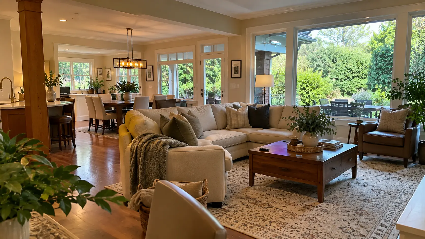
Read

Living in Sunnyside Park, South Surrey, BC: What It's Actually Like

Sunnyside Park, South Surrey, BC is the central, park-anchored part of South Surrey, in the City of Surrey, BC. It sits inland rather than on the water, between Elgin Chantrell, South Surrey, BC to the west and the King George Corridor, South Surrey, BC along Highway 99 to the east, with a genuine mix of older and newer housing.

What Sunnyside Park, South Surrey, BC is actually like

Sunnyside Park, South Surrey, BC is organized around its parks rather than a waterfront: South Surrey Athletic Park and the 140-hectare Sunnyside Acres Urban Forest Park both sit inside the neighbourhood, and the beaches belong to the communities south and west of it.

That distinction is worth making early, because it's the thing buyers most often get wrong. South Surrey and White Rock, BC get marketed as one seaside idea, and a lot of that imagery — the pier, the promenade — belongs to the City of White Rock, which is a separate municipality with its own council and its own bylaws. This neighbourhood is not that. It is a residential, inland part of the City of Surrey, and what it offers instead is a large amount of accessible green space in walking or short-driving distance of most addresses.

The practical version: if you want to look at water from your kitchen window, this is the wrong sub-area, and I'd rather say so now than after four weekends of showings. If you want to be minutes from the water while living on a quieter residential street with more park inside your own neighbourhood than most of the peninsula gets, it's a strong fit.

The housing mix, and why it matters here

Sunnyside Park, South Surrey, BC is harder to summarize than its neighbours, and that's the most useful thing to know about it. Most sub-areas on the peninsula are legible in one sentence — estate lots, or new-build subdivision, or corridor townhouses. This one is not.

The stock here is a genuine mix: older established houses alongside newer detached builds, plus townhouses and condominiums, and residential product aimed specifically at seniors and retirement buyers. That breadth is unusual for the peninsula. It means the neighbourhood can hold a young family in a house, a couple who are right sizing out of a larger property elsewhere in South Surrey, Surrey, BC, and a first-time buyer in an apartment — sometimes within a few blocks of each other.

For a buyer, the practical consequence is that you cannot form an impression of this area from three listings. Two houses on adjacent streets can be twenty or thirty years apart in build era and completely different in condition, systems and layout. That is a reason to look at more properties here than you would in a uniformly built subdivision, and a reason to read every inspection on its own terms rather than assuming the block sets the standard.

The honest gap: there is no published, verified statistic breaking this neighbourhood into detached, townhouse and apartment percentages, and no verified figure for typical lot size or build era. Listing aggregators will show you numbers that look like that. They are not board figures and I won't repeat them as if they were.

Streets and how to find your way around

South Surrey uses the City of Surrey, BC numbered grid: avenues run east–west and rise northward, streets run north–south and rise eastward.

24 Avenue — carried through part of the neighbourhood as Sunnyside Road, including the 15300 block — is the main east–west spine. 18 Avenue marks the southern edge of the athletic-park block and 148 Street its eastern edge. 159 Street runs north–south through the west side, and it's where Sunnyside Elementary sits.

Highway 99 runs along the eastern side of the peninsula, reached through the King George Corridor, South Surrey, BC, and it's the road that connects this area north toward Richmond and Vancouver and south toward the Peace Arch border crossing. King George Boulevard is the parallel surface route.

Parks and recreation — the actual draw

Three named parks do most of the work in Sunnyside Park, South Surrey, BC, and between them they explain why families choose this sub-area over the estate areas west of it or the corridor east of it.

South Surrey Athletic Park is the recreational centre of gravity, bounded by 24 Avenue to the north, 18 Avenue to the south and 148 Street to the east. It is where a great deal of the peninsula's organized sport happens, which cuts both ways: it means your kid's field is a walk rather than a drive, and it means tournament weekends bring traffic and parked cars onto surrounding streets.

Sunnyside Park itself is a neighbourhood park of about 6 hectares — roughly 15 acres — with an outdoor pool, sports fields, softball diamonds, tennis courts and playgrounds, per the City of Surrey's own park listing.

Sunnyside Acres Urban Forest Park is the one that surprises people: 140 hectares of second-growth forest that regrew after the area was logged in the early 1900s. It is a genuine forest inside a residential neighbourhood, not a landscaped green strip, and it is the single amenity most likely to sell someone on the area once they've actually walked it.

Schools

Several Surrey Schools sites serve parts of Sunnyside Park, South Surrey, BC. Sunnyside Elementary, a K–7 school, is at 2828 159 Street. H.T. Thrift Elementary sits in the southeast corner beside Semiahmoo Secondary School, backing onto South Surrey Athletic Park, and Bayridge Elementary is in the southwest corner. Semiahmoo Secondary's catchment is shared with parts of White Rock, BC.

There are also independent schools in and around the area — Southridge School and White Rock Christian Academy, both K–12, and CEFA for early years. Those are private schools, and it's worth being clear about that when you see them listed beside public schools on a marketing page.

I'm naming these, not ranking them. Surrey catchments are drawn by address, not by neighbourhood, and they change. If schooling is part of your decision, confirm the current catchment for the specific property with Surrey Schools before you write an offer. It takes five minutes and it occasionally changes which house a family buys.

Getting around

Sunnyside Park, South Surrey, BC is car-first, and there's no honest way to describe it otherwise. There is no SkyTrain on the South Surrey peninsula and none planned into it. Central location is the compensation: from here you have road access to Highway 99 through the King George Corridor, South Surrey, BC in one direction, and a short drive to White Rock, BC in the other.

On buses, I'm going to be plainer than most posts are: the route numbers you'll see quoted for this neighbourhood don't trace back to TransLink's own map, so I'm not going to repeat one. If transit is central to your decision, check TransLink's own route map against the specific address rather than trusting any blog — including this one — for a route number.

Who this area suits

It suits families who want organized sport, a pool and a real forest inside their own neighbourhood rather than a drive away.

It suits buyers who want to be near the water without paying for the water, and who are honest with themselves that "near" is the operative word.

It suits people right sizing within South Surrey, Surrey, BC who want to stay on the peninsula, stay near the same parks and the same errands, and move into a townhouse, apartment or purpose-built seniors' product without leaving the area entirely. The breadth of stock is what makes that possible here and harder in the estate sub-areas.

The honest trade-offs

No waterfront, and no borrowed waterfront. The beaches and the promenade belong to White Rock, BC and to Crescent Beach, South Surrey, BC. This neighbourhood's own assets are its parks.

Car dependency. No rapid transit, and no verified bus detail I'm willing to publish. Plan around a vehicle.

Inconsistent stock. A mix of build eras is a feature when you're shopping and a complication when you're valuing. Two similar-looking houses can be very different purchases.

Older systems in the older stock. Where the house predates the newer builds, expect the roof, windows, drainage and service panel to be its age. Price the next ten years of maintenance into the offer rather than discovering it in year two.

What the numbers can and can't tell you here

There is no published benchmark price for Sunnyside Park, South Surrey, BC. The Fraser Valley Real Estate Board reports South Surrey & White Rock as a single zone and has never broken out a sub-area within it — that was checked against the board's own August 2026 figures, not assumed. Anyone quoting you a precise Sunnyside Park average is estimating and not telling you so, and listing-site averages are not board statistics no matter how confidently they're presented.

What is published, for the zone as a whole, is this. As of August 2026 the FVREB composite benchmark for South Surrey & White Rock was $1,010,000, down 7.2% year over year; detached $1,649,200, down 7.5%; townhouse $820,300, down 11.1%; apartment $550,800, down 6.2%. Those figures are zone-wide, spanning the City of White Rock and all eight Surrey sub-areas of the peninsula together, from estate acreage to corridor apartments. They are not a number for these streets.

For context: this is the most expensive of the Fraser Valley board's zones — that composite sits above Cloverdale at $930,900, Langley at $948,600 and North Surrey at $640,800 — and its townhouse segment is the weakest-performing in the board's table. Board-wide in August 2026, the sales-to-active-listings ratio was 10%, below the 12–20% range considered balanced, on 941 MLS® sales, up 1% year over year.

Because the stock here spans detached, townhouse and apartment rather than concentrating in one, no single line of that table describes the neighbourhood on its own. If you want a real number for a real house, that's a conversation about specific comparable sales on the specific block. You can browse Sunnyside Park homes for sale, or widen it across the peninsula to South Surrey and White Rock, BC homes for sale — and I'm glad to walk through what's actually on these streets.

Frequently Asked Questions

Who is Sunnyside Park, South Surrey, BC actually a good fit for?

Families who want organized sport, a pool and a large forest park inside their own neighbourhood; buyers who want to be a short drive from the water without paying waterfront prices; and people right sizing within the peninsula who want to stay near the same parks and errands while moving into a townhouse, apartment or seniors' product. It's a weaker fit for anyone who wants a water view or a large estate lot.

What is the MLS® sub-area name for Sunnyside Park, South Surrey, BC?

The Fraser Valley Real Estate Board lists it as Sunnyside Park Surrey. That exact string matters if you're setting up a listing search or a saved alert, because a near-miss on a sub-area name returns nothing rather than returning an error.

Is Sunnyside Park, South Surrey, BC on the waterfront?

No. It's an inland, central part of South Surrey, in the City of Surrey, BC. The pier and promenade belong to the City of White Rock, BC, which is a separate municipality, and Crescent Beach, South Surrey, BC sits west of here. What this neighbourhood has instead is its own park network: South Surrey Athletic Park, Sunnyside Park with its outdoor pool and courts, and the 140-hectare Sunnyside Acres Urban Forest Park.

Which schools are near Sunnyside Park, South Surrey, BC?

Sunnyside Elementary at 2828 159 Street, H.T. Thrift Elementary and Semiahmoo Secondary School in the southeast corner, and Bayridge Elementary in the southwest corner are the Surrey Schools sites in and around the neighbourhood. Semiahmoo Secondary's catchment is shared with parts of White Rock, BC. Southridge School, White Rock Christian Academy and CEFA are independent schools in the area. Surrey catchments are assigned by address rather than by neighbourhood, so confirm the current catchment for a specific property with Surrey Schools before you make an offer.

What kind of homes are in Sunnyside Park, South Surrey, BC?

A genuine mix rather than one dominant type: older established houses alongside newer detached builds, plus townhouses, condominiums and residential product aimed at seniors and retirement buyers. There's no published, verified split between those categories and no verified typical lot size or build era, so treat any precise-sounding percentage you see on a listing site with caution.

Why can't one benchmark price describe Sunnyside Park, South Surrey, BC?

For two reasons. First, the Fraser Valley Real Estate Board reports South Surrey & White Rock as one zone and publishes no sub-area benchmark within it — as of August 2026 the zone-wide composite benchmark was $1,010,000, down 7.2% year over year, with detached at $1,649,200 (−7.5%), townhouse at $820,300 (−11.1%) and apartment at $550,800 (−6.2%), spanning the City of White Rock and all eight Surrey sub-areas together. Second, the housing here spans detached, townhouse and apartment rather than concentrating in one, so no single line of that table would describe the neighbourhood even if a sub-area figure did exist.

If a specific school is driving your search, you can find homes by school catchment rather than by neighbourhood — catchment boundaries don't always follow the lines you'd expect, and two homes a few blocks apart can be assigned to different schools.

Related Reading

About the Author

Caroline Jeklin is a REALTOR® with Royal LePage Wolstencroft Realty, licensed since 2021, with 11 Google reviews from clients across the Fraser Valley. Between 2021 and 2026 she has been part of 57 transactions, from $302,000 to $4,200,000, as of August 2026. In a neighbourhood with this much variety in its housing stock, the useful conversation is rarely about averages — it's about which specific houses on which specific streets are actually comparable to the one you're looking at, and she'll pull those for you. Read more about Caroline Jeklin, or reach her directly at 604-319-5052 or caroline@carolinejeklin.com.
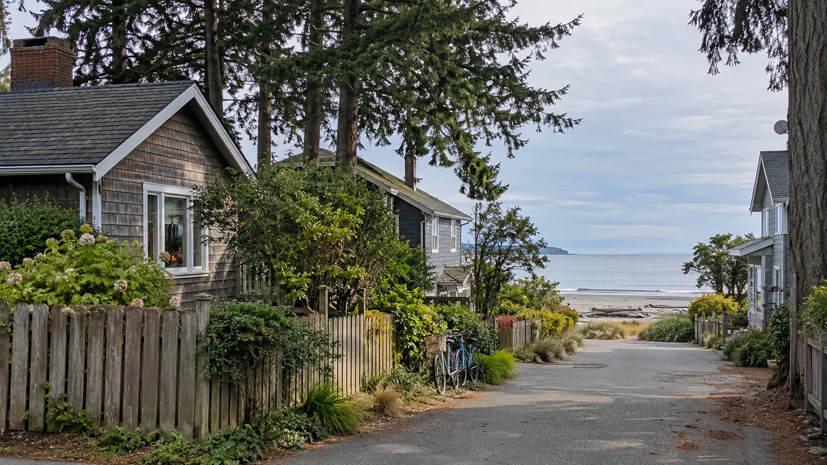
Read

Living in Elgin Chantrell, South Surrey, BC: What It's Actually Like

Elgin Chantrell, South Surrey, BC is the estate-scale side of the South Surrey peninsula, inside the City of Surrey, BC. Expect large detached houses on lots running from about half an acre upward, streets built out through the 1980s and 1990s, 128 acres of forest at Crescent Park, and a routine built around a vehicle.

What Elgin Chantrell, South Surrey, BC is actually like

Elgin Chantrell, South Surrey, BC is a low-density residential area of large detached houses on lots that run from roughly half an acre to several acres, developed mainly through the 1980s and 1990s, wrapped around the second-growth forest of Crescent Park.

The first thing to understand is the scale. This is not a subdivision where you see four rooflines from the kitchen window. Lots are wide, setbacks are deep, and many properties are treed to the point that the house isn't visible from the road. Some sit inside named gated pockets — Elgin Pointe is one — others simply at the end of a long driveway.

The second thing is that it's finished. The building here happened decades ago, so the landscaping has grown in and there is no staging yard at the end of the street waiting to become the next phase. You are not buying newness here; you are buying land, trees and a street that already looks the way it is going to look.

The third thing matters more in practice than people expect — this is a driving area. There is no retail strip inside it and no SkyTrain station, so the everyday errands happen elsewhere. If you want to walk to a coffee shop, this isn't that neighbourhood, and it's better to know before you spend three weekends looking.

The housing stock and the lots

Elgin Chantrell, South Surrey, BC is predominantly single-family detached. Neighbourhood profiles describe the area as one of Surrey's most upscale and park-like residential pockets, with large detached homes, some on gated or acreage-sized lots, developed primarily through the 1980s and 1990s. There are some strata-titled properties in the mix, but the dominant form by a wide margin is a detached house on a large private lot.

"Acreage-sized lot" is the phrase you'll see repeatedly on listing pages, and it's worth unpacking, because it means something practical rather than decorative:

More land means more property to maintain. A half-acre of lawn, hedging and mature trees is a different commitment from a 4,000-square-foot city lot, in weekends or in what you pay someone else.

Houses of that vintage and scale carry big systems. A house built in 1988 or 1994 on this scale has a roof, heating, windows, drainage and a service panel all decades into their lives. That is not a reason to avoid the stock. It is a reason to read the inspection properly and price the next ten years of maintenance into your offer rather than discovering it in year two.

Zoning and servicing are property-specific, not neighbourhood-wide. Larger parcels in this part of South Surrey, BC can carry conditions that a standard suburban lot does not, and some land on the peninsula sits inside the Agricultural Land Reserve. Whether any particular parcel is in the ALR, what its zoning permits, and how it is serviced are questions to confirm directly with the City of Surrey, a real estate lawyer, and the Agricultural Land Commission before you rely on an answer. Those bodies give you a defensible answer; a listing description does not.

Where it sits, and getting around

Neighbourhood profiles place Elgin Chantrell, South Surrey, BC roughly between King George Boulevard on the east and 140 Street on the west, running south to about 20 Avenue, further west toward 128 Street, and north to Crescent Road. Treat those as directional rather than as a survey line: there is no City of Surrey planning map drawing this neighbourhood's boundary, so the edges are described by the industry rather than defined by the municipality. If a boundary matters to your decision, the parcel's legal description and the City's zoning map are the sources.

Practically, King George Boulevard is the north–south spine on the eastern side and the road most trips out of the area use. Crescent Road carries the traffic west toward the water. 20 Avenue marks the southern edge, and 140 Street and 128 Street are the north–south routes on the western side. The retail, services and highway access all sit outside the neighbourhood itself.

On transit: there is no SkyTrain in this part of South Surrey, BC, and this is a car-first area by design and by density. Bus service in South Surrey, BC runs primarily along the arterial roads rather than through low-density residential streets, so if transit is part of your plan, check the current routes and stops for the specific address on TransLink's own map rather than assuming coverage. Household vehicle counts here tend to reflect that reality.

Schools

Elgin Park Secondary School opened in 1993 and serves part of South Surrey, BC, with enrolment reported at just over 1,300 students. Its feeder elementary schools include Chantrell Creek Elementary School, Crescent Park Elementary School, Ocean Cliff Elementary School, Ray Shepherd Elementary School and Semiahmoo Trail Elementary School. Chantrell Creek Elementary is a K–7 school located in the Crescent Park area.

I'm naming those schools, not ranking them, and one caution matters more here than people expect: Surrey catchments are assigned by address, not by neighbourhood name. On lots this large, two houses a few hundred metres apart can be in different catchments, and catchments change. If schooling is part of the decision, confirm the current catchment for the specific property with Surrey Schools before you write an offer.

Crescent Park and the outdoors

Crescent Park is the defining piece of public land here — over 128 acres of mature second-growth forest with walking trails, streams and meadows, sitting inside the neighbourhood rather than at its edge. It's the reason a lot of buyers end up in this part of South Surrey, BC: a genuinely large forested park you can walk into from the street, not a landscaped pocket park between two cul-de-sacs.

Crescent Beach, South Surrey, BC is a short drive west toward the water. Golf is frequently mentioned in listing material for this area, and courses do sit elsewhere in South Surrey, BC, though I'm not going to name one as bordering the neighbourhood without being able to point at a boundary that says so.

Greenbelt- and forest-adjacent lots are common here, which is part of the same story: a lot of these properties back onto trees rather than onto another fence.

Who Elgin Chantrell, South Surrey, BC suits

It suits a buyer who wants a large detached home on a private, treed lot of half an acre or more, and who is genuinely happy to trade walkability and newness for space, quiet and mature landscaping. It suits households with a vehicle per adult who don't need transit to work, and families who want a big forested park inside the neighbourhood.

It is a weaker fit for a buyer who wants new-build subdivision product, condo or townhouse living, or whose plan depends on a working farm or an agricultural use. That last group needs a zoning and ALR answer from the City of Surrey and the Agricultural Land Commission before a property search even starts, because it determines which parcels are worth looking at.

The honest trade-offs

Cost. This is expensive land in an expensive zone. The FVREB's South Surrey & White Rock zone carries the most expensive detached benchmark of any of its zones, and the estate stock here sits at the upper end of what that zone contains.

Maintenance. Large lot, large house, 1980s–1990s systems. Budget for it in money and weekends.

No walkable core. Groceries, coffee and services are a drive. There is no retail high street inside it.

Transit. No SkyTrain, limited residential coverage, arterial-oriented bus service. Plan around a vehicle.

Boundary fuzziness. With no municipal boundary map for this neighbourhood, whether a listing is "in" it can depend on which brokerage drew the line. Buy the parcel and its zoning, not the marketing label.

What the numbers can and can't tell you here

There is no published benchmark price for Elgin Chantrell, South Surrey, BC. That isn't an oversight — the Fraser Valley Real Estate Board publishes MLS® Home Price Index benchmarks by zone, and this neighbourhood has never been one of its zones. Anyone quoting you a precise Elgin Chantrell average is either estimating without saying so, or repeating a listing-aggregator figure that carries no board authority.

What is published is the South Surrey & White Rock zone, and those figures span the City of White Rock plus every South Surrey neighbourhood — this one, the waterfront, the townhouse pockets and the new-build subdivisions all averaged together. As of August 2026, the FVREB zone-wide benchmarks were: composite $1,010,000, down 7.2% year over year; detached $1,649,200, down 7.5%; townhouse $820,300, down 11.1%; apartment $550,800, down 6.2%. Board-wide, the Fraser Valley sales-to-active-listings ratio was 10% in August 2026 — below the 12–20% range the board describes as balanced — on 941 MLS® sales, up 1% year over year.

Read those as zone-wide context, not a number for these streets. The mix tells you more anyway: this is a predominantly detached, large-lot, decades-established area — a different product from the townhouse and apartment stock that pulls the zone composite down, and different again from the newer detached subdivisions elsewhere in South Surrey, BC.

If you want a real number for a real house, that's a conversation about specific comparable sales on comparable lots — which, on lots this variable, is the only version of the question worth answering. You can browse Elgin Chantrell homes for sale, or widen it to South Surrey and White Rock, BC homes for sale, and I'm glad to walk you through what's actually on these streets.

Frequently Asked Questions

Who is Elgin Chantrell, South Surrey, BC actually a good fit for?

Buyers who want a large detached house on a private, treed lot of half an acre or more, in an area that finished building out decades ago and has grown in since. It suits households comfortable driving for everyday errands and school runs. It's a weaker fit for anyone wanting new-build subdivision product, condo or townhouse living, or a walkable retail core.

What kind of homes are in Elgin Chantrell, South Surrey, BC?

Predominantly large single-family detached houses, many on gated or acreage-sized lots, developed primarily through the 1980s and 1990s, with some strata-titled properties in the mix. Lots commonly run from about half an acre to several acres, and forest-adjacent or greenbelt-adjacent properties are common. Homes of that vintage and scale carry roofs, windows, drainage and mechanical systems that are decades into their lives, which belongs in your inspection and your budget.

Which schools serve Elgin Chantrell, South Surrey, BC?

Elgin Park Secondary School, which opened in 1993 and reports enrolment of just over 1,300 students, serves part of South Surrey, BC. Its feeder elementary schools include Chantrell Creek Elementary School, Crescent Park Elementary School, Ocean Cliff Elementary School, Ray Shepherd Elementary School and Semiahmoo Trail Elementary School. Surrey catchments are assigned by address rather than by neighbourhood, so confirm the current catchment for the specific property with Surrey Schools before you make an offer.

Is land in Elgin Chantrell, South Surrey, BC inside the Agricultural Land Reserve?

That is a parcel-by-parcel question and not one a blog post should answer for you. Some land in South Surrey, BC sits inside the Agricultural Land Reserve and some does not, and ALR status, farm classification and permitted use are determined by the Agricultural Land Commission and the City of Surrey rather than by a listing description. If it matters to your plans for a property, get the answer in writing from those bodies and from a real estate lawyer before you remove subjects.

What do homes cost in Elgin Chantrell, South Surrey, BC?

There's no published sub-area benchmark. The Fraser Valley Real Estate Board reports South Surrey & White Rock as a single zone covering the City of White Rock and all of the South Surrey neighbourhoods together. As of August 2026, the zone-wide FVREB benchmarks were $1,010,000 composite, down 7.2% year over year; $1,649,200 detached, down 7.5%; $820,300 townhouse, down 11.1%; and $550,800 apartment, down 6.2%. Those are zone figures, not a number for these streets, and any precise Elgin Chantrell average you're quoted is an estimate rather than a published benchmark.

How do you get around Elgin Chantrell, South Surrey, BC?

By vehicle, primarily. King George Boulevard is the main north–south route on the eastern side, Crescent Road runs west toward the water, and 20 Avenue, 140 Street and 128 Street frame the southern and western edges. There is no SkyTrain in this part of South Surrey, BC, and bus service runs along the arterial roads rather than through low-density residential streets, so check TransLink's current routes and stops for the specific address rather than assuming coverage.

If a specific school is driving your search, you can find homes by school catchment rather than by neighbourhood — catchment boundaries don't always follow the lines you'd expect, and two homes a few blocks apart can be assigned to different schools.

Related Reading

About the Author

Caroline Jeklin is a REALTOR® with Royal LePage Wolstencroft Realty, licensed since 2021 and based in Cloverdale, Surrey, BC. Between 2021 and 2026 she has been part of 57 transactions across the Fraser Valley, from $302,000 to $4,200,000, as of August 2026. Her approach is to get to know what you're actually trying to do before showing you anything, and to answer the awkward questions honestly — including the ones about zoning, servicing and maintenance that a large-lot property in South Surrey, BC raises and a listing sheet doesn't. Because Elgin Chantrell, South Surrey, BC has no published benchmark of its own, the useful version of the price question here is comparable sales on comparable lots, which is exactly what she'll pull for you. Read more about Caroline Jeklin, or reach her directly at 604-319-5052 or caroline@carolinejeklin.com.
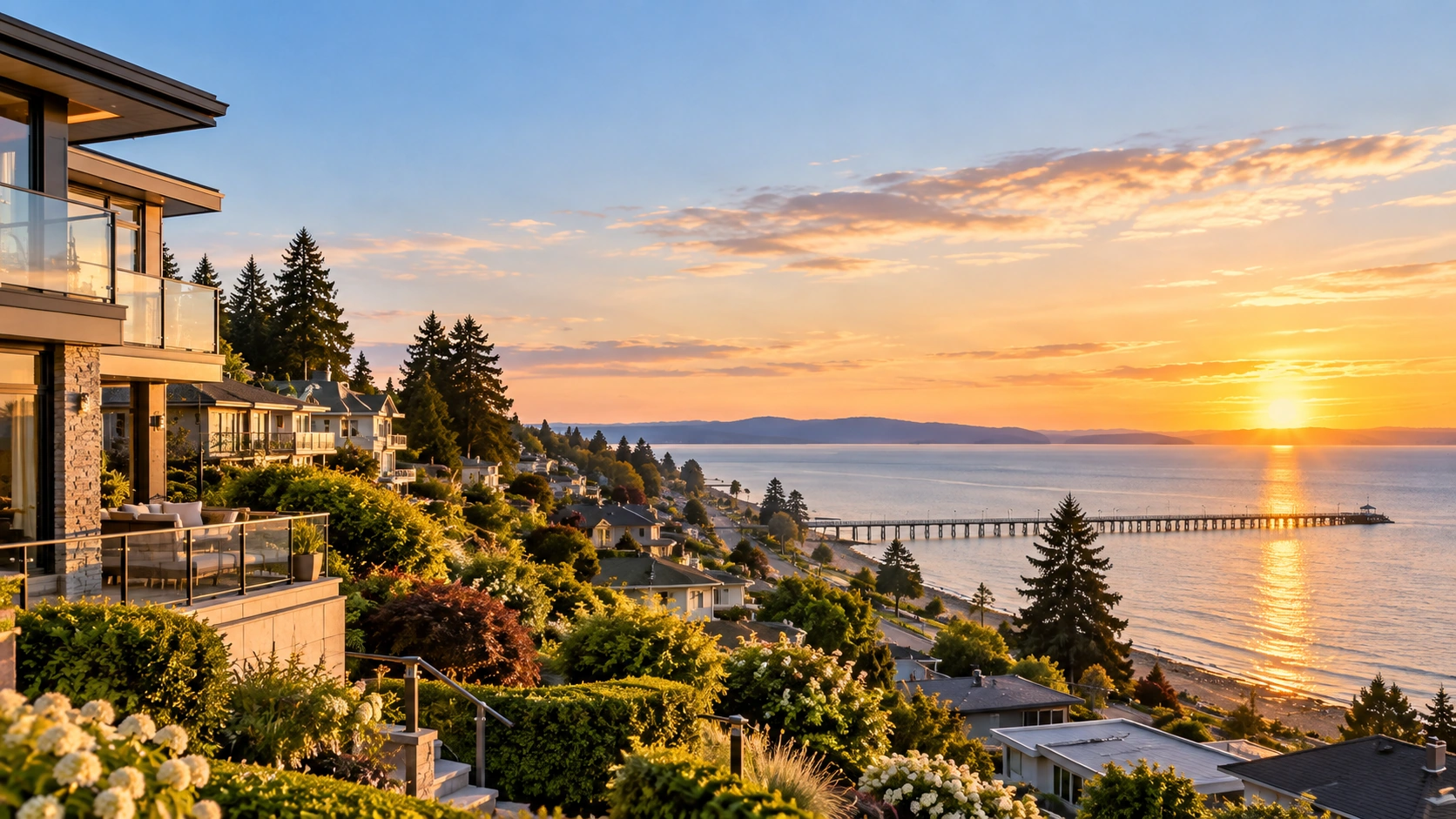
Read

Living in Crescent Beach and Ocean Park, South Surrey, BC

Crescent Beach, South Surrey, BC and Ocean Park, South Surrey, BC are two adjoining communities on the Semiahmoo Peninsula in the City of Surrey, BC. They share one MLS® listing area, but not much else: Crescent Beach sits low on Boundary Bay behind a rail crossing, and Ocean Park sits on the bluff above and behind it.

What Crescent Beach and Ocean Park, South Surrey, BC are actually like

Crescent Beach, South Surrey, BC and Ocean Park, South Surrey, BC are grouped under a single MLS® listing area, "Crescent Bch Ocean Pk", but they are two distinct communities — Crescent Beach is the low-lying beach settlement on Boundary Bay reached across the BNSF Railway, and Ocean Park is the bluff-top residential neighbourhood immediately above and behind it.

That distinction is the most useful thing to understand before you start looking, and almost nothing written about this part of Surrey, BC bothers to make it. Listing sites treat the pair as interchangeable because the board's search field does.

Crescent Beach is a small, physically contained beach community, bounded by the water of Boundary Bay on three sides and by Beecher Street and Bayview Street to the south. It is reached by exactly two roads — Crescent Road and McBride Avenue — both crossing the BNSF Railway onto the peninsula. That geography is the whole character of the place: you do not pass through Crescent Beach on your way somewhere else, you go there on purpose.

Ocean Park sits above and inland of it, on the bluff, running east to the boundary with the City of White Rock, BC. Its streets are tree-lined, its lots carry larger character and custom homes, and a small commercial strip runs along Beecher Street with restaurants and cafés. Beach-access streets — Beecher Street, Sullivan Street and Target Street — drop from the bluff toward the water.

The housing stock, and why the two halves differ

There is no published detached, townhouse and apartment split for this listing area, and I would rather say that than repeat a percentage from a listing site that never sourced it. What is verifiable is the shape of the stock.

Ocean Park, South Surrey, BC is predominantly larger character and custom detached homes on tree-lined streets. Its housing character is guided by a City of Surrey development permit area — a detail most buyers discover only after an accepted offer and a renovation idea. If you are buying here planning to alter, extend or rebuild, confirm the permit area requirements for the property with the City of Surrey first. That is a phone call, not a guess, and it occasionally changes what a lot is worth to you.

Crescent Beach, South Surrey, BC is smaller-lot, older waterfront and near-waterfront housing. The lots are small because the geography leaves no room for them to be otherwise: bay on three sides, rail line on the fourth, no direction to expand. It is also low-lying — a fact about the land, not a criticism of it — which belongs in your due diligence alongside the inspection. No verified average lot size or construction decade is published for either community — anyone quoting you one is estimating and not saying so.

Getting in and out

This is a car-first part of South Surrey, BC and it is more honest to say that than to dress it up.

Crescent Road and McBride Avenue are the only two land accesses into Crescent Beach, South Surrey, BC, and both cross the BNSF Railway at grade. That is the defining practical fact of living there — and the reason it stays quiet, because through traffic has nowhere to go. Highway 99 carries most trips out of the wider area; everything beyond the immediate neighbourhood is a drive.

There is no SkyTrain here and none planned. I will not quote you a bus route number from memory — TransLink's trip planner is the right source, and it is current in a way a blog post is not.

Ocean Park's access is simpler: it sits on the bluff with normal road connections east toward White Rock, BC and north into the rest of South Surrey, BC, and does not depend on a rail crossing.

Schools and parks

Ocean Cliff Elementary School, Crescent Park Elementary School, Ray Shepherd Elementary School and Laronde Elementary School are the elementary schools associated with these communities. I am naming them, not ranking them, and not stating any of them as your catchment — Surrey catchments are drawn by address, not by neighbourhood, and the secondary catchment in particular is worth confirming directly. Use the Surrey Schools catchment tool for the specific address before schooling factors into an offer. That check occasionally changes which house a family buys.

The parks here are why a lot of people move to this part of Surrey, BC in the first place.

Blackie Spit Park sits at the north end of Crescent Beach, South Surrey, BC, at the mouth of the Nicomekl River. The City of Surrey manages it, and it is a recognized Important Bird Area on the Pacific Flyway — which in practice means that on a migration weekend you share the trail with people carrying serious optics. It is a spit, a marsh and a shoreline.

Crescent Beach itself is the everyday one, and the reason the two access roads are busy on a hot Saturday. 1001 Steps Park, at the foot of 128 Street near Camp Kwomais, is the bluff-to-beach descent on the Ocean Park, South Surrey, BC side, with the Ocean Park Shoreline Walk along the tidal beach below.

Elgin Heritage Park and the Stewart Farm heritage house sit on the Nicomekl River nearby, and the farm is described as the only intact nineteenth-century farm remaining in Surrey. One note on the name: this is the historic "Elgin" locality near Crescent Beach, a different place from the inland Elgin Chantrell, South Surrey, BC listing area.

What's genuinely nearby

Ocean Park Village Shopping Centre and the small commercial strip along Beecher Street cover the everyday errands and the coffee — a modest but genuinely walkable village centre, which is not something you can say about most of South Surrey, BC.

What is not here is a dense urban core with everything inside a five-minute radius. Grocery, pharmacy and big-box shopping are a drive. If you are picturing walk-to-everything living, this is not that neighbourhood, and I would rather say so before you have spent three weekends looking for it.

Who these communities suit

Crescent Beach, South Surrey, BC suits a buyer who actively wants to be on Boundary Bay in a small, contained community, and who takes the rail crossing as a permanent feature rather than a problem to be solved. It is a lifestyle choice, not a commuter-convenience one.

Ocean Park, South Surrey, BC suits a buyer who wants a larger character home on a bluff-top lot near the water, with conventional road access and a small village centre in walking distance. Both suit buyers right sizing out of a larger Fraser Valley property who want the setting to carry the value rather than the square footage.

The honest trade-offs

Access into Crescent Beach, South Surrey, BC. Two roads, both over a level rail crossing. That is the trade for the quiet.

Age of the stock. Older near-waterfront housing means older roofs, windows, drainage and service panels. Budget the next ten years of maintenance rather than meeting it in year two.

Low-lying land. Crescent Beach sits low on the bay. That belongs with your insurer, your inspector and — on anything touching title or land use — a lawyer or notary. Those are their questions, not mine.

No transit answer. No SkyTrain, none coming. If a car-free household is the goal, this is not the peninsula for it.

Permit-area constraints in Ocean Park. Confirm the development permit area requirements with the City of Surrey for the specific address.

What the numbers can and can't tell you here

There is no published benchmark price for Crescent Beach, South Surrey, BC or for Ocean Park, South Surrey, BC. None. The Fraser Valley Real Estate Board publishes its MLS® Home Price Index for a South Surrey & White Rock zone, and that zone is the smallest unit it reports — it has never broken out these communities, or any of the eight South Surrey sub-areas, or White Rock individually.

What is published for that whole zone as of August 2026 is below. These are zone-wide figures spanning the City of White Rock and all eight South Surrey sub-areas — not a number for these streets.

SegmentBenchmark, August 20261-year change
Composite$1,010,000−7.2%
Detached$1,649,200−7.5%
Townhouse$820,300−11.1%
Apartment$550,800−6.2%

Two things make those numbers more useful than they look. South Surrey & White Rock is the most expensive of the Fraser Valley Real Estate Board's zones — its composite of $1,010,000 sits above Cloverdale at $930,900, Langley at $948,600, Surrey-Central at $912,700 and North Surrey at $640,800 — and its detached benchmark is the highest of the group. Its townhouse segment, at −11.1%, is the weakest in the entire board table. Board-wide in August 2026, the sales-to-active-listings ratio was 10%, below the 12–20% considered balanced, on 941 MLS® sales, up 1% year over year.

The housing mix tells you what the zone number cannot. These are predominantly detached communities — larger character homes on the Ocean Park side, older smaller-lot near-waterfront stock on the Crescent Beach side. That is a different product from the townhouse and apartment inventory pulling the zone composite down, which is why the composite is the wrong number to reason about a house here with.

For a real number on a real house, that is a conversation about comparable sales on the block, not a blog post. You can browse Crescent Beach and Ocean Park homes for sale, or widen it to South Surrey and White Rock, BC homes for sale — and I am glad to walk you through what is actually on those streets.

Frequently Asked Questions

Are Crescent Beach and Ocean Park, South Surrey, BC the same neighbourhood?

No. They share one MLS® listing area, which the board names Crescent Bch Ocean Pk, but they are two distinct communities. Crescent Beach is the low-lying beach settlement on Boundary Bay, reached by only two roads that cross the BNSF Railway. Ocean Park is the bluff-top residential neighbourhood above and behind it, running east to the boundary with the City of White Rock, BC.

Who are Crescent Beach and Ocean Park, South Surrey, BC actually a good fit for?

Crescent Beach suits a buyer who wants to be on Boundary Bay in a small, contained community and accepts the rail crossing as a permanent feature. Ocean Park suits a buyer who wants a larger character home on a bluff-top lot near the water, with normal road access and a small walkable village centre along Beecher Street. Neither suits a household that needs rapid transit.

How do you get into Crescent Beach, South Surrey, BC?

By car, over one of two roads. Crescent Road and McBride Avenue are the only land accesses onto the peninsula, and both cross the BNSF Railway at grade. Highway 99 carries most trips out of the wider area. There is no SkyTrain serving these communities and none planned, so check TransLink's trip planner for current bus service.

Which schools serve Ocean Park, South Surrey, BC?

Ocean Cliff Elementary School, Crescent Park Elementary School, Ray Shepherd Elementary School and Laronde Elementary School are the elementary schools associated with this part of South Surrey, BC. Surrey catchments are assigned by address rather than by neighbourhood, and the secondary catchment in particular should be confirmed directly, so check the Surrey Schools catchment tool for the specific property address before schooling factors into an offer.

Is the White Rock Pier part of Crescent Beach or Ocean Park, South Surrey, BC?

No. The White Rock Pier belongs to the City of White Rock, BC, a municipality separate from Surrey with its own council and bylaws. Ocean Park, South Surrey, BC borders White Rock and the pier is a short drive, but it is not a local amenity of either community. The named waterfront features here are Crescent Beach itself, Blackie Spit Park at the mouth of the Nicomekl River, and 1001 Steps Park at the foot of 128 Street.

Is there a published benchmark price for Crescent Beach and Ocean Park, South Surrey, BC?

No. The Fraser Valley Real Estate Board publishes its MLS® Home Price Index for a South Surrey & White Rock zone and reports nothing smaller. As of August 2026 that zone-wide composite benchmark, spanning the City of White Rock and all eight South Surrey sub-areas, was $1,010,000, down 7.2% year over year, with detached at $1,649,200, down 7.5%. Any precise figure quoted for these two communities specifically is an estimate rather than a published number.

If a specific school is driving your search, you can find homes by school catchment rather than by neighbourhood — catchment boundaries don't always follow the lines you'd expect, and two homes a few blocks apart can be assigned to different schools.

Related Reading

About the Author

Caroline Jeklin is a REALTOR® with Royal LePage Wolstencroft Realty, based in Cloverdale, Surrey, BC and licensed since 2021. Between 2021 and 2026 she has been part of 57 transactions across the Fraser Valley, from $302,000 to $4,200,000, as of August 2026, and carries 11 Google reviews from clients on both sides of those deals. Where an area has no published benchmark of its own — as is the case for both of these communities — the useful version of the price question is comparable sales on the specific block, and that is what she will pull for you. Read more about Caroline Jeklin, or reach her directly at 604-319-5052 or caroline@carolinejeklin.com.

Read

Living in White Rock, BC: What It's Actually Like

White Rock, BC is its own city — a 5.17 square kilometre municipality on Semiahmoo Bay, surrounded on three sides by Surrey but governed separately since 1957. Expect a hillside street grid, an apartment-heavy housing mix near the water, a working bus exchange, and a beachfront promenade that shapes daily life here more than any other feature.

What White Rock, BC is actually like

White Rock, BC is its own city rather than a Surrey neighbourhood — 5.17 square kilometres of hillside above Semiahmoo Bay, where apartments with ocean views cluster near Marine Drive and older detached homes sit on the streets climbing away from the water.

That hillside is what people underestimate until they've walked it. The city runs from the beach up to North Bluff Road at 16 Avenue, and the grade between the two is real. A home three blocks up from the water is a genuinely different daily experience from one on Marine Drive — it shows up in the view, the parking, and how often you actually walk down to the promenade rather than driving.

It is also small and finished. White Rock, BC is bounded by Bergstrom Road at 136 Street on the west, North Bluff Road at 16 Avenue on the north, Stayte Road at 160 Street on the east, and Semiahmoo Bay on the south. There is no expansion room, so what gets built here is redevelopment of something already there — a different pattern from the newer subdivisions across the line.

The part almost nobody explains: White Rock, BC is not Surrey

This matters more than it sounds, and it's the most common error in what's written about the area. White Rock is the City of White Rock, incorporated on April 15, 1957, a member municipality of the Metro Vancouver Regional District with its own mayor and council, bylaws and property tax rate. City Hall is at 15322 Buena Vista Avenue. The two cities share a border, a school district and a peninsula — they do not share a government.

So a Surrey bylaw, tax rate, permit process or council decision does not automatically apply to an address inside White Rock, BC. Secondary suite rules, short-term rental rules, tree bylaws, business licensing and parking are set by the City of White Rock inside the city and by the City of Surrey outside it. If your due diligence depends on a municipal rule, confirm which city's rule you're reading — an address on one side of Stayte Road at 160 Street and one on the other are in two different municipalities, even though the streets look the same.

The housing stock in White Rock, BC

The housing mix here is the most vertical of anywhere on the peninsula, and that's the defining fact about the market. Concrete and low-rise apartments with ocean views cluster near the waterfront and the streets just above it. Older detached character homes sit further up the hillside, on lots subdivided decades ago rather than to modern standards. Townhouses exist but are the smallest slice by a wide margin.

Listing-aggregator snapshots put apartments at roughly half of what's actively for sale in White Rock, BC at any given time, detached homes at most of the rest, and townhouses in single digits. Those proportions come from listing sites, not the Fraser Valley Real Estate Board or the City, so treat them as a picture of what tends to be for sale rather than a count of what's built. The direction is the useful part: if you're shopping here, you're mostly shopping apartments.

There's a due-diligence consequence, and it's the thing most lifestyle posts about this area skip. A large share of the low-rise apartment stock in White Rock, BC dates from the 1960s and 1970s, with newer concrete buildings nearer the water. An older building is not a worse building — plenty are well run, well reserved and in the best locations in the city. But age drives the questions that actually decide whether an apartment is a good buy: the depreciation report, the contingency reserve fund balance, whether the building has been rain-screened and when, the age of the roof, windows, piping and elevator, and what special levies have passed or are being discussed. Read the strata documents properly on any building here, whatever its vintage. That's what the housing mix means for how you shop in it.

The waterfront, the pier and the promenade

The waterfront belongs to White Rock, BC, not to South Surrey, BC, and it's the reason most people know the name.

Marine Drive runs the length of the city along the shoreline and carries the restaurant row. The White Rock Promenade runs parallel to it between Bay Street and Finlay Street, on the seaward side of the rail line. The White Rock Pier, opened in 1914, extends roughly 500 metres out into Semiahmoo Bay from the foot of the promenade. Semiahmoo Park picks up where the beachfront strip ends at Finlay Street.

Day to day, that waterfront is a genuine amenity residents use in ordinary weeks, not a postcard viewed from a distance. It also means summer weekends bring the region here, and parking along Marine Drive becomes a sport. Both are true at once, and anyone selling you only the first half is selling.

Getting around

There is no SkyTrain station in White Rock, BC, and none in South Surrey either. That's the honest starting point.

White Rock Centre is an on-street bus exchange straddling the White Rock–Surrey boundary, and the southernmost transit hub in Metro Vancouver. Route 351 runs from there to Bridgeport Station in Richmond via Highway 99 as a Frequent Transit Network route — the fastest scheduled connection to the SkyTrain network.

For driving, Highway 99 is the spine, with North Bluff Road at 16 Avenue carrying east–west traffic across the top of the city and Marine Drive running the shoreline below. Peace Arch Hospital sits within the city, which matters to a meaningful share of buyers here.

Most households in White Rock, BC keep a vehicle. But the walkable radius around the promenade and Marine Drive is real in a way it isn't in most of the Fraser Valley — plenty of residents in the buildings near the water do their week on foot, and that's the argument for living here rather than three kilometres inland.

Schools

White Rock, BC is served by School District 36 Surrey, the same district as its neighbour — it covers Surrey, White Rock and Barnston Island, and operates 103 elementary schools, 21 secondary schools, five learning centres and three adult education centres.

Schools associated with the area include École Peace Arch Elementary, a dual-track English and French Immersion K–7 school serving both White Rock and Surrey families; White Rock Elementary; and Semiahmoo Secondary School.

I'm naming them, not ranking them. Catchments in this district are drawn by address, not by neighbourhood or municipal boundary, so if schooling is part of the decision, confirm the current catchment for the specific property on the district's own catchment tool before you write an offer. Being inside the City of White Rock does not by itself tell you which school an address feeds.

Who White Rock, BC suits

It suits a buyer who wants to be near the water on foot — the promenade, the pier, the Marine Drive restaurants — and is comfortable that an apartment is the likeliest way to get there. It suits right-sizing buyers leaving a larger house and yard elsewhere in the Fraser Valley who want less maintenance and more walkability, and people who like that the city is small, built out, and running its own council rather than sitting inside a larger one.

It's a weaker fit for a buyer who wants acreage, a new-build subdivision home or a large flat lot — that stock is inland. It's also a weaker fit for anyone needing a fast, frequent rail commute, because that doesn't exist on this peninsula yet.

The honest trade-offs

The grade. The hillside is a view for some people and a daily climb for others. Walk the specific block, not the neighbourhood.

Building age. Much of the apartment stock is decades old — manageable with proper strata document review, unmanageable without it.

Summer crowds and parking. The waterfront draws the region from May onward.

No rail transit. Route 351 to Bridgeport Station via Highway 99 is the best connection available, and it's a bus.

Two sets of municipal rules on one peninsula. Straightforward once you know it, expensive if you assume Surrey's rules apply to a White Rock, BC address.

What the numbers can and can't tell you here

There is no published benchmark price for White Rock, BC, and there never has been. The Fraser Valley Real Estate Board reports South Surrey & White Rock as a single zone and has never broken White Rock out on its own. Anyone quoting a precise White Rock average is estimating from listing data and, in my experience, not saying so.

What is published is the zone. As of August 2026, the FVREB benchmark for the South Surrey & White Rock zone was $1,010,000 composite, down 7.2% year over year; $1,649,200 detached, down 7.5%; $820,300 townhouse, down 11.1%; and $550,800 apartment, down 6.2%. Those cover the entire zone — the City of White Rock plus all eight South Surrey sub-areas — not these streets specifically. Two things about the zone are worth knowing: it is the most expensive of the board's zones on the composite benchmark, ahead of Langley at $948,600, Cloverdale at $930,900 and Surrey-Central at $912,700, and its townhouse segment at −11.1% is the weakest-performing townhouse segment anywhere in the board's table. Board-wide, the Fraser Valley recorded 941 MLS® sales in August 2026, up 1% year over year, at a sales-to-active-listings ratio of 10% — below the 12–20% band the board considers balanced. You can browse White Rock homes for sale, or the zone's current inventory at South Surrey and White Rock, BC homes for sale — and if you want a number for an actual property, that's a conversation about comparable sales on the specific building or block, not a figure a blog post can honestly give you.

Frequently Asked Questions

Is White Rock, BC part of Surrey?

No. White Rock is its own municipality — the City of White Rock, incorporated on April 15, 1957 — with its own mayor and council, its own bylaws and its own property tax rate. It covers 5.17 square kilometres and is surrounded on three sides by Surrey, with Semiahmoo Bay to the south, which is why the two are so often confused. A Surrey bylaw, tax rate or council decision does not automatically apply to an address inside White Rock, BC.

Who is White Rock, BC actually a good fit for?

Buyers who want to live within walking distance of the water and are open to an apartment, and right-sizing buyers leaving a larger house and yard who want less maintenance without leaving the Fraser Valley. It's a weaker fit for anyone wanting acreage, a new-build subdivision home or a large flat lot, and for anyone who needs a frequent rail commute, because there is no SkyTrain station on this peninsula.

What kind of homes are in White Rock, BC?

Mostly apartments, then detached houses, with townhouses a distant third. Concrete and low-rise apartment buildings cluster near the waterfront and the streets just above it, while older detached character homes sit further up the hillside on lots subdivided decades ago. A large share of the low-rise apartment stock dates from the 1960s and 1970s, which makes the depreciation report, the contingency reserve fund and the rain-screening history the questions that decide whether a given unit is a good buy.

Which schools serve White Rock, BC?

White Rock is part of School District 36 Surrey, which covers Surrey, White Rock and Barnston Island. École Peace Arch Elementary, a dual-track English and French Immersion K–7 school, and White Rock Elementary both serve families in the area, and Semiahmoo Secondary School is the secondary school most associated with the peninsula. Catchments in this district are assigned by address rather than by neighbourhood or municipality, so confirm the current catchment for the specific property before you make an offer.

Does White Rock, BC have SkyTrain, and how do people get around?

There is no SkyTrain station in White Rock, BC or anywhere in South Surrey. White Rock Centre is an on-street bus exchange on the White Rock–Surrey boundary and the southernmost transit hub in Metro Vancouver, and Route 351 runs from there to Bridgeport Station via Highway 99 as a Frequent Transit Network route. Most households keep a vehicle, though the area around Marine Drive and the promenade is genuinely walkable in a way most of the Fraser Valley is not.

Is there a published benchmark price for White Rock, BC?

No. The Fraser Valley Real Estate Board reports South Surrey & White Rock as a single zone and has never published a White Rock-only benchmark. As of August 2026 the zone benchmarks were $1,010,000 composite, down 7.2% year over year; $1,649,200 detached, down 7.5%; $820,300 townhouse, down 11.1%; and $550,800 apartment, down 6.2%. Those cover the City of White Rock and all eight South Surrey sub-areas together, so any precise White Rock figure you're quoted is an estimate rather than a published number.

If a specific school is driving your search, you can find homes by school catchment rather than by neighbourhood — catchment boundaries don't always follow the lines you'd expect, and two homes a few blocks apart can be assigned to different schools.

Related Reading

About the Author

Caroline Jeklin is a REALTOR® with Royal LePage Wolstencroft Realty, licensed since 2021, working across the Fraser Valley. Between 2021 and 2026 she has been part of 57 transactions, from $302,000 to $4,200,000, as of August 2026, and carries 11 Google reviews from clients over that period. Because White Rock, BC has no published benchmark of its own, the useful version of the price question here is comparable sales in the specific building — which is what she'll pull for you, alongside the strata documents. Read more about Caroline Jeklin, or reach her directly at 604-319-5052 or caroline@carolinejeklin.com.

Read
Reciprocity Logo The data relating to real estate on this website comes in part from the MLS® Reciprocity program of either the Greater Vancouver REALTORS® (GVR), the Fraser Valley Real Estate Board (FVREB) or the Chilliwack and District Real Estate Board (CADREB). Real estate listings held by participating real estate firms are marked with the MLS® logo and detailed information about the listing includes the name of the listing agent. This representation is based in whole or part on data generated by either the GVR, the FVREB or the CADREB which assumes no responsibility for its accuracy. The materials contained on this page may not be reproduced without the express written consent of either the GVR, the FVREB or the CADREB.