Real estate tips and guides for Cloverdale, Langley and South Surrey

Cloverdale, Langley & South Surrey, BC

Everything I've written for buyers and sellers in Cloverdale, Langley and South Surrey — market updates, buyer and seller tips, and guides to the neighbourhoods I work in. If you've got a question this doesn't answer, ask me directly and I'll help you find it.

RSS

What Homes Cost in Walnut Grove, Langley Township, BC

Walnut Grove, Langley Township, BC has no benchmark price of its own, and never has had one. The Fraser Valley Real Estate Board reports Langley as a single zone covering both the Township and the City. What you can know honestly is the housing mix north of Highway 1, and what that mix does to a budget.

Start with the number that does not exist

Most pages answering this question hand you a figure. It's worth knowing where that figure comes from before you plan around it.

The Fraser Valley Real Estate Board publishes MLS® Home Price Index benchmarks for a fixed list of reporting zones, and Langley is one of them — published as one zone, with no split between Langley Township, BC and Langley City, BC and no sub-area breakdown inside either. No benchmark is published for Walnut Grove, Langley Township, BC, and none for Murrayville, Brookswood or Salmon River either. That's not a gap in this post. It's a gap in the data, and it has always been there.

So there's no sub-area figure here, because producing one would mean inventing it. Not a range, not an adjusted number, not a "typically around". A made-up number is worse than no number, because you'd budget against it. What follows instead is the published zone data with its date attached, and then the part that actually moves a budget on these streets: what is built here, and what that leaves for sale.

What the FVREB Langley reporting zone benchmarks actually cover

These are the current published MLS® HPI benchmark prices for the Fraser Valley Real Estate Board's Langley reporting zone, from its August 2026 statistics package. They cover the whole zone — both Langley Township, BC and Langley City, BC — together.

SegmentBenchmark1-year change
Composite$948,600−6.6%
Detached$1,479,400−7.1%
Townhouse$806,400−5.0%
Apartment$534,000−8.8%

Three things about that table are worth reading carefully.

The first is the date. August 2026 is the most recent month the board has published. Any August figure you're shown for this area does not exist yet.

The second is the geography. Those four numbers blend two municipalities with separate councils, bylaws and tax rates, plus every neighbourhood inside them — the older streets of Langley City, BC, the acreages out east, the newer density in Willoughby, Langley Township, BC, and the 1980s cul-de-sacs north of Highway 1. A composite across all of that is a direction, not a valuation.

The third is which lines matter here. Walnut Grove, Langley Township, BC is best known for the step from a detached house into a townhouse or a condo, which makes the $806,400 townhouse and $534,000 apartment benchmarks the two most relevant published figures for many buyers reading this. They are still zone-wide numbers describing strata product across both municipalities, not the specific complexes on Walnut Grove Drive.

For the market those figures sit in: the Fraser Valley recorded 941 MLS® sales in August 2026, up 1% year over year, with a sales-to-active-listings ratio of 10% against a balanced range of 12% to 20%, and prices down in every zone and property type. That's the condition, worth naming plainly rather than turning into a deadline. One line in the table is favourable and often missed: at −4.9%, townhouses are the most resilient segment in the whole board table.

The housing mix, and why it is really a sequence

The useful way to read prices in Walnut Grove, Langley Township, BC is chronologically. The area was built in identifiable phases, and each phase left behind a different kind of home.

Large-lot detached came first

The area was approved for development in 1979 and built out mainly through the 1980s and 1990s — local coverage calls it the Township's second-newest neighbourhood, after Willoughby, Langley Township, BC. Lot sizes shrank as it went: roughly quarter-acre parcels in the earliest subdivisions, down to about 7,000 square feet, and eventually about 5,000 square feet in the later phases.

That explains more price variation than anything else on these streets. Two detached houses of similar size and age can sit on very different quantities of land depending on which phase their subdivision went in, and land is the largest single input into a detached price in the Fraser Valley.

Then townhouses and single-level strata

Townhomes and gated complexes developed alongside the later detached phases, a niche trend of the same era. A meaningful share of that stock is single-level or duplex-style — the format people move into when they want to stop doing stairs and stop doing a yard, without leaving the neighbourhood.

Then condos, clustered at the town centre

The newest product in Walnut Grove, Langley Township, BC is low-rise condo, concentrated at the town-centre node around Walnut Grove Drive and 200 Street, near the Walnut Grove Community Centre and the Dean Drysdale Library at 8889 Walnut Grove Drive. The clustering is legible on a map: the condos are where the shops, the library and the medical services are.

The precise split is not published

Detached, townhouse and condo all exist here in quantity. What isn't available is a percentage. No Township or census breakdown quantifying the mix for this area has been published, so this post doesn't state one. Anyone quoting you a clean split for a Langley Township, BC sub-area is estimating.

The step this area is known for

A large share of local moves are not into a house at all. They are out of one.

The pattern is a detached house on a 1980s or 1990s lot, sold, and replaced with a single-level townhouse or a condo a few minutes away. People right sizing this way usually aren't trying to leave — they're keeping the community centre, the trails and the highway access while cutting the yard, the stairs and the maintenance bill. The build sequence is what makes that possible without changing neighbourhood.

Several of the strata complexes here are marketed as age-restricted, and single-level and duplex-style formats are common. Whether a particular complex is genuinely age-restricted is answered by that strata corporation's registered bylaws, not by a listing description. The same goes for rental restrictions, and for what the contingency reserve fund and the latest depreciation report say about the building's next fifteen years. Those documents are part of the purchase and are readable before subjects are removed — but how they bind you is a question for a lawyer or a notary.

Who buys here and why

Walnut Grove, Langley Township, BC draws two fairly distinct groups of buyers, and the housing mix is what selects for them: established households wanting a detached house on the cul-de-sac streets built out through the 1980s and 1990s, and buyers stepping out of a larger house into a single-level townhouse or a condo near the Walnut Grove Drive town centre without leaving the community they already know.

The everyday infrastructure supports both readings. Walnut Grove Secondary School at 8919 Walnut Grove Drive serves grades 8 through 12 with roughly 2,000 students; James Kennedy Elementary runs dual-track English and French Immersion, and Alex Hope Elementary is a K–7 school of about 560 students. Other elementary schools serve the area too, but only those two were independently confirmed by address and enrolment for this post, so those are the two named here. Catchments in the Langley School District were redrawn in 2026 — check a specific address against the district's own school locator, not a listing sheet.

Walnut Grove Community Park runs to 20.2 acres with a splash park, playgrounds, baseball diamonds and walking trails; the Walnut Grove Aquatic Centre has a 50-metre pool; the Langley Sportsplex handles ice; and the ravine trail network runs roughly from 216 Street west to 196 Street. Redwoods Golf Course sits on 88 Avenue. A buyer moving from a house into a townhouse a few blocks away keeps all of it.

What actually sets the price on a specific home

Once you're looking at real listings rather than a zone index, four things move the number far more than any average would.

Lot size and subdivision vintage, for detached. The quarter-acre-to-5,000-square-foot spread across the build-out is the biggest single variable in the detached stock, and it doesn't read off a photograph.

Strata health, for townhouses and condos. Two identical-looking units a block apart can carry very different monthly fees and very different exposure to a future special levy. The financial statements, the depreciation report and the minutes are where that lives.

Age of the building envelope. A neighbourhood built mainly in the 1980s and 1990s is now at the point where roofs, windows, hot water tanks and exterior finishes come due together. That's not a reason to walk away from a well-kept property; it's a reason to price the next decade of maintenance into the offer.

Access. Highway 1 forms the southern edge, and the interchange at 200 Street — rebuilt around 1999 by agreement between the province and the Township, replacing a failing 1960s structure — is why commercial development concentrated where it did, at Thunderbird Village and along the 200 Street corridor. A second interchange at 216 Street serves the east side, and the Golden Ears Bridge connects north across the Fraser River. Proximity to those routes cuts both ways: convenience on one side, road noise on the other, and it shows up in the sale price.

One thing that does not set the price here, despite how often it's implied: rapid transit. The Surrey–Langley SkyTrain does not reach this part of Langley Township, BC. The line runs along Fraser Highway and terminates at 203 Street inside Langley City, BC, well south of these streets. No station serves this area. The access story here is the highway and the bridge, and always has been.

The cost that does not show up in a benchmark

A benchmark is a purchase price. What you carry afterwards is a separate calculation, and one line of it is genuinely different on this side of the municipal boundary.

The total 2026 residential property tax rate in Langley Township, BC is 3.61686 per $1,000 of assessed value, against 4.20670 in Langley City, BC — about $3,617 a year versus $4,207 on a home assessed at $1,000,000. It's a real difference that compounds over a long hold, but it's one line in a budget that also carries strata fees, insurance and maintenance, and how those net out for you is a conversation with a mortgage broker and an accountant.

Getting a real number

What a specific home here is worth comes from recent comparable sales on those streets and in that complex, adjusted for lot size, vintage, strata health and condition — not from a zone-wide index blending two municipalities. That's a conversation, and it costs nothing.

In the meantime you can browse Walnut Grove homes for sale, or widen it to Langley Township, BC homes for sale, which covers the whole municipality.

Frequently Asked Questions

Is there a published benchmark price for Walnut Grove, Langley Township, BC?

No. The Fraser Valley Real Estate Board publishes MLS® Home Price Index benchmarks for the Langley reporting zone as a whole and has never broken out sub-areas inside it, or even split Langley Township, BC from Langley City, BC. Any precise figure quoted for this sub-area is someone's estimate, not a published statistic.

What are the published Langley benchmark prices as of August 2026?

For the Fraser Valley Real Estate Board's Langley reporting zone in August 2026: $1,479,400 detached, down 7.1% year over year; $948,600 composite, down 6.6%; $806,400 townhouse, down 5.0%; and $534,000 apartment, down 8.8%. Those figures cover both Langley Township, BC and Langley City, BC together.

Is a housing-type breakdown published for Walnut Grove, Langley Township, BC?

No. Detached houses, townhouses and low-rise condos all exist here in quantity, but no Township or census breakdown quantifying the percentage split between them has been published, so this post does not state one. Any clean percentage figure quoted for a Langley Township, BC sub-area is an estimate.

Is a townhouse or a condo the smaller step in Langley Township, BC?

On the published zone figures, apartments carry the lower benchmark — $534,000 against $806,400 for townhouses as of August 2026 — but those are zone-wide numbers covering both municipalities, and the two formats are not interchangeable. Monthly strata fees, the depreciation report and the contingency reserve fund often matter more to the real cost than the purchase price gap does.

Are prices falling across Langley Township, BC right now?

Yes, on the published data. Every segment in the Fraser Valley Real Estate Board's Langley reporting zone was down year over year in August 2026, with the composite off 6.6%. Board-wide there were 941 MLS® sales that month, up 1% year over year, and a sales-to-active-listings ratio of 10% against a balanced range of 12% to 20%. Townhouses held up best, at −5.0%.

How do I find out what a specific home in Walnut Grove, Langley Township, BC is worth?

Through comparable sales on that block or in that complex, adjusted for lot size, subdivision vintage, condition, strata health and access to Highway 1 at 200 Street. A zone-wide benchmark can tell you which direction the market is moving; it cannot value a house. That part starts with the address.

Related Reading

About the Author

The Royal LePage President's Gold Award, which Caroline Jeklin received in 2025, places her in the top 6–10% of agents in her local marketplace. She is a REALTOR® with Royal LePage Wolstencroft Realty, licensed in 2021, and has been part of 57 transactions between 2021 and 2026, ranging from $302,000 to $4,200,000, as of August 2026. She wrote this one because a community with no published benchmark of its own gets the price question answered with invented figures more often than not. Read more about Caroline Jeklin, or reach her directly at 604-319-5052 or caroline@carolinejeklin.com.
Read

Living in Walnut Grove, Langley Township, BC: What It's Actually Like

Walnut Grove, Langley Township, BC sits north of Highway 1, between the 200 Street and 216 Street interchanges, with the Golden Ears Bridge at its northern reach. It was approved for development in 1979 and built out through the 1980s and 1990s, which makes it settled suburban rather than new — and that shapes almost everything below.

Most pages about this area say "family-friendly" and stop there, which describes nowhere. What follows is what is actually on the ground, and where the honest answer is that nobody publishes the number.

What Walnut Grove, Langley Township, BC is actually like

Walnut Grove, Langley Township, BC is a cul-de-sac suburb approved for development in 1979 and largely filled in through the 1980s and 1990s, so it reads as settled rather than new — mature trees, a civic spine along Walnut Grove Drive, and Highway 1 at 200 Street doing the work a transit station does in other suburbs.

The civic core is genuinely legible, which is unusual for a Fraser Valley suburb. The Walnut Grove Community Centre, the Dean Drysdale Library at 8889 Walnut Grove Drive and the Community Policing Office sit within a block of each other, with Walnut Grove Secondary School at 8919 Walnut Grove Drive next door.

Retail works off two corridors: Thunderbird Village, with more than forty shops, near the Highway 1 and 200 Street interchange, and 88 Avenue running east–west. Cineplex Langley Cinemas sits by the same interchange. That is more day-to-day shopping than most Township sub-areas have inside their own boundaries. Local press calls it the Township's second newest neighbourhood, after Willoughby, Langley Township, BC — old enough that the trees have grown in, new enough that you are not usually buying a 1960s house.

The housing stock, and how it changed as the area filled in

The build-out sequence in Walnut Grove, Langley Township, BC explains why two streets a few minutes apart can feel like different neighbourhoods. The earliest subdivisions went in on roughly quarter-acre lots. As the area filled through the 1980s and 1990s, lot sizes shrank — to about 7,000 square feet in the middle phases, and to as little as about 5,000 square feet later. Townhomes and gated communities developed alongside as a niche trend of the same era, and the most recent product is low-rise condo clustered at the town-centre node around Walnut Grove Drive and 200 Street. Large-lot detached, then smaller-lot detached and townhouse strata, then condo at the centre: that progression is visible on the ground.

One thing to be straight about: there is no published breakdown of what percentage of Walnut Grove, Langley Township, BC is detached versus townhouse versus apartment. No Township or census figure splits it that way, and plenty of area pages imply one anyway.

One servicing point that almost never appears on competing pages: this area is on municipal water and sanitary sewer, maintained by the Township's Utilities Department — not a well-and-septic neighbourhood, unlike parts of Brookswood, Langley Township, BC or Salmon River, Langley Township, BC.

The 55+ and right sizing side of Walnut Grove, Langley Township, BC

There is a real cluster of age-restricted strata communities here. Churchill Park at 9208 208 Street is a gated development of 147 duplex-style townhouses. Twin Lakes is 73 single-level townhomes built in 1993. Spencer Green is 97 duplex-style townhomes, also gated. The Residences at Walnut Grove is a 55+ condo building near shops and medical and pharmacy services.

One caution, and it is a real one: age restrictions live in a strata corporation's registered bylaws, not in a listing description. No municipal or strata primary source confirming a current registered restriction for these was available for this piece, and British Columbia's rules on age-restricted strata and rental restrictions have changed in recent years. Whether a specific building is age-restricted today is a question for the strata documents themselves and for a lawyer or notary.

What I can tell you is what the housing is: single-level or duplex-style townhomes, often gated, with a garden, within reach of the same community centre, aquatic centre and shops families here use. That combination is not common in the Fraser Valley.

What I see when people are right sizing here

The part people get wrong about right sizing into this area is that they picture giving something up. When I sit down with a couple in their sixties looking at the 55+ strata communities here, what they tell me is that they still like that privacy and space. A lot of those 55+ are great for that — single level, duplex-style, a real patch of garden, a gate at the entrance. It isn't an apartment with a view of a parkade. So the brief I end up writing with them isn't "smaller." It's single level, low maintenance, keep the privacy. Those are three separate requirements and only one of them has anything to do with square footage. Getting that order right is most of the work.

Getting around: Highway 1 at 200 Street, not a SkyTrain station

Around 1999 the provincial government and the Township agreed to concentrate commercial development around a rebuilt Highway 1 and 200 Street interchange, replacing a deteriorating 1960s-era structure. It feeds Highway 1 straight into the commercial spine at Thunderbird Village, and 200 Street runs south from it as a Major Transit Growth Corridor toward Willowbrook. A second, more recent interchange at 216 Street serves the eastern side, where 216 Street is also a Township-designated truck route up to 88 Avenue. The Golden Ears Bridge carries traffic north across the Fraser River, with a pedestrian and bike path to Pitt Meadows. Bus service is TransLink Route 562, and Carvolth Exchange supports park-and-ride connections.

Now the part I would rather you hear from me than from a listing: the Surrey–Langley SkyTrain does not reach Walnut Grove, Langley Township, BC. The extension runs along Fraser Highway from King George Station in Surrey to a terminus at 203 Street, which is in Langley City, BC — a separate municipality from the Township. That corridor sits south of Highway 1; this area sits north of it. No station is planned here, and the line's anticipated in-service date is late 2029. "Close to the new SkyTrain" still gets written about this area, and it is worth knowing that it isn't so. If rapid-transit-adjacent living is your top requirement, Willowbrook or Langley City Centre are the honest answer.

Schools, parks and what is actually there

Schools. The confirmed public schools serving Walnut Grove, Langley Township, BC are Walnut Grove Secondary School at 8919 Walnut Grove Drive, grades 8 to 12 with roughly 2,000 students; James Kennedy Elementary, a dual-track English and French Immersion school; and Alex Hope Elementary, around 560 students, kindergarten to grade 7. Other elementary schools serve the area, but I could not confirm each one by name and address, and I am not going to publish a count I cannot source. The Langley School District redrew catchment boundaries in 2026, so check the SD35 School Locator against the specific address you are considering rather than a neighbourhood name. I do not publish school rankings.

Parks and recreation. Walnut Grove Community Park is 20.2 acres — splash park, playgrounds, baseball diamonds including the George Zarrelli diamond, walking trails and covered picnic areas. The Walnut Grove Aquatic Centre has a 50-metre pool, a leisure pool and a waterslide; the Langley Sportsplex covers ice; Redwoods Golf Course is on 88 Avenue. The local trail network is a ravine system of paved paths and bridges running roughly from 216 Street across to 196 Street, and the Fort-to-Fort Trail and Derby Reach Regional Park are reachable via Fort Langley. Fire Hall 8 is at 9580 – 208 Street.

Who this area suits, and the honest trade-offs

Established families first: detached stock on cul-de-sacs, a large secondary school, a 20.2-acre park, an aquatic centre and an ice rink. Buyers right sizing out of a larger detached home second. Commuters who drive or cross the bridge third. It does not suit a buyer whose non-negotiable is walking to a rapid-transit station.

It is car-first. Bus service exists and the town centre is walkable within itself, but the daily pattern is driving.

The build-out era cuts both ways. Housing largely from the 1980s and 1990s means mature landscaping and settled streets. It also means roofs, windows and mechanical systems at or past a typical replacement cycle — an inspection question on every property, not a neighbourhood problem.

Strata living carries rules detached living does not — fees, and bylaws under British Columbia's Strata Property Act covering pets, rentals, alterations and, in some buildings, age. Read those documents before you fall for a unit, and take the questions they raise to a lawyer or notary.

Property tax is a Township rate, not a neighbourhood one. The Township of Langley's total 2026 residential rate is 3.61686 per $1,000 of assessed value across all authorities. A rate is not a bill — the bill is the rate times your assessment.

What the market numbers can and can't tell you here

Plainly: no benchmark price is published for Walnut Grove, Langley Township, BC. There never has been. The Fraser Valley Real Estate Board publishes a single Langley reporting zone, covering the Township and the City together, with no split between them and no sub-area figures at all.

Here is what does exist, labelled honestly. In the FVREB August 2026 statistics package, Langley zone MLS® HPI benchmarks were: composite $948,600, down 6.6% year over year; detached $1,479,400, down 7.1%; townhouse $806,400, down 5.0%; apartment $534,000, down 8.8%. Fraser Valley-wide that month, the sales-to-active-listings ratio was 10% — below the 12–20% band FVREB describes as balanced — on 941 MLS® sales, up 1% year over year, with prices down in every zone and property type.

Those are Langley-zone figures covering both municipalities. They are not a Walnut Grove number, and I will not estimate one, adjust one or call one "roughly." What a specific street or a specific 55+ community is doing is a conversation about comparable sales, not a table. What the table does show is shape rather than level: Langley townhouses were its most resilient segment, and this area has a deep supply of them.

Before deciding anything, it is worth browsing current Walnut Grove homes for sale, or the wider Langley Township, BC homes for sale. A real listing tells you more about whether an area appeals than reading about it does.

Frequently Asked Questions

Who is Walnut Grove, Langley Township, BC a good fit for?

Established families, and buyers right sizing into single-level strata. It is one of the more complete sub-areas in the Township. It has a civic core on Walnut Grove Drive, a 20.2-acre community park, an aquatic centre with a 50-metre pool, an ice rink, retail at Thunderbird Village and along 88 Avenue, and confirmed schools including Walnut Grove Secondary School. The trade-off is that it is car-first, with no rapid-transit station planned or existing.

Does the Surrey–Langley SkyTrain reach Walnut Grove, Langley Township, BC?

No. The extension runs along Fraser Highway from King George Station in Surrey to a terminus at 203 Street, which is inside Langley City, BC — a separate municipality from Langley Township. That corridor sits south of Highway 1 and this community sits north of it. No station is planned to serve it, and the line's anticipated in-service date is late 2029. Access here is by Highway 1 at the 200 Street and 216 Street interchanges and by the Golden Ears Bridge.

What kind of homes are in Walnut Grove, Langley Township, BC?

A mix, built mostly through the 1980s and 1990s. The earliest subdivisions went in on roughly quarter-acre lots; lot sizes fell to about 7,000 square feet in the middle phases and to as little as about 5,000 square feet later. Townhouse and gated strata developments came in alongside, and low-rise condo is concentrated at the town-centre node near Walnut Grove Drive and 200 Street. No published Township or census breakdown gives the percentage split, so anyone quoting one is estimating.

Are there 55+ communities in Walnut Grove, Langley Township, BC?

Yes, and it is one of the area's defining features. Churchill Park at 9208 208 Street is a gated community of 147 duplex-style townhouses; Twin Lakes is 73 single-level townhomes built in 1993; Spencer Green is 97 duplex-style townhomes, also gated; and The Residences at Walnut Grove is a 55+ condo building. Age restrictions sit in a strata corporation's registered bylaws rather than in a listing, so confirm the current restriction in the strata documents and take the legal questions to a lawyer or notary. That is not a REALTOR®'s call to make.

Which schools serve Walnut Grove, Langley Township, BC?

Independently confirmed public schools include Walnut Grove Secondary School at 8919 Walnut Grove Drive, grades 8 to 12 with roughly 2,000 students; James Kennedy Elementary, a dual-track English and French Immersion school; and Alex Hope Elementary, kindergarten to grade 7 with around 560 students. Other elementary schools also serve the area. The Langley School District redrew catchment boundaries in 2026, so check the SD35 School Locator against a specific address, not a neighbourhood name.

Is Walnut Grove, Langley Township, BC on municipal sewer or on septic?

Municipal water and sanitary sewer. The Township of Langley's Utilities Department maintains water supply and the storm water and sanitary sewer systems serving the community. That distinguishes it from parts of the Township such as Brookswood and Salmon River, where well and septic servicing is common, and it matters if you have been comparing this area against more rural Langley Township, BC options.

If a specific school is driving your search, you can find homes by school catchment rather than by neighbourhood — catchment boundaries don't always follow the lines you'd expect, and two homes a few blocks apart can be assigned to different schools.

Related Reading

About the Author

Caroline Jeklin is a REALTOR® with Royal LePage Wolstencroft Realty, licensed in 2021 and based in Cloverdale, Surrey, BC, working with buyers and sellers across the Fraser Valley including Langley Township, BC. Buyers moving between a detached home and single-level strata living are among the conversations she takes slowest, because the requirement people arrive with is rarely the one they leave with. She has been part of 57 transactions with clients from $302,000 to $4,200,000 (2021–2026, as of August 2026), and holds 11 Google reviews. Read more about Caroline Jeklin, or reach her at 604-319-5052 or caroline@carolinejeklin.com.

Read

What Homes Cost in Salmon River, Langley Township, BC

Salmon River, Langley Township, BC has no published benchmark price of its own, and never has. The Fraser Valley Real Estate Board reports Langley as a single zone covering both Langley Township, BC and Langley City, BC. What can be known honestly is the housing mix north of 56 Avenue — acreage, detached homes, private wells and septic systems — and what that mix does to a budget.

Start with what is not published

Most pages answering this question hand you a number. That number is almost always an estimate wearing the clothes of a statistic, and here the disguise is thinner than usual.

The Fraser Valley Real Estate Board publishes MLS® Home Price Index benchmarks for a fixed list of reporting zones. Langley is one of them — one zone, undivided. There is no separate benchmark for Langley Township, BC and Langley City, BC, and none for any sub-area inside either of them, including Salmon River. That is not a gap in this post; it is a gap in the data, and it has always been there.

So there is no sub-area figure here, because producing one would mean inventing it. Not a range, not an adjusted number, not a "typically around". A fabricated number is worse than no number, because you would plan against it. What follows instead is the published zone data with its date attached, an honest account of how badly that data fits this corner of the Township, and then the part that actually moves a budget out here.

What the published benchmarks actually cover

These are the current published MLS® HPI benchmark prices for the Langley zone, from the Fraser Valley Real Estate Board's August 2026 statistics package. They cover Langley Township, BC and Langley City, BC together, every neighbourhood in both, blended into one figure per segment.

SegmentBenchmark1-year change
Composite$948,600−6.6%
Detached$1,479,400−7.1%
Townhouse$806,400−5.0%
Apartment$534,000−8.8%

Two notes. August 2026 is the most recent reporting month the board has published, so anything presented to you as an August figure does not exist yet. And detached here is the priciest of the western zones — $139,700 above the Cloverdale, Surrey, BC detached benchmark of $1,339,700 — while townhouse, at −5.0%, is among the most resilient segments anywhere in the board's zone table.

For the market these figures sit inside: the Fraser Valley recorded 941 MLS® sales in August 2026, up 1% year over year, with a sales-to-active-listings ratio of 10%. Balanced is 12% to 20%. Below that is a buyer's market, and prices are falling in every zone and every property type. That is the condition, not a deadline.

Why that benchmark fits this area worse than almost anywhere

This is the most useful thing this post can tell you.

An HPI benchmark is built from the stock that actually trades in a zone, and this zone's detached figure is built overwhelmingly from serviced suburban houses — subdivision lots on municipal water and sewer. The typical property in Salmon River, Langley Township, BC is not that. It is a detached home on acreage, on a private well, with its own septic system, in a rural planning area the Township itself designates the Salmon River Uplands.

Those are not two versions of the same product. They are different assets: land quantity, servicing, permitted use and financing all differ. A benchmark built mostly from the first will not describe the second in either direction — it is not the zone number plus a premium, and it is not the zone number minus a discount. It is not measuring the same thing.

So treat the $1,479,400 detached benchmark as what it is: a reading on which way the wider market across Langley Township, BC and Langley City, BC is moving. Useful for direction, useless for valuation out here. Anyone quoting you a precise figure for this area, or an acreage-adjusted version of the zone number, is quoting you arithmetic they did themselves.

The housing mix that sets your budget here

Land is the product

The stock in Salmon River, Langley Township, BC is predominantly detached homes on acreage. Local planning commentary and area profiles describe Township policy permitting subdivision down to about one acre, with most existing parcels running between one and five acres, and lot sizes ranging from small to genuinely farmable because much of the area was developed before the 1970s Agricultural Land Reserve designation arrived.

That reorders the budget conversation. In a serviced subdivision you are largely buying a house and the lot is a modifier; here the acreage is frequently the larger share of the value and the house is the modifier. Two properties a few hundred metres apart on 232 Street or 240 Street can differ enormously in usable land while presenting nearly identical square footage indoors.

Well and septic, not municipal service

Almost every property in Salmon River, Langley Township, BC is on a private well with a septic system rather than municipal water and sewer, according to consistent area sourcing. That should shape how you budget, not just how you picture the place.

Utility billing looks different from a serviced Township address — water is not metered by the municipality and there is no sewer charge — but testing, maintenance and eventual replacement of both systems sit with the owner. The due-diligence list is also longer. Well-flow testing and septic inspection are standard purchase conditions on properties like these, carried out by qualified inspectors and well professionals, and they belong in the subject clauses your REALTOR® and your lawyer or notary draft together, not in an assumption that the systems are fine because the taps ran during the showing.

There is almost nothing else to buy

Area sources describe no townhome or condominium developments in this part of the Township. Whatever the budget, the product in Salmon River, Langley Township, BC is a detached house on land.

The consequence is blunt: the $806,400 townhouse benchmark and the $534,000 apartment benchmark, as of August 2026, describe zone product that sits somewhere else entirely. There is no entry-level rung here to step onto, and patience does not change that, because the inventory does not exist to be waited for.

The Agricultural Land Reserve sits underneath much of it

Part of the Salmon River Uplands, in Langley Township, BC, is inside the Agricultural Land Reserve, and area sourcing describes most parcels as one- to five-acre holdings within it. ALR status is a provincial land-use designation governing what may be built and how land may be used, and it varies parcel by parcel.

That is not something to settle from a listing description. What may be done on a specific parcel is confirmed against the Agricultural Land Commission's own mapping and answered, in writing, by a real-estate lawyer and the Township's planning department for that exact legal description, before subjects are removed. It is a legal question, and worth paying a lawyer to answer properly.

How this area sits against the rest of Langley Township, BC

Without a published sub-area figure, the honest positioning statement is about mix rather than price — and it is still useful.

An area made up almost entirely of detached homes on one- to five-acre parcels has a higher floor than one that also offers townhouses, apartments and small suburban lots, because there is simply less inexpensive product in it. That is arithmetic about inventory, not a price quote. The ceiling is wide open, because land quantity varies so much: the same area holds modest older houses on small acreages and substantial homes on parcels several times the size.

Carrying costs run on the same Township-wide basis as everywhere else — the 2026 Class 1 residential rate is 3.61686 per $1,000 of assessed value, all authorities included — but a bill is rate times assessment, and acreage assessments are their own conversation.

Access is highway-oriented rather than transit-oriented. Salmon River, Langley Township, BC sits between Highway 1 and Glover Road, north of 56 Avenue, and Willowbrook Shopping Centre — the nearest full-scale retail concentration — sits where Fraser Highway meets 200 Street and Highway 10, straddling the Township and City line. Plan on driving for essentially everything, and treat that as fixed rather than as something a future project changes. The Surrey–Langley SkyTrain does not come here: the line runs the Fraser Highway corridor and terminates at 203 Street in Langley City, BC, with no station anywhere in this part of the Township.

Who buys here and why

Buyers who focus on Salmon River, Langley Township, BC are shopping for land more than for a house type. The stock is overwhelmingly detached homes on acreage with no townhouse or apartment inventory to fall back on, so the people who look here are the people who have already decided that the land is the point.

In practice that tends to mean households buying a property rather than a floor plan, and often households combining more than one generation under one roof, because larger homes on larger parcels accommodate that in a way a subdivision lot does not. Where two or more households buy together, ownership structure and financing are worth settling with a lawyer or notary and a mortgage broker before anyone writes an offer — title, succession and how a shared purchase is financed are their questions, and answering them late is expensive.

It also tends to mean buyers comfortable with maintenance. Williams Park at 64 Avenue and 238 Street, with the Salmon River running through it, is the local green space rather than a walkable retail street, and development interest — including a proposed housing site on more than 100 acres near 240 Street and 56 Avenue, next to the Tall Timbers golf course — changes a rural area slowly and is worth following if you are buying to hold.

What actually sets the price on a specific property

The variables that move the number here are not the ones that move it in a subdivision.

Usable acreage, not just acreage. Parcel size is the headline; how much of it is level, dry, cleared and actually usable is the price.

The condition of the well and the septic system. Two properties can look identical and differ by a five-figure sum in deferred servicing work. That is what the inspection period is for.

What the ALR designation permits on that parcel. Confirmed in writing, per parcel, by a lawyer and the Township — never assumed from a neighbour's setup.

The house and its vintage. Because much of the area predates the 1970s, the stock ranges widely in age and in how much of it has been renewed.

Highway access. Proximity to Highway 1 and Glover Road cuts both ways, convenience against noise, and it shows up in pricing.

None of those are visible in a zone benchmark. All of them are visible in comparable sales of similar acreage properties, which is what a real valuation is built from.

Getting a real number

If you want to know what a specific property here is worth, that is a conversation about recent comparable sales of similar parcels, not a figure lifted from a zone-wide index. It costs you nothing.

In the meantime you can browse Salmon River homes for sale, or widen it to Langley Township, BC homes for sale, which covers every neighbourhood in the municipality.

Frequently Asked Questions

Is there a published benchmark price for Salmon River, Langley Township, BC?

No. The Fraser Valley Real Estate Board publishes MLS® Home Price Index benchmarks for the Langley zone as a whole — a single zone covering both Langley Township, BC and Langley City, BC — and has never broken out sub-areas within it. Any precise figure quoted to you for this area is someone's estimate, not a published statistic.

What benchmark prices does the Fraser Valley Real Estate Board publish for this part of the Fraser Valley?

As of August 2026, the FVREB benchmarks for the Langley zone are $1,479,400 for a detached home, down 7.1% year over year; $948,600 composite, down 6.6%; $806,400 for a townhouse, down 5.0%; and $534,000 for an apartment, down 8.8%. Those cover Langley Township, BC and Langley City, BC together. For context, the Fraser Valley recorded 941 MLS® sales in August 2026, up 1% year over year, at a sales-to-active-listings ratio of 10% against a balanced range of 12% to 20%.

Why is the zone detached benchmark a poor guide to an acreage property in Salmon River, Langley Township, BC?

Because the benchmark is built largely from serviced suburban detached houses on subdivision lots with municipal water and sewer, and the typical property in this area is a detached home on one to five acres with a private well and a septic system. Those are different assets, not two versions of the same one, so the zone figure is useful for direction and unreliable for valuation here, in either direction.

Can you buy a townhouse or an apartment in Salmon River, Langley Township, BC?

Effectively no. Area sources describe no townhome or condominium developments in this part of Langley Township, BC, so the $806,400 townhouse and $534,000 apartment benchmarks as of August 2026 describe product that sits elsewhere in the zone. A buyer whose budget lands near either figure will be looking at another part of the Township or at Langley City, BC.

What should I budget for beyond the purchase price on an acreage property in Salmon River, Langley Township, BC?

Servicing and land are the two lines a serviced-suburb budget does not carry. There is no municipal water metering or sewer charge, but well and septic testing, maintenance and eventual replacement sit with the owner, and acreage brings its own upkeep. Property tax runs on the Township-wide 2026 Class 1 residential rate of 3.61686 per $1,000 of assessed value, all authorities included, applied to the assessment on that specific parcel.

What determines the price difference between two similar-looking acreage properties in Salmon River, Langley Township, BC?

Usable land rather than total land, the condition of the well and septic system, what the parcel's Agricultural Land Reserve status permits, the age and renewal history of the house, and proximity to Highway 1 and Glover Road. None of those appear in a zone benchmark, and all of them appear in comparable sales of similar parcels.

Related Reading

About the Author

Working across Langley Township, BC and the wider Fraser Valley, Caroline Jeklin is a REALTOR® with Royal LePage Wolstencroft Realty. She received the Royal LePage President's Gold Award in 2025, placing her in the top 6–10% of agents in her local marketplace, and has been part of 57 transactions between 2021 and 2026, ranging from $302,000 to $4,200,000, as of August 2026. She wrote this one because an area with no published benchmark, and a housing type the zone index barely represents, is exactly where invented numbers do the most damage — the mix, the servicing and the land tell a buyer more about their budget than a figure nobody can source. Read more about Caroline Jeklin, or reach her directly at 604-319-5052 or caroline@carolinejeklin.com.
Read

Living in Salmon River, Langley Township, BC: What It's Actually Like

Salmon River, Langley Township, BC is the Township's acreage country — a rural pocket north of 56 Avenue, between Glover Road and Highway 1, where most properties sit on one to five acres and run on a private well and septic system rather than municipal service. It suits a specific buyer, and it is worth being honest about which one.

Start With the Name, Because It Causes Confusion

Salmon River, Langley Township, BC is really two things sharing one name, and they are not the same thing.

The river itself is a watercourse. It runs through Williams Park at 64 Avenue and 238 Street and finishes downstream at the Bedford Channel by Fort Langley and McMillan Island — the older, broader geographic reference, stretching well beyond any one neighbourhood.

The Salmon River Uplands is the Township's own planning designation for the rural land above it, a named area of more than 170 hectares and the term the Township's own Engineering Servicing Plan uses. When precision matters, that is the correct one.

What does not exist is an official Township map drawing a bounded neighbourhood called plain "Salmon River" with a legal description. Listings and local usage treat it as a neighbourhood; the Township treats it as a rural planning area. Knowing that saves a confusing conversation when a boundary question comes up.

Salmon River, Langley Township, BC is the rural, acreage side of the Township — the area the Township itself designates Salmon River Uplands, north of 56 Avenue, between Glover Road and Highway 1, where most parcels run from about one to five acres.

Practically, that means corridor roads rather than subdivision loops — 72 Avenue, 64 Avenue, 232 Street, 240 Street and 248 Street recur on listings out here, and a proposed housing site near 240 Street and 56 Avenue beside the Tall Timbers golf course has been in the local news as the Township works through what happens on Uplands land. The texture is long driveways, outbuildings and neighbours you can see but not hear.

What the Housing Stock Actually Is

Detached houses on land. That is the whole picture, and the honesty of that sentence matters more than a longer one would.

Parcels are large. Reported Township policy allows subdivision down to about one acre, and most existing parcels sit between one and five acres. Development here predates the 1970s introduction of the Agricultural Land Reserve, which is why lot sizes vary so much from one road to the next.

The homes are larger too, and vary widely in era. Because the land was carved up over decades rather than built out as one master-planned subdivision, older houses sit next to much newer builds on comparable acreage.

Attached housing is effectively absent. Real-estate sources covering the area describe no townhome or condo developments in it — a description of what is on the market rather than a zoning statement, but the practical point holds: if you want a strata, this is not the area.

One number is deliberately absent here: a minimum lot size for the suburban residential zoning that governs the area. Quoting a figure not read from the bylaw itself would be guessing with a citation attached. If a minimum lot area matters to your plans, that comes from the Township's building and development desk, in writing, for the specific parcel.

Well and Septic Is the Defining Practical Difference

Almost all Uplands properties are on private wells with septic systems rather than municipal water and sewer. That single fact reshapes the whole purchase.

It changes what you inspect. Well-flow testing and septic inspections are standard purchase conditions out here — in BC these are written as subjects, and they are the ones that decide whether a rural property works. A well that produces well in March and poorly in August is a different house than the photos suggest.

It changes what you budget for. Municipal water and sewer arrive as a utility bill; a well and a septic field arrive as maintenance, periodic pumping and eventually replacement. Neither is worse — but the second is the owner's responsibility.

It also changes the timeline, because those inspections take booking that a townhouse purchase does not — build that into your dates rather than discovering it mid-subject-period. None of this is a hurdle. It is a fact about the land in this part of Langley Township, BC, and plenty of households across the Township live on well and septic and think nothing of it.

The Agricultural Land Reserve Is a Legal Question

Part of Salmon River, Langley Township, BC — the Salmon River Uplands specifically — sits within the Agricultural Land Reserve, the provincial designation that restricts how land can be used and subdivided.

Here is the important framing, and almost no area page gets it right: ALR status is not a lifestyle feature. It is a legal restriction on a specific parcel. Whether a given property is in the ALR, and what that permits or prevents for a second dwelling, a business use or a subdivision, is answered by the Agricultural Land Commission and by a real-estate lawyer or notary reviewing that parcel — never by a general article, and never by a REALTOR®.

So the practical advice is narrow: if you are looking here with any plan beyond living in the house that is on it, get the ALR status confirmed for the address, in writing, before your subjects come off.

Getting Around: Plan on Driving

Salmon River, Langley Township, BC is a car-dependent area, and that is an outcome of rural land use rather than a service gap anyone is about to close.

Bus service is minimal to non-existent. The route that once served 240 Street, 56 Avenue and 248 Street was discontinued in September 2016. If transit matters, check current TransLink schedules for the specific address rather than assuming coverage.

Highway access is the compensation. The area sits between Highway 1 and Glover Road, so getting onto the highway network is straightforward in a way it is not from deeper rural pockets.

The Surrey–Langley SkyTrain does not reach this area, and will not. The eight-station extension runs along Fraser Highway and terminates at 203 Street — which is in Langley City, BC, a separate municipality from the Township. This area sits well off that corridor and is the furthest of the Township's four best-known sub-areas from any planned station. Anyone selling you rural acreage on a future rapid-transit story is describing a different part of the region.

Schools and Parks

Williams Park, at 64 Avenue and 238 Street, is the named park associated with Salmon River, Langley Township, BC, and the river runs through it. It is a genuine local asset rather than a marketing line.

For schools, catchment references for the Uplands name Walnut Grove Secondary, over in Walnut Grove, Langley Township, BC, plus Topham Elementary and Dorothy Peacock Elementary. Two real cautions attach to that list: it comes from a realtor-compiled catchment page rather than the school district's own map, and the Langley School District redrew catchment boundaries in 2026 as a new school came online. Confirm the catchment for a specific street address against the district's live School Locator before you get attached to a house because of a school.

No school rankings appear here. They are not a fair measure of a school, and not something to buy a house on.

Who This Area Suits — and Who It Does Not

The clearest fit is a household that wants land and has a use for it: room for a workshop, vehicle or trailer storage, animals, a real garden, or simply distance from the next house. The second is a multi-generational household, where the size of the home and the lot let two households share an address without sharing a hallway.

When a family tells me they are trying to get two households under one roof, this is the first area I bring up. I think of Salmon River, Langley Township, BC as the strongest multi-generational area in the Township, and the reason is the land rather than the floor plan. More acreage and larger homes give you room for a second kitchen, separate parking, and a space for parents or adult kids that is genuinely their own — the kind of separation most families otherwise have to buy twice to get. What makes it workable is that it is not remote — Willowbrook Shopping Centre, over at Fraser Highway and 200 Street, is an ordinary errand out here, not a trip anyone plans around. The part buyers underestimate is that these are well and septic properties, which changes the questions you ask, not whether you should be looking.

A multi-generational purchase also raises questions this post deliberately does not answer. How title is held between two households, how a mortgage is structured across more than one income, and what happens when one household eventually wants out belong to a real-estate lawyer or notary and a mortgage broker — before the offer, not after.

It suits you less if you want to walk to a coffee shop, if you rely on transit, if strata living and low maintenance are the point of the move, or if a private well and septic system sounds like more house than you want to be responsible for. All four are reasonable positions; this area simply does not accommodate them.

What Homes Cost Here

Plainly: there is no published benchmark price for Salmon River, Langley Township, BC, and there never has been. The Fraser Valley Real Estate Board publishes MLS® Home Price Index benchmarks for the Langley zone as a single zone, covering both Langley Township, BC and Langley City, BC together, with no sub-area figures at all. Anyone quoting a precise number for this area is estimating and not saying so.

For scale, the Langley-zone figures for August 2026 were a composite benchmark of $948,600 (down 6.6% year over year) and a detached benchmark of $1,479,400 (down 7.1%). Townhouses sat at $806,400 (down 5.0%) and apartments at $534,000 (down 8.8%). Those are zone-wide numbers spanning two municipalities and every neighbourhood in them — not this area's numbers. Across the Fraser Valley in August 2026, the sales-to-active-listings ratio was 10%, against a balanced range of 12–20%, on 941 MLS® sales, up 1% year over year. Source: FVREB Municipal Market Report, August 2026.

What can be said honestly without a number is the mix, and it is what actually drives price here: detached homes on acreage, essentially no attached housing, well and septic rather than municipal service. A property here is priced on land, servicing and outbuildings far more than on square footage — which is exactly why a zone-wide benchmark tells you so little about it.

To see what is currently listed, browse Salmon River homes for sale, or widen it to Langley Township, BC homes for sale. For a figure on a specific property rather than a zone average, call 604-319-5052 or email caroline@carolinejeklin.com; the home evaluation page is the place to start if you already own here.

Frequently Asked Questions

Who is Salmon River, Langley Township, BC a good fit for?

A household that wants land and is comfortable driving. It is the Township's rural side — parcels mostly between one and five acres, detached homes, private wells and septic systems, and highway access between Highway 1 and Glover Road. It is a poor fit if you want walkable errands, transit, or the low maintenance of a strata, because none of those are on offer here.

Are homes in Salmon River, Langley Township, BC on well and septic?

Almost all of them are. The area runs on private wells and septic systems rather than municipal water and sewer, which is why well-flow tests and septic inspections are standard purchase subjects out here. That also means water and waste are an ownership responsibility and a maintenance budget rather than a monthly utility bill.

Does the Surrey–Langley SkyTrain reach Salmon River, Langley Township, BC?

No. The eight-station extension runs along Fraser Highway and ends at 203 Street, which is inside Langley City, BC — a separate municipality from the Township. This area sits well off that corridor and is the furthest of the Township's best-known sub-areas from any planned station. It should not factor into a decision to buy here.

What does it mean if a property in Salmon River, Langley Township, BC is in the Agricultural Land Reserve?

Part of the Salmon River Uplands falls inside the ALR, the provincial designation that restricts how land may be used and subdivided. Whether a specific parcel is in it, and what that permits, is confirmed by the Agricultural Land Commission and reviewed by a real-estate lawyer or notary for that address. It is a legal question about the parcel, not a general feature of the area, and it should be answered in writing before subjects are removed.

Which schools serve Salmon River, Langley Township, BC?

Catchment references for the area name Walnut Grove Secondary, over in Walnut Grove, Langley Township, BC, plus Topham Elementary and Dorothy Peacock Elementary. That list comes from a realtor-compiled catchment page rather than the school district directly, and the Langley School District redrew boundaries in 2026, so the catchment for any specific street address should be confirmed against the district's live School Locator before it influences an offer.

If a specific school is driving your search, you can find homes by school catchment rather than by neighbourhood — catchment boundaries don't always follow the lines you'd expect, and two homes a few blocks apart can be assigned to different schools.

Related Reading

About the Author

Caroline Jeklin is a REALTOR® with Royal LePage Wolstencroft Realty, licensed since 2021 and working across the Fraser Valley. She has been part of 57 transactions with clients ranging from $302,000 to $4,200,000 (2021–2026, as of August 2026), and carries 11 Google reviews from past clients. The most useful thing she does on a rural search is slow it down — the questions that decide a property out here are about servicing, restrictions and the land itself, and they are best asked before anyone falls in love with a kitchen. Learn more about Caroline Jeklin, or reach her at 604-319-5052 or caroline@carolinejeklin.com.

Read

What Homes Cost in Murrayville, Langley Township, BC

Murrayville, Langley Township, BC has no published benchmark price of its own, and never has. The Fraser Valley Real Estate Board reports Langley as a single zone covering both Langley Township, BC and Langley City, BC. What you can know honestly is the housing mix around Five Corners, and what that mix does to a budget.

Start with the number that does not exist

Most pages answering this question hand you a figure for the neighbourhood, and it is almost always an estimate wearing a statistic's clothes. The Fraser Valley Real Estate Board publishes MLS® Home Price Index benchmarks for a fixed list of reporting zones. Langley is one of them, and it is one zone — not split between Langley Township, BC and Langley City, BC, two separate municipalities with their own councils, bylaws and tax rates. Below that zone nothing is broken out at all. There is no published benchmark for Murrayville, Langley Township, BC, and none for any other neighbourhood inside Langley Township, BC. There never has been.

So I am not going to give you a figure for this neighbourhood, because I would have to invent it. Not a range, not an adjusted number, not a "typically around". A made-up number is worse than no number, because you would budget against it and then meet the real listings. What follows instead is the published data that genuinely covers this area, with its coverage stated, and then the things that actually move a budget here: the mix, the vintage, the servicing, and the costs a benchmark never shows.

The published benchmark figures, August 2026, and exactly what they cover

These are the MLS® HPI benchmark prices for the FVREB Langley zone, from the board's August 2026 statistics package. Read them as what they are: one blended figure per segment covering the whole of Langley Township, BC and the whole of Langley City, BC together.

SegmentBenchmark1-year change
Composite$948,600−6.6%
Detached$1,479,400−7.1%
Townhouse$806,400−5.0%
Apartment$534,000−8.8%

Three things in that table are worth slowing down for.

The date. August 2026 is the most recent month the board has reported. Any August figure presented to you for this area does not exist yet.

The detached line. At $1,479,400, detached housing in this zone is the most expensive of the Fraser Valley markets I work in — $139,700 above the Cloverdale, Surrey, BC zone's $1,339,700 benchmark. That gap is the most useful orientation number a detached buyer can carry into a search here.

The townhouse line. Down 4.9% over the year, it is the most resilient segment anywhere in the board's zone table.

For the market these sit inside: the Fraser Valley recorded 941 MLS® sales in August 2026, up 1% year over year, with a sales-to-active-listings ratio of 10% against a balanced range of 12% to 20%, and prices down across every zone and property type. That is a buyer's market on the published numbers. I am naming the condition, not a deadline.

The catch with all four figures is coverage. One zone blends the rural east of Langley Township, BC with the apartment buildings going up in Langley City, BC. A composite that wide tells you the direction of travel; it does not describe a street.

The housing mix in Murrayville, Langley Township, BC

This is the part that actually answers the budget question, and the part nobody writes, because it means admitting what is not published.

A core older than almost anything around it

The historic centre is Five Corners, the multi-way intersection at Yale Road and 216 Street, which the Langley Heritage Society describes as a place where time has "stood relatively still for over 100 years." The subdivision bounded by 216 Street, 216A Street, 48 Avenue and 48A Avenue is one of the oldest in Langley Township, BC — six of the original eight building lots still carry houses built before 1930. Old Yale Road runs through the same fabric: the historic New Westminster-to-Yale route, on the Township's Heritage Register since 2008, inside the Murrayville Heritage Conservation Area Community Plan adopted in 2010, and BC's first concrete road surface when it was laid in 1922.

For a budget, that history is not decoration. Pre-1930 houses price on entirely different terms than 1990s stock — different systems, different inspection findings, different insurance conversations. What a heritage conservation area permits on a specific property is a question to put to the Township's planning department in writing, about that address, before subjects are removed.

All three forms exist here, and the exact split is not published

Detached houses, townhouses and apartments all trade in this neighbourhood, and point-in-time listing inventory shows no single form clearly dominant. That is as precise as the honest version gets. Neither the Township nor BC Assessment publishes a percentage breakdown by form here, and listing-portal snapshots are inventory on a given afternoon, not a census. For the same reason there are no typical lot sizes in this post: no primary source states them, so any figure you see quoted is somebody's impression.

What the mix does tell you is real, though. An area carrying all three forms has more than one way in. A buyer whose budget sits nearer the $806,400 townhouse or $534,000 apartment benchmark is not automatically shut out here the way they would be in a neighbourhood built almost entirely of detached houses.

The named subdivisions, including the one you will see in listings

Several named subdivisions and complexes sit inside Murrayville, Langley Township, BC: Legado, James Hill, Upper Murrayville, Macklin Corners, Lower Murrayville, Park Lane, Murray's Corner and Southridge.

"Upper Murrayville" deserves a flag, because it turns up in listing copy constantly. It is real-estate and local parlance for a subdivision distinct from the historic core — not a mapped planning area, and no Township document defines its boundaries. When a listing leans on it, the useful follow-up is which streets, not which label.

Municipal water and sewer, not well and septic

This area is on municipal water and sanitary sewer, confirmed by the Township's own $9.9 million Old Yale Road project west of 216 Street, which explicitly includes sanitary and watermain upgrades. So there is no well flow test and no septic inspection in your due-diligence costs, and no field to replace later. In the Township, though, water, sewer, garbage and recycling were unbundled from property taxes — approved June 2024, effective 2025 — and arrive on a separate statement. A Township tax bill is not the whole carrying cost.

How the area sits against the rest of Langley Township, BC

Without a sub-area figure, honest positioning is about composition rather than price. The civic weight here is unusual. Langley Memorial Hospital, the Langley RCMP Main Detachment at 22180 48A Avenue, the Langley School District administrative offices, the Murrayville Library at 100-22071 48 Avenue and the W.C. Blair Recreation Centre at 22200 Fraser Highway all sit inside this one neighbourhood, as does Langley Regional Airport.

That is an institutional core, not a retail one. Murrayville, Langley Township, BC is organised around that core and its trail connections rather than around a shopping strip, and daily errands generally mean a short trip toward Langley City, BC. Whether that reads as a drawback or as the point is a question about you.

Who buys here and why

Buyers who focus on Murrayville, Langley Township, BC are usually choosing an established, mixed-vintage neighbourhood over a newly built subdivision, and the housing mix is what makes that a live choice at more than one budget: detached, townhouse and apartment product all exist here, so the area holds several entry points rather than only one.

The everyday infrastructure supports that read. James Hill Elementary sits at 22144 Old Yale Road and Langley Secondary School at 21405 56 Avenue; the Murrayville Outdoor Activity Park at 20338 65 Avenue carries basketball courts and pathways, McLeod Athletic Park handles a great deal of organized sport, and the Derek Doubleday Arboretum sits on Fraser Highway just east of the Langley City, BC boundary.

One caution on schools, because it changes offers. The Langley School District redrew catchment boundaries in 2026 with a new secondary and middle school coming online. If a catchment is part of why you want a particular house, check that address against the district's live School Locator rather than against any list, including this one.

The Surrey–Langley SkyTrain is not a factor in this neighbourhood's prices

It gets used as one, so it is worth being precise. The extension runs along Fraser Highway from King George Station in Surrey to a terminus inside Langley City, BC — the separate municipality — at the Langley City Centre station, 203 Street and Industrial Avenue. All eight of its stations sit on that corridor, and not one of them lands in Murrayville, Langley Township, BC.

So listing copy here that gestures at "future SkyTrain access" is describing a station in another municipality, a drive or a bus ride away. That may still matter to you. It is not a station in the neighbourhood, and it should not be paid for as though it were.

What actually sets the price on a specific house

Once you are looking at real listings, three things move the number far more than any zone benchmark would.

Vintage, and whether the work has been done. In a neighbourhood spanning pre-1930 heritage houses through to modern construction, "updated" and "original" are two price tiers of the same street.

Which subdivision, precisely. Listings in Murrayville, Langley Township, BC lean on "Upper Murrayville" as shorthand; ask which streets it means.

Position relative to Fraser Highway and 216 Street. Access to the two main routes cuts both ways, and it shows up in pricing.

None of those are visible in a benchmark. All of them are visible in comparable sales on the block, which is what a real valuation is built from.

Getting a number that is actually about your house

If you want to know what a specific home here is worth, that is a conversation about recent comparable sales on those streets, adjusted for vintage, form, condition and position. It takes me an afternoon and costs you nothing. In the meantime you can browse Murrayville homes for sale, or widen it to Langley Township, BC homes for sale, which covers every neighbourhood in the municipality.

Frequently Asked Questions

Is there a published benchmark price for Murrayville, Langley Township, BC?

No. The Fraser Valley Real Estate Board publishes MLS® Home Price Index benchmarks for the Langley zone as a whole, covering both Langley Township, BC and Langley City, BC, and has never broken out neighbourhoods inside it. Any precise figure quoted for this specific area is someone's estimate, not a published statistic.

What do the published benchmark figures for Langley Township, BC actually cover?

As of August 2026, the FVREB benchmarks for the Langley zone are $1,479,400 for a detached home, down 7.1% year over year; $948,600 composite, down 6.6%; $806,400 for a townhouse, down 5.0%; and $534,000 for an apartment, down 8.8%. Those figures cover Langley Township, BC and Langley City, BC together, not either one separately.

How much of the housing in Murrayville, Langley Township, BC is detached versus townhouse or apartment?

The precise split is not published. Neither the Township of Langley nor BC Assessment reports a detached, townhouse and apartment breakdown for this neighbourhood, and listing-portal snapshots are inventory on a given day, not census data. What can be said honestly is that all three forms trade here, with no single form clearly dominant.

Do homes marketed as "Upper Murrayville" sell for more than the rest of Murrayville, Langley Township, BC?

There is no published data that could answer that, because no benchmark is reported below the zone level and the label has no mapped boundaries to measure. It is real-estate and local parlance for a named subdivision distinct from the historic Five Corners core, alongside others such as Legado, James Hill, Macklin Corners and Southridge. Treat it in a listing as a prompt to ask which streets are meant, then price those streets on their own comparable sales.

Should the Surrey–Langley SkyTrain be priced into an offer in Murrayville, Langley Township, BC?

No station is planned in this neighbourhood. All eight stations sit on the Fraser Highway corridor and the terminus is at Langley City Centre, 203 Street and Industrial Avenue, inside Langley City, BC — a separate municipality. TransLink anticipates the line in service in 2029. Listing copy promising "future SkyTrain access" here describes a station that will be a drive or a bus ride away.

What will property taxes cost on a home in Murrayville, Langley Township, BC?

The Township of Langley's 2026 Class 1 residential rate is 3.61686 per $1,000 of assessed value, against Langley City, BC's 4.20670 — roughly $3,617 versus $4,207 on a $1,000,000 assessment. A lower rate is not automatically a lower bill: the Township's own 2026 tax newsletter uses $1.5 million as the average assessed value of a Township residential home, and that assessment at the Township rate works out near $5,425. Water, sewer, garbage and recycling are billed separately.

Related Reading

About the Author

A neighbourhood with no published benchmark attracts invented numbers, and this post exists because the housing mix, the vintage of the stock and the tax and utility structure tell a buyer more than a figure nobody can source. Caroline Jeklin received the Royal LePage President's Gold Award in 2025, placing her in the top 6–10% of agents in her local marketplace. She is a REALTOR® with Royal LePage Wolstencroft Realty, working across Langley Township, BC and the wider Fraser Valley, and has been part of 57 transactions between 2021 and 2026, ranging from $302,000 to $4,200,000, as of August 2026. Read more about Caroline Jeklin, or reach her directly at 604-319-5052 or caroline@carolinejeklin.com.
Read

Living in Murrayville, Langley Township, BC: What It's Actually Like

Murrayville, Langley Township, BC is the historic, institution-heavy pocket of the Township, centred on the Five Corners intersection at Yale Road and 216 Street. It holds Langley Memorial Hospital, the RCMP main detachment and the school district's administrative offices, on municipal water and sewer — a civic core rather than a retail one.

The Five Corners Core, and What It Means Day to Day

Most neighbourhood write-ups gesture at "heritage character" without naming a building. Here it is specific and checkable. The subdivision bounded by 216 Street, 216A Street, 48 Avenue and 48A Avenue is one of the oldest in the Township — of its original eight building lots, six houses built before 1930 are still standing. The Langley Heritage Society describes the Five Corners area as a place where time has stood relatively still for over a century, and the Township's own material calls it the traditional civic core, sitting amid the homes and shops.

Murrayville, Langley Township, BC is organised around a civic core rather than a shopping strip: Langley Memorial Hospital, the Langley RCMP Main Detachment at 22180 48A Avenue, the Langley School District administrative offices and the Murrayville Library at 100-22071 48 Avenue all sit inside the neighbourhood, while a full grocery run usually means a short drive west toward Langley City, BC.

That civic concentration shapes ordinary life more than any listing description suggests. It means steady daytime traffic around 216 Street and Fraser Highway that has nothing to do with residents, a hospital within the neighbourhood, and no dense retail high street of the kind a newer master-planned community gets on day one.

Local names get used constantly and inconsistently here: Legado, James Hill, Upper Murrayville, Macklin Corners, Lower Murrayville, Park Lane, Murray's Corner and Southridge all appear on listings and in conversation. These are subdivision and complex names in common local use, not mapped Township planning zones. No Township planning document defines a boundary for "Upper Murrayville", so if a listing leans on the label, the honest reading is that it describes a pocket people recognise, not a line on a municipal map.

What "Walkable" Actually Means Here

Walkability is the word that causes the most confusion in Murrayville, Langley Township, BC, because two people can use it to mean completely different things and both leave the conversation thinking they agree.

When a buyer tells me walkability matters, I've learned to ask what they mean by it, because here the answer is rarely the one they arrived with. It's not specifically walkability close to a store. It's being able to walk around a community and trails — out the door, a loop, back again, without driving anywhere first. That distinction decides whether somebody is happy here or quietly frustrated. If your mental picture of walkable is a coffee shop at the end of the block, this isn't that, and no amount of touring will make it that. If your picture is a neighbourhood you can genuinely walk through, it is. Upper Murrayville — the name people use locally rather than any official boundary — is desirable for a lot of people for exactly that reason.

So the practical test isn't a walk score. It's whether you'd enjoy the loop from the front door, and whether you're comfortable that the milk run is a drive.

The Housing Stock

Two things about the housing here are well sourced, and a third commonly repeated claim is not.

The vintage range is unusually wide for one neighbourhood. Pre-1930s heritage houses cluster tightly around the Five Corners core, with newer detached subdivisions filling out the surrounding streets, and townhouse and condo product present as well. You can look at a house from the 1920s and a complex from the 2010s within a short walk of each other.

It is on municipal water and sanitary sewer, not well and septic. That is confirmed by the Township's own Old Yale Road project, which includes sanitary and watermain upgrades for the corridor. This matters more than it sounds: buyers coming from other parts of the Township, where servicing genuinely varies property to property, often assume the same uncertainty applies here, and it does not.

What nobody can honestly publish is the exact mix. There is no Township or BC Assessment figure giving a detached, townhouse and apartment breakdown here, and no verified typical lot size. Listing portals float numbers for both, but those are point-in-time inventory counts, not census or municipal data. I'd rather tell you a number doesn't exist than quote one that can't be traced.

Schools

Named public schools in the Langley School District (SD35) serving this area include James Hill Elementary at 22144 Old Yale Road, a K-5 school built in 1995, and Langley Secondary School at 21405 56 Avenue.

One caution matters more than the list. SD35 redrew catchment boundaries in 2026 as a new secondary and middle school came online, reported by the Langley Advance Times in April 2026. Catchments here should be treated as live information, not settled fact — confirm the catchment for a specific address against the district's own school locator before you get attached to a house. Two homes a few blocks apart can feed different schools, and a listing is not a reliable source for this.

Independent schools also appear in aggregated lists for the area. They are private, not part of the public system, and aren't a catchment option.

Parks, Recreation and Amenities

W.C. Blair Recreation Centre, at 22200 Fraser Highway, is the anchor facility in Murrayville, Langley Township, BC — a wave pool, sauna and hot tub, and the reason a lot of families in the surrounding streets never need to drive far for swimming.

Murrayville Outdoor Activity Park, 20338 – 65 Avenue, sits at the northern edge of the area, with a basketball court and trails and pathways.

McLeod Athletic Park carries a running track, football and soccer fields and a grandstand, and hosts a large slow-pitch league.

Derek Doubleday Arboretum, on Fraser Highway just east of the Langley City, BC boundary, includes a demonstration garden and the Walk to Remember monument to Afghanistan veterans.

Langley Regional Airport, home to the Canadian Museum of Flight, sits within the neighbourhood per the Township's own community page — a point of local character, and worth a visit on a clear weekend afternoon if aircraft noise would bother you.

The Murrayville Cemetery, off 216 Street near Sharon United Church, dates to the 1890s — part of why the historic core reads the way it does.

Getting Around

Fraser Highway is the main corridor in Murrayville, Langley Township, BC, running through the area and connecting west toward Langley City, BC and east toward Aldergrove. 216 Street is the principal north–south route, and Old Yale Road — the historic New Westminster-to-Yale route, on the Township's Heritage Register since 2008 and covered by the Murrayville Heritage Conservation Area Community Plan of 2010 — still functions as a working road. It was BC's first concrete road surface, built in 1922.

The segment west of 216 Street to the municipal boundary is being rebuilt under a $9.9 million Township project that includes sanitary and watermain upgrades. If you're buying near that corridor, ask about the construction schedule — the Township publishes it.

For transit, TransLink's Route 560 community shuttle links the area toward Langley Centre. Check the current routing on TransLink's own page rather than a neighbourhood guide — community shuttle routes change more often than trunk routes do.

The Surrey–Langley SkyTrain, stated accurately

This is where most competing pages get vague, so here it is plainly. The Surrey–Langley SkyTrain does not reach Murrayville, Langley Township, BC. The line runs along Fraser Highway from King George Station in Surrey to a terminus at Langley City Centre, at 203 Street — and Langley City is a separate municipality from Langley Township, BC. There is no station planned inside the neighbourhood, or anywhere else in the Township. Residents here would drive or take a bus to that terminus.

The line is a real regional transit investment, targeted for service in late 2029, and it will change how Langley Township, BC connects to the rest of Metro Vancouver. It is not a reason to hurry a purchase, and anyone selling it to you as one is describing a station you won't have.

What Homes Cost Here

Plainly: there is no published benchmark price for Murrayville, Langley Township, BC, and there never has been. The Fraser Valley Real Estate Board reports benchmarks for the Langley zone as a single zone — one figure covering Langley Township, BC and Langley City, BC together, with no sub-area breakdown. Any page quoting you a precise Murrayville number is estimating, and I won't.

For scale, the Langley-zone figures for August 2026 were a composite benchmark of $948,600 (down 6.6% year over year), detached at $1,479,400 (down 7.1%), townhouse at $806,400 (down 5.0%) and apartment at $534,000 (down 8.8%). Across the Fraser Valley, the sales-to-active-listings ratio sat at 10% in August 2026 against a balanced range of 12–20%, on 941 MLS® sales, up 1% year over year, with prices down in every zone and every property type. Those are zone-wide numbers covering both municipalities. Source: FVREB, August 2026.

What can be said honestly without a number is the shape of the market here: a wide vintage range, full municipal servicing, and a civic rather than retail core. Those things drive what a specific house is worth far more than the neighbourhood label does.

To see what's currently listed, browse Murrayville homes for sale, or widen it to Langley Township, BC homes for sale. For a figure on a specific address rather than a zone average, call 604-319-5052 or email caroline@carolinejeklin.com; my guide for buyers walks through the steps.

The Honest Trade-Offs

Errands are a drive. The core of Murrayville, Langley Township, BC is civic, not commercial. If you want a walkable grocery run, this is the wrong fit and you'll know within a month.

Institutional traffic is a daily fact. A hospital, a police detachment and the school district's head office generate steady weekday movement on 216 Street and Fraser Highway.

The vintage range cuts both ways. A 1920s house near Five Corners and a 2010s townhouse are entirely different ownership experiences. Heritage character is lovely; heritage plumbing is a budget line.

No rapid transit is coming here. Plan around the car and the bus; the 2029 line is a regional benefit reached by driving to Langley City, BC.

Subdivision names are marketing, not geography. "Upper Murrayville" describes a pocket locals recognise, not a Township boundary. Ask which streets are meant.

None of that makes it a difficult place to live. It's established, serviced and civically anchored, with real walking loops and genuine history — and it suits people who want a community to walk around rather than a storefront to walk to.

Frequently Asked Questions

Who is Murrayville, Langley Township, BC a good fit for?

Households who want an established, fully serviced neighbourhood with genuine history and walking loops. It's anchored by civic uses rather than retail — Langley Memorial Hospital, the RCMP main detachment, the school district offices, a library and W.C. Blair Recreation Centre are all inside the area. The trade-off is that daily grocery shopping generally means a short drive rather than a walk.

Is Murrayville, Langley Township, BC walkable?

It depends entirely on what you mean by walkable. It is not walkable in the errand sense — there is no dense retail high street, and a full grocery run is a drive. It is walkable in the community sense, with trails, pathways and quiet residential loops you can start from your own front door. No independent walk-score measurement is published for the area.

Does the Surrey–Langley SkyTrain reach Murrayville, Langley Township, BC?

No. The line runs along Fraser Highway and ends at Langley City Centre, at 203 Street, which is in Langley City — a separate municipality from Langley Township, BC. No station is planned inside the Township. Residents would drive or take a bus to that terminus. Service is targeted for late 2029.

Are homes in Murrayville, Langley Township, BC on well and septic?

No. The area is on municipal water and sanitary sewer. That is confirmed by the Township's own Old Yale Road improvement project, a $9.9 million rebuild of the segment west of 216 Street that explicitly includes sanitary and watermain upgrades. Servicing varies elsewhere in the Township, which is why the assumption travels — but it doesn't apply here.

Is "Upper Murrayville" an official part of Murrayville, Langley Township, BC?

It's a name in common local use for a subdivision within the broader area, alongside others such as Legado, James Hill, Macklin Corners, Lower Murrayville, Park Lane, Murray's Corner and Southridge. No Township planning document formally defines its boundaries, so it should be read as real-estate parlance for a recognisable pocket rather than an official zone. If a listing uses it, ask which streets are meant.

What schools serve Murrayville, Langley Township, BC?

Public schools in the Langley School District (SD35) serving the area include James Hill Elementary at 22144 Old Yale Road and Langley Secondary School at 21405 56 Avenue. SD35 redrew catchment boundaries in 2026 as new schools came online, so confirm the catchment for a specific address against the district's own school locator before making an offer.

Related Reading

About the Author

Caroline Jeklin is a REALTOR® with Royal LePage Wolstencroft Realty, working across Langley Township, BC and the wider Fraser Valley. Licensed in 2021, she has been part of 57 transactions with clients ranging from $302,000 to $4,200,000 (2021–2026, as of August 2026). Working out what a buyer actually means by "walkable" is one of the most useful questions in a search like this one, and it saves people buying the wrong picture of a neighbourhood. Learn more about Caroline Jeklin, or reach her at 604-319-5052 or caroline@carolinejeklin.com.

Read

What Homes Cost in Brookswood, Langley Township, BC

Brookswood, Langley Township, BC has no published benchmark price of its own and never has had one. The Fraser Valley Real Estate Board reports a single combined zone covering both Langley Township, BC and Langley City, BC. What you can know honestly is the housing mix here — lots, era, servicing — and what that mix does to a budget.

Start with what is not published

Most pages answering this question hand you a number, and that number is almost always an estimate dressed up as a statistic. The Fraser Valley Real Estate Board publishes MLS® Home Price Index benchmarks for a fixed list of reporting zones, and one of those zones is combined in two directions at once. It does not separate Langley Township, BC from Langley City, BC, two municipalities with their own councils, bylaws and tax rates. And it breaks out no sub-area inside either — there is no Brookswood, Langley Township, BC benchmark, and none for any other sub-area of the Township. That is a gap in the data, not in this post, and it has always been there.

So I'm not going to give you a figure for this one area, because I would have to make it up. Not a range, not an "adjusted" number, not a "typically around" — a fabricated number is worse than none, because you would plan against it. What I can give you is the published figures with their coverage attached, and the things that actually move a budget here: the lots, the age of the stock, the shops, and whether the house is on septic or sewer.

The published benchmarks, August 2026

These are the current MLS® HPI benchmark prices from the board's August 2026 statistics package. Read the coverage carefully: they cover the whole combined zone — Langley Township, BC and Langley City, BC together — not Brookswood, and not any other sub-area.

SegmentBenchmark1-year change
Composite$948,600−6.6%
Detached$1,479,400−7.1%
Townhouse$806,400−5.0%
Apartment$534,000−8.8%

August 2026 is the most recent month published; anything presented as a September figure does not exist yet. The detached line is the one that matters here. At $1,479,400 it is $139,700 above the Cloverdale, Surrey, BC detached benchmark of $1,339,700 for the same month. In an overwhelmingly detached area, that line describes the product actually trading — and even it is a two-municipality average, not a local one.

The Fraser Valley recorded 941 MLS® sales in August 2026, down 14% from July and up 1% year over year, with a sales-to-active-listings ratio of 10% against a balanced range of 12% to 20%. Below that is a buyer's market, and prices are falling in every zone and property type. I'm naming the condition, not a deadline.

The housing mix that actually sets your budget here

It skews detached, and the lots are the story

The Township of Langley's own community page describes Brookswood-Fernridge as primarily single-family residential. It runs from 196 Street in the west to 204 and 206 Street in the east, with 33A Avenue and 36 Avenue along the north and 28 Avenue at the southern edge of the broader planning area. 200 Street and 32 Avenue are its arterials, and Campbell Valley Regional Park borders the Fern Ridge portion to the south.

Lots across that footprint run substantially larger than what the same money buys in Cloverdale, Surrey, BC or in the newer subdivisions to the north. Land is the largest single input into a detached price in the Fraser Valley, so lot size here is not a minor variable — it is usually the variable. It is also why comparing a listing here against one in a newer Langley Township, BC neighbourhood on asking price alone misleads you: you are comparing two different quantities of land.

The stock is largely 1970s and 1980s

Much of the housing in Brookswood, Langley Township, BC went in across a defined window, and it shows. George Preston Recreation Centre at 20699 42 Avenue opened in November 1973, and Brookswood Secondary School at 20902 37A Avenue opened the same year. A stock of that vintage has a predictable maintenance profile: roofs, hot water tanks, windows and exterior finishes come due in the same decade. Price that into your offer rather than into your regret.

There has also been heavy renovation activity here, so two houses on one street can be genuinely different products — one with the kitchen, roof and mechanicals done, one still on originals. No index tells those apart. Comparable sales do.

The detached shops, and what the bylaw actually allows

A large share of Brookswood, Langley Township, BC properties carry a detached outbuilding — a shop. It is one of the most sought-after features here, and one of the most misunderstood. Here is what the Township of Langley Zoning Bylaw No. 2500 says for the rural zones covering much of it.

In the RU-1 and RU-2 zones, an accessory building not used for agricultural or farm purposes is capped at 200 m², about 2,153 sq ft of ground-floor building area, and at 9 metres or two storeys in height, whichever is less. A home occupation is expressly permitted and may run from a detached accessory building, limited to 186 m² (2,002 sq ft) on rural lots over 1.7 hectares and 140 m² (1,507 sq ft) on smaller ones.

The part buyers most often get wrong: a detached shop is not a legal rental suite under that base zoning. It is a workshop, storage or business structure. The Township's 2024 small-scale multi-unit housing reform did introduce coach houses above a detached garage, but eligibility requires municipal water and sewer, a lot of an acre or less inside the Urban Containment Boundary, and a location outside a Transit-Oriented Area — conditions much of traditional Brookswood does not meet. If rental income from the outbuilding is part of how you plan to carry the mortgage, put that to the Township in writing about the specific parcel before subjects are removed.

Septic or sewer is a real price question here

This is where Brookswood, Langley Township, BC differs from Walnut Grove or Murrayville, and where the common assumption is wrong in both directions.

It is a mixed-servicing area. Much of the traditional suburban fabric was developed on individual septic systems, and roughly 13,000 people there are still on septic today. Sewer connections concentrate around the core near 200 Street and 40 Avenue, and in newly serviced pockets where small-scale multi-unit development is proceeding. So "it's all septic" is wrong, and so is assuming the house you are looking at is on sewer because the one down the road is.

A septic system has a service life, a maintenance obligation and a replacement cost, and it limits what can be added. Confirm the servicing for the specific address in writing, as part of your subject conditions. The Township has built a sewer main intended to eventually serve many of those septic properties, but its engineering servicing plan was still being issued section by section through 2025 — servicing extension, not zoning, is the bottleneck here.

How this area sits against the rest of Langley Township, BC

Without a published sub-area figure, the honest positioning statement is about mix rather than price. Townhouse and apartment product is scarce here compared with the denser northern parts of the Township, and because a detached shop is not a legal suite there is less built-in mortgage-helper income in the stock. An area made up almost entirely of larger-lot detached housing has a higher entry point than one offering all three forms, because there is simply less inexpensive product in it. That is arithmetic about inventory, not a price quote — and it means a buyer whose budget lands near the $806,400 townhouse or $534,000 apartment benchmark will generally be looking north rather than south of 40 Avenue.

Two other things belong in a cost conversation. The Surrey–Langley SkyTrain does not reach this area: its terminus at 203 Street sits inside Langley City, BC, and there is no station in or near Brookswood, so reaching one means driving or taking TransLink route 561. And the property tax rate is not the tax bill — the bill is rate times assessed value, and the Township bills water, sewer, garbage and recycling separately from taxes altogether. The FAQ below has the 2026 numbers.

Who buys here and why

Buyers who set out to look in Brookswood, Langley Township, BC are usually buying land and a detached house on it rather than a particular floor plan, and a large share of them want room for a workshop, a trade run from home, or vehicle and RV storage. The housing mix selects for that: with very little townhouse or apartment product in the area and detached stock sitting on larger lots, the people who shop here are the people who need the lot more than they need the square footage.

In practice that means move-up buyers rather than first-time ones, larger or multi-generational households, and owners who expect to stay a long time, comfortable with a car-dependent commute and, across much of the area, with septic maintenance. Belmont Elementary School at 20390 40 Avenue and Brookswood Secondary School both offer French Immersion, so a family can run the full elementary-to-secondary track locally, while Brookswood Library at 20045 40 Avenue, Langley Passive Park and Noel Booth Park carry the rest. Catchment boundaries change, so confirm the current SD35 catchment for an address before you buy on it.

It also means someone right sizing out of a large property often finds the fit awkward, because the product runs big.

Getting a real number

Five things move the number on a specific listing far more than any area average: lot size and shape, servicing, whether the outbuilding is permitted, condition, and position — frontage on the 200 Street or 32 Avenue arterials trades convenience against traffic noise, while backing onto greenspace such as Anderson Creek does the reverse.

None of those is visible in a benchmark. All of them are visible in comparable sales on the block, which is what a real valuation is built from. That takes me an afternoon and costs you nothing.

In the meantime you can browse current inventory for Brookswood, Langley BC here.

Frequently Asked Questions

Is there a published benchmark price for Brookswood, Langley Township, BC?

No. The Fraser Valley Real Estate Board publishes MLS® Home Price Index benchmarks for a single combined zone covering both Langley Township, BC and Langley City, BC, and has never broken out sub-areas inside it. Any precise figure quoted for this one area is someone's estimate, not a published statistic.

What do the published benchmark figures covering Langley Township, BC show right now?

As of August 2026, the FVREB benchmarks are $1,479,400 for a detached home, down 7.1% year over year; $948,600 composite, down 6.6%; $806,400 for a townhouse, down 5.0%; and $534,000 for an apartment, down 8.8%. Those figures cover Langley Township, BC and Langley City, BC together, not any individual neighbourhood.

Does septic servicing change what a home in Brookswood, Langley Township, BC is worth?

It changes what you are buying, which is the part a benchmark cannot show. Servicing there is mixed: roughly 13,000 people are still on individual septic systems, while sewer connections concentrate around the core near 200 Street and 40 Avenue and in newly serviced small-scale multi-unit pockets. Septic carries maintenance, a replacement cost and limits on what can be added, so confirm the servicing for the specific address in writing during your subject period.

How large a detached shop is allowed on a property in Brookswood, Langley Township, BC?

Under the Township of Langley Zoning Bylaw No. 2500, in the RU-1 and RU-2 rural zones a non-agricultural accessory building is capped at 200 m², about 2,153 sq ft of ground-floor area, and at 9 metres or two storeys in height, whichever is less. A home occupation may operate from it within its own floor-area limits. Zoning varies by parcel, so confirm it for the specific address with the Township.

Can you buy a townhouse or an apartment in Brookswood, Langley Township, BC?

Very little of either exists there. The area is dominated by detached housing on larger lots, and townhouse and apartment supply sits mainly in the denser northern parts of Langley Township, BC. A buyer whose budget is near the August 2026 townhouse benchmark of $806,400 or the apartment benchmark of $534,000 will usually be looking elsewhere.

What does owning a home in Langley Township, BC cost beyond the mortgage?

The Township of Langley's total 2026 residential property tax rate is 3.61686 per $1,000 of assessed value, against 4.20670 in Langley City, BC. A lower rate is not automatically a lower bill, because the bill is rate multiplied by assessed value and the Township's own 2026 newsletter uses $1.5 million as the average assessed value of a Township residential home. Water, sewer, garbage and recycling are also billed separately from property taxes in the Township, and a septic property carries its own maintenance instead of a sewer charge.

Related Reading

About the Author

Caroline Jeklin is a REALTOR® with Royal LePage Wolstencroft Realty, licensed in 2021 and working across Langley Township, BC and the wider Fraser Valley. She holds 11 Google reviews from past clients and has been part of 57 transactions between 2021 and 2026, from $302,000 to $4,200,000, as of August 2026. She wrote this one because the price question for an area with no published benchmark usually gets answered with an invented number, when the lot, the servicing and the shop tell a buyer far more. Read more about Caroline Jeklin, or reach her at 604-319-5052 or caroline@carolinejeklin.com.

Read

Living in Brookswood, Langley Township, BC: What It's Actually Like

Brookswood, Langley Township, BC is the low-rise, large-lot southwest corner of the Township, a municipality in Metro Vancouver, BC. Expect detached houses on generous lots along the 200 Street and 32 Avenue corridors, plenty of detached workshops, a mix of septic and municipal sewer, and a car-first routine.

What Brookswood, Langley Township, BC is actually like

Brookswood, Langley Township, BC is the Township's large-lot southwest corner, running roughly between 196 Street and 204 Street with 200 Street and 32 Avenue as its two arterial roads, and it is still predominantly detached single-family housing rather than the townhouse-and-apartment mix going up further north.

The Township treats Brookswood and Fern Ridge as one combined planning area, with named sub-neighbourhoods inside it — Booth, Fernridge, Rinn. It runs from 196 Street in the west to 204 Street and 206 Street in the east, and from 33A Avenue and 36 Avenue in the north down to 28 Avenue, with Fern Ridge continuing south toward 20 Avenue and 16 Avenue. Anderson Creek threads through it, and Campbell Valley Regional Park sits on its southern edge.

The result is a part of Langley Township, BC that reads suburban but feels semi-rural in places. Streets are wide, houses sit well back, and many have a second building on the lot. This isn't a neighbourhood where the corner store is a five-minute walk. It's one where the yard is the point.

The housing stock, the lots and the shops

The Township describes Brookswood, Langley Township, BC as an area that "primarily features single-family residential homes," and that holds up on the street. Much of the stock dates from the 1970s and 1980s, on lots noticeably larger than what the same money buys in a newer Fraser Valley subdivision.

The detail that separates Brookswood, Langley Township, BC from almost anywhere else in the region is the shop — a detached workshop, garage or storage building out back. Buyers who want one should know what the bylaw permits, because this is where assumptions get expensive.

Under Township of Langley Zoning Bylaw No. 2500, in the RU-1 and RU-2 rural zones, an accessory building not used for agriculture is capped at 200 m² (about 2,153 sq ft) of ground-floor building area, and at 9 metres or two storeys, whichever is less. A home occupation is explicitly permitted in those zones and can run out of a detached accessory building, capped at 186 m² (2,002 sq ft) on RU lots over 1.7 hectares or 140 m² (1,507 sq ft) on smaller ones, with limits on how many people work on site and how much customer traffic the use generates.

Here's the part that surprises people: a detached shop is not a legal rental suite. Under base rural zoning it's a workshop, storage or business structure, and residential rental use isn't permitted. The Township's 2024 small-scale multi-unit housing amendments did introduce a coach house — a dwelling unit in the second storey of a detached garage — but eligibility is narrow: inside the Urban Containment Boundary, connected to both municipal water and sewer, one acre or smaller, no heritage designation, outside a Transit-Oriented Area. Because much of traditional Brookswood sits outside those servicing boundaries, many classic shop lots don't qualify.

Zoning questions on a specific parcel are worth confirming with the Township before you write an offer, not after.

Septic and sewer: the thing most buyers get wrong

The common assumption is that Brookswood, Langley Township, BC is all septic. That's wrong, and so is the opposite. It's a mixed-servicing area.

Most of traditional Brookswood was originally developed on individual septic tanks rather than sewer, unlike Walnut Grove, Murrayville and Willoughby elsewhere in Langley Township, BC. Existing sewer hookups concentrate along 200 Street and near the core at 40 Avenue. The Township has built a sewer main from an existing pump station, by way of Langley City, BC, intended to eventually serve roughly 13,000 people in Brookswood currently on septic, and newer small-scale multi-unit projects are proceeding in the pockets that do have servicing.

But the extension isn't finished. The Township was still issuing the Brookswood-Fernridge engineering servicing plan section by section as recently as July 2025, and pockets are expected to stay on septic, partly by owner preference and partly because of servicing constraints.

So the advice is per-address: find out what the specific property is on before you fall in love with it. Septic changes your maintenance budget, your inspection scope and, if you're planning a coach house, whether the plan is legal at all. There's no shortcut answer for the neighbourhood as a whole, because it doesn't have one.

Getting around

This is car-first, and it's more useful to say so plainly than to soften it.

200 Street is the main north–south route through Brookswood, Langley Township, BC, 32 Avenue the everyday east–west one, and 40 Avenue carries traffic around the older core. Highway access runs via Fraser Highway and the 200 Street corridor rather than directly off Highway 1, which sits well to the north. On transit, TransLink Route 561 connects the area to Langley Centre, having replaced the former Route C61 in 2018.

One correction, because it comes up constantly: the Surrey–Langley SkyTrain does not reach Brookswood, Langley Township, BC. Its terminus at 203 Street is inside Langley City, BC, and the Willowbrook station at 196 Street is in the City as well. Neither is in Brookswood. Residents here drive or bus to a Langley City, BC station. If you're being told a station is coming to these streets, it isn't.

Schools, parks and what's actually there

Two Langley School District schools anchor Brookswood, Langley Township, BC. Brookswood Secondary School at 20902 37A Avenue serves grades 8 to 12, with French Immersion and Spanish offered, and Belmont Elementary School at 20390 40 Avenue is a dual-track French Immersion school in the core. I'm naming them, not ranking them — catchments here are drawn by address, so confirm the current one for the property before schooling drives your offer.

For recreation, George Preston Recreation Centre at 20699 42 Avenue has been the community's hockey and curling facility since 1973, Brookswood Library is at 20045 40 Avenue, and Fire Hall 5 – Brookswood sits at 20355 32 Avenue, with a new Fire Hall No. 5 built to post-disaster standards funded in the Township's 2026 budget.

Parks are a genuine strength. Langley Passive Park carries an 18-hole disc golf course, soccer fields, a picnic shelter, a pond and trails. Noel Booth Park has six ball diamonds and one of the longest trails in the area, and Dale Ball Passive Park is the dog-walking one. There's a BMX track from 1977 and a skate park from 2001, Campbell Valley Regional Park borders Fern Ridge to the south, and playground upgrades at Bell Park are named in the 2026 budget.

What isn't here is a walkable retail core. Groceries and errands are a drive, most often north toward Langley City, BC. If a five-minute walk to a coffee shop is on your list, that's a different neighbourhood.

What's changing

The community plan governing Brookswood, Langley Township, BC and Fernridge was adopted by Bylaw No. 5300 in October 2017, replacing one in place since 1987, and the Township describes it as an outline of how the community grows over the next 25-plus years. The Booth, Fernridge and Rinn neighbourhood plans followed in July 2023, revised through 2024 for provincial small-scale multi-unit housing compliance.

Where that stands in late 2026: adopted, in early implementation, not built out. In December 2025, Council gave three of four readings to the first major small-scale multi-unit rezoning in the area — a 13.7-acre project of up to 240 units with confirmed municipal water and sewer — with final reading still outstanding. Current activity mixes small-scale multi-unit applications with conventional single-family and townhouse proposals, and uptake across the Township has been limited so far.

The practical read: zoning is no longer the constraint here. Servicing extension is.

Who this area suits, and who it doesn't

It suits a buyer who wants land — room for a shop, a trade run from home within the bylaw's limits, vehicle or RV storage, a yard. It suits larger or multi-generational households who need lot size more than finished square footage, people comfortable with septic maintenance and a car-dependent routine, and families who want French Immersion at both elementary and secondary level. It suits owners who stay a long time, which is most of who's already here.

It's a weaker fit if you want walkable amenities, if you're transit-dependent, if you want a brand-new home in a finished subdivision, or if you're right sizing into something low-maintenance — maintenance here is the trade for the space.

What the numbers can and can't tell you

There is no published benchmark price for Brookswood, Langley Township, BC, and there never has been. The Fraser Valley Real Estate Board reports Langley as a single zone covering both Langley Township, BC and Langley City, BC — two separate municipalities with separate councils, bylaws and tax rates. Anyone quoting you a precise Brookswood figure is estimating and not saying so.

What is published, for the Langley zone as a whole, is this. As of August 2026, the FVREB benchmark price for a detached home in the Langley zone was $1,479,400, down 7.1% year over year, with the composite at $948,600, down 6.6%, townhouses at $806,400, down 5.0%, and apartments at $534,000, down 8.8%. Those cover the Township and the City together, not these streets. Across the Fraser Valley that month, the sales-to-active-listings ratio was 10% — balanced is 12% to 20% — on 941 MLS® sales, up 1% year over year, with prices down in every zone and property type.

What the housing mix tells you is more useful than a borrowed number. This is overwhelmingly older detached stock on larger lots, with a meaningful share of properties carrying a detached accessory building and a meaningful share still on septic — a different product from the newer townhouse and apartment supply that pulls the Langley-zone composite around.

If you want a real number for a real house, that's a conversation about comparable sales on the specific block. You can browse Brookswood homes for sale, or widen it to Langley Township, BC homes for sale — and I'm happy to walk through what's actually trading nearby.

Frequently Asked Questions

Who is Brookswood, Langley Township, BC a good fit for?

It suits buyers who want space and are comfortable driving. Brookswood, Langley Township, BC is a low-rise, large-lot area of the Township with mostly detached single-family homes, strong park access including Campbell Valley Regional Park, and French Immersion available at both Belmont Elementary School and Brookswood Secondary School. It suits people who want space and are comfortable driving. It's a weaker fit for anyone who wants walkable amenities or transit.

Is all of Brookswood, Langley Township, BC on septic?

Both, depending on the address. Most of traditional Brookswood was developed on individual septic tanks, with sewer hookups concentrated along 200 Street and near the core at 200 Street and 40 Avenue. The Township has built a sewer main intended to eventually serve roughly 13,000 people currently on septic, but the extension is still being engineered section by section and some pockets are expected to stay on septic. Confirm servicing for the specific property.

Can you rent out a detached shop in Brookswood, Langley Township, BC?

Not under base rural zoning. Under Township of Langley Zoning Bylaw No. 2500, a detached accessory building in the RU-1 and RU-2 zones is a workshop, storage or business structure, capped at 200 m² of ground-floor area, and residential rental use isn't permitted in it. The Township's 2024 small-scale multi-unit housing changes allow a coach house above a detached garage, but only on lots inside the Urban Containment Boundary with municipal water and sewer, one acre or smaller, no heritage designation and outside a Transit-Oriented Area.

Does the Surrey–Langley SkyTrain reach Brookswood, Langley Township, BC?

No. The line's terminus at 203 Street sits inside Langley City, BC, and the Willowbrook station at 196 Street is in the City as well. Neither is in Brookswood, and no station is planned within it. Residents drive or take TransLink Route 561 toward Langley Centre to reach the network.

Which schools serve Brookswood, Langley Township, BC?

Brookswood Secondary School at 20902 37A Avenue covers grades 8 to 12 and offers French Immersion and Spanish, and Belmont Elementary School at 20390 40 Avenue is a dual-track French Immersion school in the core. Catchments in Langley Township, BC are assigned by address rather than by neighbourhood, so confirm the current catchment for the specific property with the Langley School District before you make an offer.

What is changing in Brookswood, Langley Township, BC?

The Brookswood-Fernridge Community Plan was adopted in October 2017, and the Booth, Fernridge and Rinn neighbourhood plans followed in July 2023, revised in 2024 for provincial small-scale multi-unit housing rules. As of late 2026 the plans are adopted and in early implementation rather than built out — the first major small-scale multi-unit rezoning had three of four readings in December 2025. Servicing extension, not zoning, is the visible constraint on how fast the area changes.

Related Reading

About the Author

Between 2021 and 2026, Caroline Jeklin has been part of 57 transactions across the Fraser Valley, from $302,000 to $4,200,000, as of August 2026. She's a REALTOR® with Royal LePage Wolstencroft Realty, licensed since 2021, and she received the Royal LePage President's Gold Award in 2025, placing her in the top 6–10% of agents in her local marketplace. In Brookswood, Langley Township, BC the two questions that decide most purchases are what the lot is serviced by and what the bylaw lets you do with the building out back — and both are answered per address, not per neighbourhood. Read more about Caroline Jeklin, or reach her directly at 604-319-5052 or caroline@carolinejeklin.com.
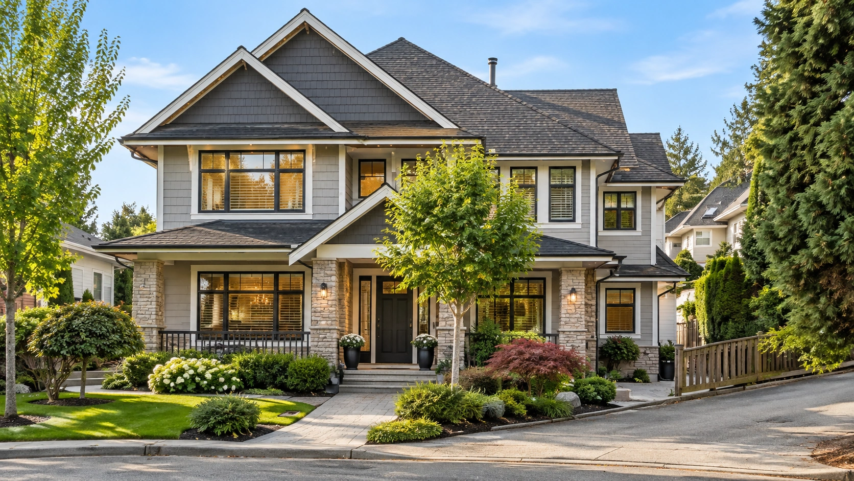
Read

What Homes Cost in Clayton Heights, Surrey, BC

Clayton Heights, Surrey, BC is the newest, densest quadrant of Cloverdale, which is itself a neighbourhood of Surrey, BC. No benchmark price is published for it, and none ever has been. What can be said honestly is the Cloverdale-wide number, and the housing mix that decides where a specific home sits inside it.

The Number Nobody Publishes for This Sub-Area

Start with the thing most area write-ups quietly skip.

The Fraser Valley Real Estate Board publishes MLS® Home Price Index benchmarks for the Cloverdale, Surrey, BC zone as a single reporting area. It does not break that zone into quadrants. There is no benchmark for Clayton Heights, Surrey, BC, no benchmark for East Cloverdale, Surrey, BC, no benchmark for West Cloverdale, Surrey, BC and no benchmark for Downtown Cloverdale, Surrey, BC. That is not a gap in this post — it is a fact about what gets measured.

So if a page hands you a tidy average for this quadrant, it was produced by someone, not published by anyone — a precision that does not exist, and a buyer who anchors on it is anchoring on nothing.

Two things are worth doing instead. Use the Cloverdale-wide figures for scale, knowing exactly what they cover. Then read the housing mix, because here the mix does more to set a price than the address does.

The Cloverdale, Surrey, BC Zone Figures, August 2026

These cover all four quadrants of Cloverdale, Surrey, BC together. They are not this sub-area's numbers.

SegmentBenchmark priceChange over one year
Composite$930,900−6.0%
Detached$1,339,700−6.3%
Townhouse$757,200−6.4%
Apartment$505,700−11.3%

Source: FVREB MLS® HPI, August 2026.

Two things in that table are worth pulling out.

Detached is the most resilient segment in the zone. Down 6.3% over the year, against 8.8% in Surrey-Central, 7.5% in South Surrey & White Rock and 8.3% across the Fraser Valley Board — a meaningfully smaller decline than every neighbouring zone.

Apartments are the weakest. Down 11.3% over the year, the softest apartment market anywhere in the board's table, while still sitting above Surrey-Central's apartment benchmark of $462,800. Expensive and falling fastest at the same time is an uncomfortable combination, and it is the honest read on that segment right now.

Across the Fraser Valley in August 2026 there were 941 MLS® sales, down 14% from July and up 1% year over year, and the sales-to-active-listings ratio sat at 10% against a balanced range of 12 to 20%. That is a buyer's market by the board's own measure — more choice, longer decisions, more room to negotiate subjects. It is a condition, not a countdown, and it will change when the ratio changes rather than on any date you can circle.

What the Housing Mix Tells You Instead

This is where a sub-area post can be genuinely useful without inventing a figure, because the stock here is unlike the rest of the neighbourhood.

Townhouses make up an unusually large share

Complexes built through the 2000s and 2010s are everywhere in this quadrant, in a way they simply are not in the older streets south of 64 Avenue. That matters for budgeting because the townhouse benchmark of $757,200 sits $582,500 below the detached benchmark of $1,339,700. A zone-wide composite figure blends both, so in an area weighted this heavily toward attached housing, the composite is a poor proxy for what most listings here actually ask.

If you are shopping strata, the listing price is only part of the cost. Monthly maintenance fees, the contingency reserve fund balance, any approved special levy and the depreciation report all belong in your budget before the offer, not after. In a complex fifteen or twenty years old, roofs, envelopes and rainscreening start landing in the minutes — the ordinary lifecycle of the building, and exactly what the strata documents exist to show you.

Detached homes are usually built with a suite

The typical detached house here was designed with a legal basement suite in mind, and a large share also have a coach house off the rear lane. The quadrant was master-planned as lane-served, higher-density housing rather than as a traditional subdivision, so this is the intended product, not a conversion.

That changes the arithmetic in a way a benchmark can never show. Two houses on the same street, one with a rented legal suite and one without, are not the same purchase and will not attract the same offers — the income is doing real work in the price. How much of that income a lender will count toward your qualification is a mortgage broker's question, and it is worth asking before you set a maximum rather than after.

Lots are small and the stock is young

Front yards are shallow, houses sit close together, and useable outdoor space is more often a rear patio than a yard. There is very little older housing. If your budget is aimed at land — a big yard, distance from the neighbour's fence, room for a trailer — this quadrant is not where it goes furthest, and the older streets in East Cloverdale, Surrey, BC or the larger lots in West Cloverdale, Surrey, BC are the more sensible comparison.

The other side of that is real too: newer roofs, windows, service panels and drainage. Older stock elsewhere in Cloverdale, Surrey, BC often carries a decade of deferred maintenance priced into nothing. Here, more of what you are buying is already done.

Who Buys Here, and Why

The buyers this quadrant was built for are move-up households stepping out of a townhouse and into a detached home, and in Clayton Heights, Surrey, BC that step almost always comes with a legal suite attached to it. The trade is lot size for newer construction and a mortgage helper — which is why the detached stock here sells on its rental income as much as on its square footage.

It also draws first-time buyers, because the townhouse supply gives them somewhere to start inside the neighbourhood they eventually want a house in, and households right sizing out of a larger, older home who want less yard but still want a detached house rather than a strata.

It suits you less if outdoor space is the point of the move, if you need to park a boat or a trailer, or if street parking in front of your own house would bother you. Suites and coach houses put more vehicles on each lot than the curb was designed for, and that varies block by block — easily checked by driving the street on a weekday at six in the evening rather than at a Sunday showing.

How This Quadrant Sits Against the Rest of the Neighbourhood

Without a published sub-area figure, the useful comparison is structural rather than numerical.

The older streets of East Cloverdale, Surrey, BC are mostly detached houses on smaller lots, many built without a full basement, which means fewer suites and more room at the curb. West Cloverdale, Surrey, BC runs to larger lots and a higher-end character. Downtown Cloverdale, Surrey, BC is the historic commercial core, roughly between 168 Street and 176 Street, with the oldest stock and the most walkable errands.

Against all three, this quadrant is the newest, the densest and the most heavily weighted toward attached housing and suited detached homes. That mix is what makes it, in practice, the more accessible way into a detached house in Cloverdale, Surrey, BC — not because the ground is cheaper, but because the product is different and the income is built in.

What Actually Moves the Price on a Specific Home

Zone benchmarks describe a typical property. Nobody buys a typical property. On a given listing in this quadrant, the things that move the number are concrete:

Whether the suite is legal, and whether it is tenanted. A permitted, occupied suite is income; an unpermitted one is a risk that belongs in your due diligence.

Whether there is a coach house. A second dwelling off the lane is a second income stream and a materially different property.

Which side of a main road it sits on. Homes fronting 72 Avenue or 188 Street live with traffic that homes two streets in do not. Fraser Highway carries the Surrey–Langley SkyTrain construction, and Highway 15 along the eastern edge carries the freight and border traffic north to Highway 1 and south to the crossing.

The block's parking reality. It is the complaint residents raise most, it is structural rather than incidental, and it varies enough street to street to show up in what a house sells for.

Catchment. Much of the area is served by Clayton Heights Secondary, and Surrey catchments are assigned by address rather than by neighbourhood — two homes a few blocks apart can feed different elementary schools. Confirm it for the specific address.

Strata health, for attached homes. Two identical floor plans in two different complexes are two different purchases once the depreciation report and the contingency reserve fund are on the table.

Getting a Real Number for a Real Home

A zone benchmark tells you the neighbourhood is down about 6% over the year. It does not tell you what to offer on the house you saw on Saturday. That answer comes from comparable sales on comparable stock — same form, same era, same suite arrangement, ideally the same few blocks.

To see what is currently listed, browse Clayton Heights homes for sale, or widen it to Cloverdale, Surrey, BC homes for sale. For a figure on one specific home instead of a zone average, call 604-319-5052 or email caroline@carolinejeklin.com. If you are earlier in the process, the guide for buyers walks through the steps, and the mortgage calculator is a reasonable place to sanity-check a payment before you fall for a listing.

Frequently Asked Questions

Is there a published benchmark price for Clayton Heights, Surrey, BC?

No, and there never has been. The Fraser Valley Real Estate Board reports Cloverdale, Surrey, BC as one zone and does not publish quadrant-level benchmarks. Any precise figure quoted for this sub-area has been estimated by whoever published it. The available published numbers are Cloverdale-wide: as of August 2026, a composite benchmark of $930,900, down 6.0% year over year, and a detached benchmark of $1,339,700, down 6.3%.

Are home prices in Clayton Heights, Surrey, BC rising or falling?

The honest answer is at the zone level only. Across Cloverdale, Surrey, BC in August 2026, every property type was down year over year: composite −6.0%, detached −6.3%, townhouse −6.4% and apartment −11.3%. Fraser Valley-wide, 941 MLS® sales in the month were down 14% from July and up 1% year over year, with a sales-to-active-listings ratio of 10% against a balanced range of 12 to 20%. That is a buyer's market by the board's own measure.

What is the most affordable way into a detached home in Clayton Heights, Surrey, BC?

Usually a detached house with a legal basement suite, which is the standard product here rather than the exception, and sometimes a coach house off the rear lane as well. The rental income is part of what makes the payment work for a move-up family. How much of that income a lender will count toward your qualification varies by lender and by file, so confirm it with a mortgage broker before you set your maximum.

How does a legal suite change what a home is worth in Clayton Heights, Surrey, BC?

It changes the buyer pool, and with it the price. A permitted, tenanted suite makes the house partly an income property, which brings in buyers who are underwriting it as one. An unpermitted suite does the opposite: it introduces a compliance question and belongs squarely in your subjects. Confirm the permit status with the City of Surrey rather than relying on how the listing describes it.

Is Clayton Heights, Surrey, BC cheaper than the rest of Cloverdale, Surrey, BC?

There is no published figure that can answer that, and anyone who gives you one has made it up. What is true is structural: this quadrant carries far more townhouses and suited detached homes than the older streets elsewhere in the neighbourhood, on smaller lots and with newer construction. That mix generally makes the entry point into a detached home more accessible here, without saying anything about the price per square foot of the land.

What should a buyer budget for beyond the purchase price here?

For strata purchases, the monthly maintenance fee, the contingency reserve fund balance, any approved special levy and whatever the depreciation report flags in the next few years. For detached homes with a suite or coach house, budget for the landlord side: insurance, vacancy, and the costs of being a landlord even when the income is reliable. Property transfer tax, legal fees and a home inspection apply either way, and for figures on your own situation a mortgage broker and a lawyer or notary are the right people to ask.

Related Reading

About the Author

Caroline Jeklin is a REALTOR® with Royal LePage Wolstencroft Realty, licensed since 2021, and a recipient of the Royal LePage President's Gold Award in 2025 — an award given to the top 6 to 10% of agents in her local marketplace. Between 2021 and 2026 she has been part of 57 transactions across the Fraser Valley, ranging from $302,000 to $4,200,000, as of August 2026. Because no benchmark is published below the Cloverdale, Surrey, BC zone, the price question in this quadrant is really a question about comparable sales on the specific block and the specific form of housing — which is the version of it she can actually answer. Read more about Caroline Jeklin, or reach her at 604-319-5052 or caroline@carolinejeklin.com.

Read

What Homes Cost in Downtown Cloverdale, Surrey, BC

Homes in Downtown Cloverdale, Surrey, BC are priced against the Cloverdale zone as a whole, because no benchmark exists for the quadrant itself. Downtown Cloverdale is one of four quadrants of Cloverdale, a neighbourhood of Surrey, and its housing mix — older detached, townhouse and low-rise apartment — is what actually sets your budget here.

There is no published benchmark for this quadrant, and there never has been

Start with the thing most area guides quietly skip.

The Fraser Valley Real Estate Board publishes MLS® Home Price Index benchmarks by zone. Cloverdale, Surrey, BC is one zone. It is not broken into quadrants, so there is no Downtown Cloverdale, Surrey, BC benchmark, no East Cloverdale benchmark, no West Cloverdale benchmark and no Clayton Heights benchmark. That is not a gap that will be filled next quarter — those sub-area figures have never been published.

So when a page tells you the "average price in Downtown Cloverdale," one of two things is happening. Either it is quoting the Cloverdale zone number without saying so, or somebody has averaged a handful of recent sales and called the result a benchmark. In a quadrant this small, across a housing stock this mixed, that average swings on which four homes happened to close that month.

I'm not going to invent a number for you. What I can do is give you the real Cloverdale-wide figures, tell you honestly what they cover, and then describe the housing mix here well enough that you can work out where inside that range your own search sits. That last part is the useful bit, and it's the part nobody writes.

The Cloverdale, Surrey, BC benchmarks, August 2026

These are the Fraser Valley Real Estate Board MLS® HPI benchmark prices for the Cloverdale, Surrey, BC zone, August 2026. They cover all four quadrants together, including Downtown Cloverdale, Surrey, BC — not this quadrant on its own.

SegmentBenchmark (Cloverdale zone)1-year change
Composite$930,900−6.0%
Detached$1,339,700−6.3%
Townhouse$757,200−6.4%
Apartment$505,700−11.3%

Two things sit underneath that table.

Cloverdale detached has held up better than its neighbours. At −6.3% over the year, detached here fell more slowly than Surrey-Central at −8.8% and South Surrey & White Rock at −7.5%, and better than the Fraser Valley Board's −8.3%. Note that "Surrey" in the board's reporting means Surrey-Central, a separate zone — there is no all-of-Surrey benchmark to compare against.

Apartments are the opposite story. At −11.3%, the Cloverdale apartment benchmark fell further over the year than any other segment in the board's table. That matters here more than in the other three quadrants, because this is where most of Cloverdale's low-rise apartment stock actually is.

For context on the wider market: across the Fraser Valley in August 2026, the sales-to-active-listings ratio was 10%, against a balanced range of 12% to 20%, on 941 MLS® sales — up 1% year over year, with prices down in every zone and every property type. That is a buyer's market by the board's own measure. I'll name the condition and leave the timing to you; there's no deadline in it.

The housing mix here is what actually moves your budget

This is where a quadrant-level answer is possible without inventing a quadrant-level price.

Cloverdale, Surrey, BC as a whole reads as a detached-home neighbourhood, and the zone benchmark reflects that. Downtown Cloverdale, Surrey, BC is the exception inside it. The band between 168 Street and 176 Street carries a genuinely mixed stock:

  • Post-war and mid-century detached homes on modest lots, particularly on the streets close to the commercial core. Smaller lots than West Cloverdale, Surrey, BC, and older systems.

  • Low-rise apartment buildings of three and four storeys, concentrated near 176 Street and 60 Avenue. This is the most apartment-heavy quadrant of Cloverdale.

  • Townhouse complexes from several build eras, from the 1990s through recent infill.

  • Newer detached infill — houses built in the last fifteen years dropped onto older lots, occasionally next door to a home four decades older.

The practical consequence: the spread of what you can buy within a ten-minute walk is wider here than anywhere else in Cloverdale, Surrey, BC. The townhouse and apartment benchmarks in the table above are the ones that describe a large share of this quadrant's stock, while in West Cloverdale, Surrey, BC the detached line does almost all the work. Two buyers with very different budgets can both shop the same eight blocks, and that is unusual.

It also means the zone detached benchmark misleads here. A 1958 house on a modest lot and a 2019 infill build on the same street are both "detached in Cloverdale," and they are not the same purchase.

Who buys in this quadrant, and why

The buyers who end up in Downtown Cloverdale, Surrey, BC are usually the ones who have decided that being able to walk to the library, the recreation centre and a grocery store matters more to them than the extra land they would get further west. What makes that possible on more than one budget is the mix: this is the quadrant where new construction keeps being added on top of an older base, so there is more than one price of entry.

That trade — walkability for lot size — is the single clearest pattern in this quadrant, and it shows up across three quite different budgets.

People right sizing out of a larger family home. The mix is the whole point: there is an actual step-down option, in townhouse or low-rise apartment form, inside the same few blocks as the detached stock. In most of Cloverdale, Surrey, BC, right sizing means leaving the area. Here it doesn't have to.

First-time and single buyers. The apartment and townhouse stock near 176 Street and 60 Avenue is the most accessible entry point in Cloverdale outside Clayton Heights, Surrey, BC, and unlike the newer areas it comes with somewhere to walk to.

Buyers who want an older detached home on a smaller lot and are comfortable trading a newer build for a shorter walk and, usually, a lower purchase price than the equivalent square footage west of 168 Street.

Who tends not to buy here: anyone whose priority is a large lot, a workshop, or new construction. That buyer is better served in West Cloverdale, Surrey, BC or Clayton Heights, Surrey, BC, and I'd rather say so than spend a Saturday proving it.

Where I draw the line, and what "desirable" means without a number

When someone asks me where Downtown Cloverdale, Surrey, BC actually starts and stops, I give them the same two numbers: 168th to 176th. That band is the main middle ground of Cloverdale, Surrey, BC — not the newer construction out west, not the older compact grid across 176 Street — and I'd call it very desirable. I say that as a description of the area, not as a price. Desirable shows up in how often a buyer who started out looking at the whole neighbourhood narrows to those blocks once they've walked them. It does not show up in a benchmark, because no benchmark for those blocks exists. Anyone who tells you otherwise is quoting the zone and hoping you won't check.

What actually changes the price address to address

Inside a quadrant this mixed, the variables below move a number further than the quadrant boundary does.

Which street, and how far from Highway 15. 176 Street through the commercial core is Highway 15, the provincial route running south to the Pacific Highway border crossing, and it carries commercial truck traffic. A home a few streets off it and a home fronting it are different products. This is the most underreported price factor in the area.

Build era and what's been done since. With four or five vintages on a block, condition varies enormously. Roof, drain tile, electrical service and windows are the items that decide whether an older detached home here is a bargain or a project.

For stratas, the building's paperwork. On an older low-rise, the depreciation report, the reserve fund balance and the special levy history matter more to your real cost than the finish level of the kitchen. Read them before your subjects come off, not after.

Distance to the civic cluster. The Museum of Surrey, the Cloverdale Library, the Cloverdale Recreation Centre and the Cloverdale Fairgrounds are all within a short radius, and so is the Cloverdale Millennium Trail on the old rail alignment. Proximity to those is a real part of what people are paying for here.

Budgeting past the purchase price

A few costs that catch buyers out in this quadrant specifically.

Strata fees on older low-rise buildings. Lower monthly fees are not automatically cheaper. A building with modest fees and a thin reserve fund is deferring a bill, not avoiding one.

Older-home maintenance. On post-war and mid-century detached stock, budget for systems, not cosmetics. An inspection matters more here than in an area where everything went up in the same three years.

Property tax and utilities are set by the City of Surrey and apply across the municipality — check the current year's rate against the assessed value of the specific home rather than an area average.

Your deposit and financing are conversations for a mortgage broker and, on anything unusual, a lawyer or notary. I'll flag what to ask; I won't answer it for them.

How to get a number for your own search

There is no shortcut around the fact that the useful number is address-specific. What I'd do in your position:

  1. Decide the housing type first. Detached, townhouse and apartment are three different markets in this quadrant, and the zone benchmarks above are the honest starting range for each.

  2. Walk the band between 168 Street and 176 Street. Once on a weekday, once on a Saturday when the main street is busy. It's small enough that an afternoon settles a lot.

  3. Look at what's actually listed, not what an area average implies. You can browse Downtown Cloverdale homes for sale, or the whole neighbourhood at Cloverdale, Surrey, BC homes for sale — and filter by street and property type.

  4. Then get a real number on a real address. That's a twenty-minute conversation, and it beats any figure on any area page, including this one.

Frequently Asked Questions

Is there a published benchmark price for Downtown Cloverdale, Surrey, BC?

No. The Fraser Valley Real Estate Board publishes MLS® HPI benchmarks for the Cloverdale zone as a whole and does not break it into quadrants, so no Downtown Cloverdale benchmark exists and none ever has. Any page quoting a specific average for the quadrant is either repeating the Cloverdale, Surrey, BC zone figure without saying so, or averaging a small handful of recent sales, which is not the same thing.

What do the Cloverdale, Surrey, BC benchmarks say for someone buying in this quadrant?

For August 2026 the Cloverdale zone benchmarks were $1,339,700 detached (down 6.3% over the year), $757,200 townhouse (down 6.4%), $505,700 apartment (down 11.3%) and $930,900 composite (down 6.0%). Those cover all four quadrants together. They're the honest starting range by property type for Downtown Cloverdale, Surrey, BC, but they do not describe this quadrant specifically.

Is Downtown Cloverdale, Surrey, BC cheaper than the rest of Cloverdale, Surrey, BC?

There's no published figure that would let anyone answer that with a number, and I won't estimate one. What can be said is that the housing mix differs: this quadrant carries more townhouse and low-rise apartment stock than West Cloverdale, Surrey, BC, and its detached homes sit on smaller, older lots. That mix means the entry point by property type is lower here, which is not the same as the same home costing less.

What is the most accessible way into Downtown Cloverdale, Surrey, BC?

The low-rise apartment and townhouse stock, concentrated near 176 Street and 60 Avenue. It's the most accessible entry point in Cloverdale, Surrey, BC outside Clayton Heights, Surrey, BC, and it comes with walkable errands the newer quadrants don't offer. On any older strata, read the depreciation report, the reserve fund balance and the special levy history before your subjects come off.

Are prices rising or falling for buyers looking at Downtown Cloverdale, Surrey, BC?

Falling, across the board. In August 2026 the Fraser Valley Real Estate Board reported prices down in every zone and every property type, on 941 MLS® sales, up 1% year over year. The sales-to-active-listings ratio was 10%, below the balanced range of 12% to 20%. Cloverdale, Surrey, BC detached held up best at −6.3%; apartments there fell furthest at −11.3%.

What should I budget for beyond the purchase price in Downtown Cloverdale, Surrey, BC?

On older detached homes, systems rather than cosmetics — roof, drain tile, electrical service and windows. On older low-rise stratas, the monthly fee plus whatever the reserve fund is not currently covering. Property tax and utilities are set by the City of Surrey and should be checked against the specific home's assessed value. Deposit and financing questions belong with a mortgage broker.

Related Reading

About the Author

Caroline Jeklin is a REALTOR® with Royal LePage Wolstencroft Realty, licensed in 2021 and working across the Fraser Valley from Cloverdale, Surrey, BC. She has been part of 57 transactions in that time, at prices from $302,000 to $4,200,000 (2021–2026, as of August 2026), and carries 11 Google reviews from past clients. She spends a lot of her working life explaining why a zone benchmark is not an address, which is most of what this post is about — in Downtown Cloverdale, Surrey, BC, where a 1958 bungalow and a recent infill build can sit on the same street, that distinction decides whether a budget is realistic. You can read more about Caroline Jeklin's background and approach, or reach her directly at 604-319-5052 or caroline@carolinejeklin.com.

Read

What Homes Cost in West Cloverdale, Surrey, BC

West Cloverdale, Surrey, BC has no published benchmark price of its own, and never has. The Fraser Valley Real Estate Board reports Cloverdale, Surrey, BC as one zone. What you can know honestly is the housing mix west of 168 Street — and that it splits at 60 Avenue, with larger lots and detached stock to the south, a genuine mix of townhomes and smaller-lot detached to the north — and what that does to a budget.

Start with what is not published

Most pages that answer this question give you a number. That number is almost always an estimate dressed up as a statistic, and it's worth understanding why before you plan around one.

The Fraser Valley Real Estate Board publishes MLS® Home Price Index benchmarks for a fixed list of reporting zones. Cloverdale, Surrey, BC is one of them. The quadrants inside it — the western one west of 168 Street, the older eastern streets, the historic core, and Clayton Heights, Surrey, BC — are not reported separately. There is no benchmark published for West Cloverdale, Surrey, BC, none for East Cloverdale, Surrey, BC, and none for Downtown Cloverdale, Surrey, BC. That isn't a gap in this post. It's a gap in the data, and it has always been there.

So I'm not going to give you a sub-area figure, because I'd have to make it up. Not a range, not an "adjusted" number, not a "typically around". A fabricated number is worse than no number, because you'd plan against it.

What I will do is give you the published Cloverdale-wide figures with their date attached, and then spend the rest of this post on the thing that actually moves your budget in this part of the community: the mix.

The Cloverdale, Surrey, BC benchmarks, August 2026

These are the current published MLS® HPI benchmark prices for the Cloverdale zone as a whole, from the Fraser Valley Real Estate Board's August 2026 statistics package. They cover all four quadrants together.

SegmentBenchmark1-year change
Composite$930,900−6.0%
Detached$1,339,700−6.3%
Townhouse$757,200−6.4%
Apartment$505,700−11.3%

Two things about that table are worth reading carefully.

The first is the date. August 2026 is the most recent reporting month FVREB has published. Anything presented to you as an August figure for this area does not exist yet.

The second is the detached line. Down 6.3% over the year sounds like a decline, and it is — but across the Fraser Valley it is the shallowest detached decline in the board's zone table. Surrey-Central detached is down 8.8% over the same period, South Surrey and White Rock detached is down 7.5%, and the Fraser Valley Board overall is down 8.3%. Cloverdale detached has fallen at a meaningfully slower rate than its neighbours. For a buyer looking at the western quadrant — which is overwhelmingly detached — that is the most relevant single fact in the whole package.

For context on the market these figures sit in: the Fraser Valley recorded 941 MLS® sales in August 2026, up 1% year over year, with a sales-to-active-listings ratio of 10%. Balanced is 12% to 20%. Below that is a buyer's market, and prices are falling in every zone and every property type. I'm naming the condition, not a deadline.

The housing mix that actually sets your budget here

This is the part nobody writes, and it's the part that answers the real question.

It skews detached, hard

The stock west of 168 Street is dominated by detached, single-family houses. Most of it went in from the late 1990s onward, after the City of Surrey approved neighbourhood concept plans for the area's two halves, split at 60 Avenue, in 1997. The city now describes both as largely complete.

That has a direct budget consequence. In a quadrant where the overwhelming majority of what trades is detached, the Cloverdale, Surrey, BC composite benchmark of $930,900 — which blends detached, townhouse and apartment sales across all four quadrants — is the least useful number on the table for you. The detached benchmark of $1,339,700 is the one that describes the product actually being sold on these streets, and even that is a Cloverdale-wide figure, not a local one.

Lot sizes run larger, and that's most of the difference

Lots in this quadrant are larger than in most of the rest of Cloverdale, Surrey, BC, and the houses were built to fill them. Land is the single biggest input into a detached price in the Fraser Valley, so a larger lot in a finished, planned subdivision is not a small variable — it's usually the variable.

That's also why comparing a listing here to a listing in the older eastern streets on price alone will mislead you. You're often comparing two different quantities of land with a house on each.

The stock has a narrow, consistent vintage

Because the area built out over a defined window rather than across four decades, the housing has an unusually consistent age. Practically, that means fewer of the surprises that come with genuinely old stock — and it also means many of these homes are now at the age where roofs, hot water tanks and exterior finishes come due together. Read the inspection with that in mind and price the next decade of maintenance into your offer rather than into your regret.

What you won't find much of

Townhouse and apartment product is scarce south of 60 Avenue, where the stock is almost entirely larger-lot detached. North of 60 Avenue it is not scarce at all — established townhouse complexes including Arbour Village on 164 Street, Westfield on 166 Street and Turnberry on 168 Street run to a couple of hundred units between them, on smaller detached lots than the southern half. Across both halves, secondary suites and coach homes are far less common than in the newer, denser parts of Cloverdale, Surrey, BC built out in the 2000s and 2010s.

That matters to a budget in two directions. South of 60 Avenue there is very little entry-level way in — the $757,200 townhouse and $505,700 apartment benchmarks describe Cloverdale product that mostly sits elsewhere in the community, not on those streets. North of 60 Avenue the townhouse stock is the entry point, and it is the reason you can start here and move up without leaving the quadrant. And there's less mortgage-helper income built into the stock, so what you can carry is more likely to rest on your own household income alone than it would in Clayton Heights, Surrey, BC.

How this quadrant sits against the rest of Cloverdale, Surrey, BC

Without a published sub-area number, the honest positioning statement is a statement about mix, not price — and it's still useful.

A half made up almost entirely of larger-lot detached homes has a higher entry point than one that also offers townhouses, apartments and suited newer construction, because there is simply less inexpensive product in it. That is arithmetic about inventory, not a price quote. A buyer whose budget lands near the Cloverdale townhouse or apartment benchmark will usually find their options north of 60 Avenue, in Downtown Cloverdale, Surrey, BC, or in Clayton Heights, Surrey, BC — rather than on the larger-lot streets south of 60th.

The flip side is that the segment this quadrant is made of — detached — is the segment that has held up best in Cloverdale, Surrey, BC over the past year.

Who buys here and why

Who buys in West Cloverdale, Surrey, BC depends on which side of 60 Avenue they are looking at. South of 60th the buyer is almost always a move-up household with the budget for a large-lot detached house they intend to stay in, because there is very little else on offer. North of 60th the entry point is far lower — the townhouse stock gives a way in to someone who could not carry the southern half — and that difference decides where most people actually end up.

In practice, south of 60 Avenue that tends to mean move-up buyers rather than first-time ones, and households who have already decided which part of the Fraser Valley they want to be in. The everyday infrastructure across this side of Cloverdale, Surrey, BC supports that read — A.J. McLellan Elementary at 16545 61 Avenue sits inside the quadrant, Lord Tweedsmuir Secondary at 6151 180 Street is a short drive east, and Cloverdale Athletic Park at 6410 168 Street on the eastern edge carries a great deal of the organized sport in the community. Bose Forest Park at 6203 164 Street is the quieter counterweight.

It also means people right sizing out of a larger property sometimes find the southern half awkward, because the product there runs big. If you want less house and less yard but still want a house, the townhouse stock north of 60 Avenue is the place to look before you write off the quadrant altogether.

What actually sets the price on a specific house

Once you're looking at real listings, four things move the number far more than any area average would:

Lot size and shape. As above. It's the biggest single input, and it varies more within this quadrant than the streetscape suggests.

What backs onto it. The western and southern edges of the quadrant run along Agricultural Land Reserve farmland near 64 Avenue and 152 Street. A home whose rear boundary faces protected farmland is a different proposition from one facing another row of houses. What can and cannot be done on any particular ALR parcel is a question for a lawyer and the City of Surrey's planning department, asked in writing about that specific parcel before subjects are removed.

Whether it's been updated. In a stock of consistent vintage, the homes that have had kitchens, roofs and mechanicals done separate sharply from the ones that haven't.

Access. Highway 10 runs along the southern edge, Highway 15 along 176 Street handles north–south travel, and Fraser Highway cuts diagonally toward Langley City, BC and Langley Township, BC. Proximity to those routes cuts both ways — convenience on one side, road noise on the other — and it shows up in pricing.

None of those are visible in a benchmark. All of them are visible in comparable sales on the block, which is what a real valuation is built from.

Getting a real number

If you want to know what a specific home is worth, that's a conversation about recent comparable sales on those particular streets, not a figure lifted from a zone-wide index. It takes me an afternoon and it costs you nothing.

In the meantime, you can browse West Cloverdale homes for sale, or widen it to Cloverdale, Surrey, BC homes for sale, which covers all four quadrants.

Frequently Asked Questions

Is there a published benchmark price for West Cloverdale, Surrey, BC?

No. The Fraser Valley Real Estate Board publishes MLS® Home Price Index benchmarks for the Cloverdale, Surrey, BC zone as a whole and has never broken out the quadrants inside it. Any precise figure you're quoted for this sub-area is someone's estimate, not a published statistic.

What are the published Cloverdale, Surrey, BC benchmark prices right now?

As of August 2026, the FVREB benchmarks for the Cloverdale zone are $1,339,700 for a detached home, down 6.3% year over year; $930,900 composite, down 6.0%; $757,200 for a townhouse, down 6.4%; and $505,700 for an apartment, down 11.3%. Those are Cloverdale-wide figures covering all four quadrants.

Why would a home west of 168 Street cost more than one elsewhere in Cloverdale, Surrey, BC?

Because of the mix rather than any published premium. The quadrant is almost entirely larger-lot detached housing, with very little townhouse, apartment or suited newer product, so there's less inexpensive inventory in it than in quadrants that offer all of those. Land is also the largest single input into a detached price in the Fraser Valley, and lots here run larger.

Can you buy a townhouse or an apartment in West Cloverdale, Surrey, BC?

Very little of either exists west of 168 Street. Townhouse and apartment product is concentrated in the newer and more central parts of Cloverdale, Surrey, BC, so a buyer whose budget sits near the Cloverdale townhouse benchmark of $757,200 or the apartment benchmark of $505,700 as of August 2026 will usually find their options in another quadrant.

Is this a buyer's market or a seller's market in 2026?

A buyer's market, on the published numbers. The Fraser Valley recorded 941 MLS® sales in August 2026, up 1% year over year, with a sales-to-active-listings ratio of 10% against a balanced range of 12% to 20%, and prices falling across every zone and property type. Cloverdale detached has held up better than its neighbours, down 6.3% against Surrey-Central's 8.8%.

How do I find out what a specific home in West Cloverdale, Surrey, BC is worth?

Through comparable sales on that block, adjusted for lot size, condition, what the property backs onto and access to Highway 10 and Highway 15. A zone-wide benchmark can tell you which direction the market is moving; it can't value a house. That part starts with the address.

Related Reading

About the Author

Caroline Jeklin is a REALTOR® with Royal LePage Wolstencroft Realty, working across Cloverdale, Surrey, BC and the wider Fraser Valley. She received the Royal LePage President's Gold Award in 2025, placing her in the top 6–10% of agents in her local marketplace. Licensed in 2021, she has been part of 57 transactions between 2021 and 2026, ranging from $302,000 to $4,200,000, as of August 2026. She wrote this one because the price question for a quadrant with no published benchmark gets answered with invented numbers more often than not, and the housing mix is a better guide to a budget than a figure nobody can source. Read more about Caroline Jeklin, or reach her directly at 604-319-5052 or caroline@carolinejeklin.com.

Read

What Homes Cost in East Cloverdale, Surrey, BC

East Cloverdale, Surrey, BC has no published benchmark price of its own, and it never has. Cloverdale is a neighbourhood of Surrey, BC, and the Fraser Valley Real Estate Board reports it as one zone rather than four quadrants. So the honest starting point is the Cloverdale-wide numbers, plus what the local housing mix actually is.

Start with what does not exist

The Fraser Valley Real Estate Board publishes MLS® Home Price Index benchmarks for a fixed list of reporting areas. Cloverdale, Surrey, BC is on that list. East Cloverdale, Surrey, BC is not, and neither are West Cloverdale, Surrey, BC, Downtown Cloverdale, Surrey, BC or Clayton Heights, Surrey, BC. There has never been a quadrant-level benchmark for any of them.

That matters because a lot of pages will happily quote you an "average price in East Cloverdale". That number usually comes from a small slice of recent sales inside a hand-drawn map boundary, run through an average and presented with the confidence of a published index — or from a plausible-looking adjustment to the Cloverdale figure.

I won't do that. A benchmark is a specific statistical construct — the price of a typical home of a given type in a given area, tracked over time — and inventing one for a sub-area by nudging the parent zone's number is not analysis. It's decoration. If a figure isn't published, this post doesn't carry it.

The Cloverdale, Surrey, BC benchmarks, August 2026

These are the Fraser Valley Real Estate Board's MLS® HPI benchmark prices for the Cloverdale, Surrey, BC zone as of August 2026, the most recent reporting month. They cover all four quadrants of Cloverdale, Surrey, BC together — not East Cloverdale specifically.

SegmentBenchmark, August 2026Change over 1 year
Composite$930,900−6.0%
Detached$1,339,700−6.3%
Townhouse$757,200−6.4%
Apartment$505,700−11.3%

Three things worth pulling out of that table.

Detached is holding up better here than almost anywhere nearby. Cloverdale detached is down 6.3% year over year, against 8.8% for Surrey-Central detached, 7.5% for South Surrey & White Rock and 8.3% for the Fraser Valley Board as a whole — a notably slower rate of decline than its neighbours. That's the most favourable statistic in the zone, and it's a detached statistic, which matters for a quadrant built mostly of detached houses.

Apartments are the weakest segment in the region. Cloverdale apartments are down 11.3% over the year, the steepest decline of any apartment market in the August 2026 table, while still costing more than Surrey-Central apartments at $505,700 versus $462,800. Expensive and falling fastest is an uncomfortable combination, and anyone shopping that segment should know it going in.

Everything is down on price, even as sales hold up. August 2026 in the Fraser Valley was a buyer's market by the board's own measure: sales-to-active-listings ran at 10%, where 12–20% is considered balanced, on 941 MLS® sales — down 14% from July, though up 1% year over year. Prices fell in every zone and every property type. That's the condition, not a deadline — and it changes how an offer gets written far more than it changes what a house is worth.

What the housing mix here tells you instead

This is the part nobody writes, and it's more useful than a fake sub-area average.

The dominant form on this side of Cloverdale, Surrey, BC is the detached house on a regular, modest lot. The stock is older than what's been built west of 168 Street and considerably older than the townhouse-and-coach-home product that fills Clayton Heights, Surrey, BC. Streets here are built out. There is no fenced-off phase at the end of the block waiting to become another forty units.

A few consequences follow directly from that mix, and each one is a real input into price:

It skews detached. If you're shopping for a townhouse or an apartment, most of the Cloverdale, Surrey, BC inventory in those segments sits elsewhere in the neighbourhood — the newer strata developments and the multi-family projects clustered nearer Highway 15 along 176 Street and up toward Fraser Highway. That means the Cloverdale composite benchmark of $930,900, which blends all three property types, describes a mix that isn't really the mix on these streets. The detached figure is the more relevant one here, and it is the higher one.

Lots run smaller. Compared with West Cloverdale, Surrey, BC, lot sizes here are more compact. Land is a large share of what a detached Fraser Valley house is worth, so a smaller lot pulls against the price of an otherwise-comparable home. That's a real downward pressure on individual sale prices in this quadrant relative to the larger-lot streets in the same zone — and it is precisely why I won't put a number on it, because the size of that effect varies block by block and there is no published figure for it.

The stock is older. Older houses come with older roofs, older windows, older drainage and older electrical service. Many were built without a full basement, which is why secondary suites and coach homes are less common here than in the newer parts of Cloverdale, Surrey, BC. That cuts two ways on price. Fewer suites means less mortgage-helper income for a buyer to count on, which softens what some buyers can pay. It also means fewer vehicles per address and more room at the curb, which is a genuine quality-of-life advantage buyers do pay for.

Location inputs are strong and stable. Lord Tweedsmuir Secondary School on 180 Street, Martha Currie Elementary School and Don Christian Elementary School on 184 Street, Don Christian Park and the Don Christian Recreation Centre at 6220 184 Street, and Cloverdale Athletic Park off 64 Avenue and 168 Street are all fixed features of the area. Proximity to a park, a rec centre or a school people want is a durable input into what a specific address is worth — and Surrey catchments are drawn by address, not by neighbourhood, so confirm the current catchment for the exact property rather than assuming the quadrant.

Who buys here, and why

Most buyers looking at East Cloverdale, Surrey, BC are choosing it because their budget buys an established detached house here rather than a townhouse or an apartment somewhere else in Cloverdale, Surrey, BC. The trade they are making is lot size and the age of the home — lots here run about 2,000 to 3,000 square feet, against 7,000 and up on the larger-lot streets south of 60 Avenue in West Cloverdale, Surrey, BC, and that gap is usually where a buyer's expectations meet their budget.

That trade is the whole shape of the market on these streets. A buyer who wants land — a big yard, distance from the neighbour's fence, room for a shop — gets further west, or out toward Langley Township, BC, where Fraser Valley Real Estate Board detached benchmarks run higher still at $1,479,400 as of August 2026. A buyer who wants brand-new construction with a suite below and a coach home behind goes to Clayton Heights, Surrey, BC. A buyer who wants a walkable heritage main street goes to Downtown Cloverdale, Surrey, BC.

What's left for this quadrant is a specific and quite common buyer: a household that wants a finished street, an easy numbered grid, parks and schools within a few minutes' drive, and a detached house rather than a strata — and is willing to accept a smaller lot and a house with some age on it to get all four inside one budget.

Right-sizing buyers land here for related reasons: less yard to keep up, no strata council, no monthly maintenance fee, and a house that's already been through its settling. They compete for the same inventory as the families.

When the honest answer is a different city

Not every budget conversation ends with a house in this neighbourhood, and pretending otherwise wastes months of someone's life.

One of the situations I've worked through recently was a multi-generational family selling their Cloverdale, Surrey, BC home to move to Maple Ridge, BC — not because anything was wrong with where they were, but because they needed enough room for more than one family under one roof. That's worth knowing when you're pricing this part of Surrey, BC. The thing that moves people out of Cloverdale, Surrey, BC usually isn't the monthly payment. It's square footage, and how many bedrooms the same money buys somewhere further out. If space for two or three generations is what you're actually buying, I'd rather run that comparison with you properly than talk you into a house that's already too small on the day you get the keys.

Multi-generational purchases also raise questions I don't answer — how title is held, how a mortgage is structured across two households, what happens on an exit. Those belong with a lawyer or notary and a mortgage broker, early, not after an offer is written.

What actually sets the price of one house here

Since there's no sub-area benchmark to anchor to, here is what a real valuation on these streets is built from.

Comparable sales on the block, not the quadrant. Three or four recent sales of similar houses within a short radius will tell you more than any index. That's what I pull when someone asks what a specific address is worth.

Lot size and shape. On smaller, older lots, frontage, depth and whether the lot is flat or sloped all move the number.

Condition and remaining life on the big items. Roof, windows, drainage, service panel, furnace. On older stock these aren't cosmetic questions, and in a buyer's market they get priced into offers rather than argued away.

Whether there's a legal suite. Less common here than in the newer parts of the neighbourhood, and when it exists it's a meaningful premium.

The street itself. Proximity to 64 Avenue, to Highway 10 along 56 Avenue, or to a park moves the number in both directions.

The SkyTrain timeline. The Surrey-Langley SkyTrain extension along Fraser Highway is scheduled to open in late 2029, with a station planned at Fraser Highway and 184 Street. That's a real future input, and it's also four years out — buyers price it partially, not fully, and anyone telling you it's already in the price is guessing.

If you want to see what's currently listed, browse East Cloverdale homes for sale, or widen it to Cloverdale, Surrey, BC homes for sale for the whole neighbourhood rather than one quadrant. And if you want a number for one specific house — yours or one you're considering — that's a conversation about comparables, not a statistic anyone can publish.

Frequently Asked Questions

Is there a published benchmark price for East Cloverdale, Surrey, BC?

No. The Fraser Valley Real Estate Board publishes MLS® HPI benchmarks for the Cloverdale, Surrey, BC zone as a whole and has never broken out the quadrants. There is no benchmark for East Cloverdale, Surrey, BC, none for West Cloverdale, Surrey, BC, none for Downtown Cloverdale, Surrey, BC and none for Clayton Heights, Surrey, BC. Any precise sub-area figure you're quoted is somebody's estimate presented as a published number.

What were Cloverdale, Surrey, BC benchmark prices in August 2026?

As of August 2026, the Fraser Valley Real Estate Board's MLS® HPI benchmarks for the Cloverdale zone were $1,339,700 for detached, down 6.3% year over year; $757,200 for townhouses, down 6.4%; $505,700 for apartments, down 11.3%; and a composite of $930,900, down 6.0%. Those figures cover all four quadrants of Cloverdale, Surrey, BC together.

Why won't a REALTOR® give me an average price for East Cloverdale, Surrey, BC?

Because a defensible one doesn't exist. A benchmark measures a typical home of a given type in a published reporting area, and no board publishes one at quadrant level. Producing a sub-area figure means either averaging a handful of sales inside a boundary you drew yourself, or adjusting the Cloverdale, Surrey, BC number by judgement. Both look precise and neither is. Comparable sales on the specific block are the honest substitute.

Are there townhouses and apartments in East Cloverdale, Surrey, BC?

Fewer than elsewhere in the neighbourhood. This quadrant skews strongly detached, on older and more compact lots, and most of the townhouse and apartment inventory in Cloverdale, Surrey, BC sits in the newer developments in other parts of the neighbourhood. That's why the Cloverdale composite benchmark of $930,900, which blends all three property types, describes a mix that isn't really the mix on these streets.

How does a buyer's market in the Fraser Valley change what I pay in East Cloverdale, Surrey, BC?

In August 2026 the Fraser Valley ran at a sales-to-active-listings ratio of 10%, below the 12–20% considered balanced, on 941 MLS® sales, up 1% year over year. In practice that means more inventory, more time to look, and more room to write subjects that actually protect you — an inspection, financing, a title review. On older detached stock in East Cloverdale, Surrey, BC, the inspection subject is the one that earns its keep.

How do I find out what my own home in East Cloverdale, Surrey, BC is worth?

Through comparable sales, not an index. That means recent sales of similar houses within a short radius, adjusted for lot size, condition, the remaining life on the roof and mechanical systems, and whether there's a legal suite. It's a specific piece of work on a specific address, and it's the only thing that produces a number you can act on in a quadrant with no published benchmark.

Related Reading

About the Author

Caroline Jeklin is a REALTOR® with Royal LePage Wolstencroft Realty, licensed since 2021. Between 2021 and 2026 she has been part of 57 transactions across the Fraser Valley, ranging from $302,000 to $4,200,000, as of August 2026, and she holds 11 Google reviews from past clients. Pricing a home in a quadrant with no published benchmark is comparable-sales work rather than index work, and it's the piece of this she'd rather do properly than approximate. Read more about Caroline Jeklin, or reach her directly at 604-319-5052 or caroline@carolinejeklin.com.

Read
Reciprocity Logo The data relating to real estate on this website comes in part from the MLS® Reciprocity program of either the Greater Vancouver REALTORS® (GVR), the Fraser Valley Real Estate Board (FVREB) or the Chilliwack and District Real Estate Board (CADREB). Real estate listings held by participating real estate firms are marked with the MLS® logo and detailed information about the listing includes the name of the listing agent. This representation is based in whole or part on data generated by either the GVR, the FVREB or the CADREB which assumes no responsibility for its accuracy. The materials contained on this page may not be reproduced without the express written consent of either the GVR, the FVREB or the CADREB.