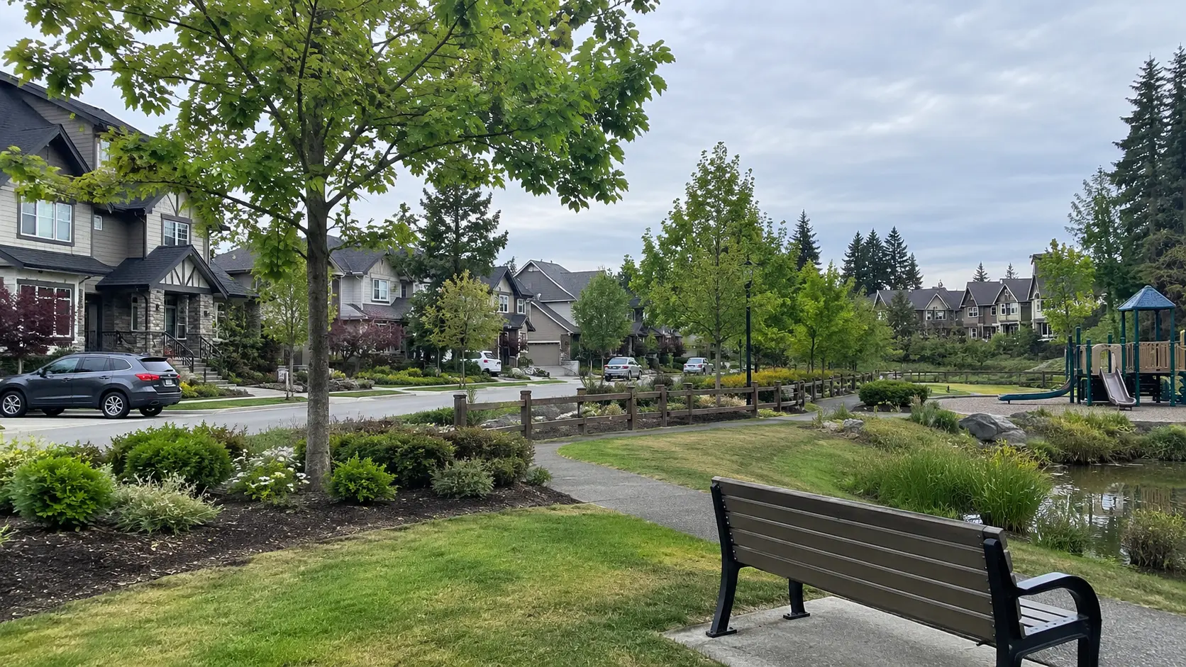
West Cloverdale, Surrey, BC is the settled, larger-lot western quadrant of Cloverdale, Surrey, BC, sitting west of 168 Street between Highway 10 and 64 Avenue, with Agricultural Land Reserve farmland along its western and southern edges. It's quiet, finished, and built for people who intend to stay a while.
Where the area actually sits
The City of Surrey defines this quadrant precisely, which is unusual and useful. West Cloverdale, Surrey, BC is the group of neighbourhoods along the Agricultural Land Reserve escarpment, west of 168 Street, between Highway 10 and 64 Avenue. The city planned it in two halves — West Cloverdale North and West Cloverdale South, split at 60 Avenue — approving both neighbourhood concept plans in 1997, and now describes both as largely complete.
That last detail matters more than it sounds. A neighbourhood that finished building out lives differently from one still filling in — no next phase, no construction road, no sales centre. What you see driving 60 Avenue or 62 Avenue on a Tuesday evening is what the area is.
The character, and why people who live here rarely leave
West Cloverdale, Surrey, BC is the established, larger-lot side of the community, west of 168 Street — but it is really two areas, split at 60 Avenue. South of 60th is the executive end: lots from about 7,000 square feet up to 12,000, running down toward Highway 10. North of 60th is older and more mixed, with larger townhomes and detached homes on lots closer to 2,000 to 4,000 square feet, which is why you can start in a condo there, move up to a townhouse, and end up in a detached house without ever leaving the neighbourhood.
The feel is residential in the old sense of the word. Long blocks, trees planted when the subdivisions went in and given nearly thirty years to fill out, driveways with room on them, and — because the western edge backs onto protected farmland rather than more houses — an actual horizon at the end of some streets. It isn't a walkable-café neighbourhood and doesn't pretend to be.
When buyers ask me where the higher-end side of Cloverdale, Surrey, BC is, I tell them West Cloverdale, Surrey, BC, and then I usually say the same two things. The first is that it tends to be the OG — the established part, the one that was already finished while other pockets were still being framed. The second is that anyone going there is going into a home. I don't say that as a slogan. I mean it literally: almost nobody buys here as a stepping stone. They buy because they've decided this is the house, and they're planning to be in it for a long time.
Housing stock and lot sizes
The stock is mostly detached and single-family, built from the late 1990s onward as the two neighbourhood plans rolled out — and those two plans are the thing to understand, because they split the quadrant at 60 Avenue. South of 60th is almost entirely larger-lot detached. North of 60th is a genuine mix, with established townhouse complexes and smaller-lot detached alongside each other. That gives the area a consistent vintage — old enough to have settled and landscaped and had a round of updates, new enough to sit outside the eras that generate the biggest renovation conversations.
Lot sizes are what people notice first. They run larger here than almost anywhere else in Cloverdale, Surrey, BC, and the houses were built to use them: side yards you can walk down, back yards that fit a table and a trampoline and still have grass left.
Density is where the two halves diverge most. South of 60 Avenue you won't find much of it — townhouse and apartment product is genuinely scarce, and secondary suites and coach homes are far less common than in the areas built out in the 2000s and 2010s. North of 60 Avenue is different: established townhouse complexes including Arbour Village on 164 Street, Westfield on 166 Street and Turnberry on 168 Street add up to a couple of hundred units between them, and the detached lots up there run smaller. Either way, residents of denser Surrey neighbourhoods will appreciate the knock-on effect immediately: street parking is generally not an issue.
Because the mix south of 60 Avenue skews so heavily toward larger detached homes, the entry point into that half of West Cloverdale, Surrey, BC sits above most of the rest of Cloverdale, Surrey, BC — while the townhouse stock north of 60th is what makes a more modest way in possible at all. That's a housing-mix statement, not a price quote — more on that below.
The Agricultural Land Reserve edge along 64 Avenue and 152 Street
The single most distinctive fact about this quadrant is what borders it. Agricultural Land Reserve land — the provincial designation that reserves farmland for agricultural use — runs along 64 Avenue and 152 Street, and the western boundary of the area is the ALR escarpment itself.
For a buyer the practical read is simple, and worth understanding before you fall in love with a view: that open space is open because it's designated, not because nobody has got to it yet. ALR land is administered under a provincial framework and doesn't behave like ordinary residential land waiting its turn. If a home's back fence looks out over fields, you're far less likely to be looking at a subdivision in five years than almost anywhere else in the Fraser Valley.
That's the awareness, and it's where my part of the conversation ends. What may or may not be built on a specific ALR parcel, and what it means for a particular property line, are questions for a lawyer and for the City of Surrey's planning department — asked about that parcel, in writing, before subjects are removed. A REALTOR® can point you at the boundary on a map. Nobody should be giving you the legal answer over coffee.
The flip side is worth naming honestly: farmland is a working landscape, with seasons, equipment and smells. Most people who choose this edge consider that a feature. Some don't, and the way to find out which you are is to stand on the street, more than once.
Getting around
This is a car-first quadrant, and pretending otherwise would do you no favours. The road geometry, though, is unusually convenient for a place that feels this quiet. Highway 10 forms the southern edge. Highway 15 — 176 Street — runs south toward the Pacific Highway border crossing and north toward the Trans-Canada. Fraser Highway cuts through on the diagonal toward Langley City, BC and Langley Township, BC. And 64 Avenue and 168 Street work as through-routes rather than barriers.
Transit is the honest weak point. Like most of Cloverdale, Surrey, BC, this is a bus-to-a-connection area rather than a rapid-transit one, and a household here will realistically want two vehicles.
Schools and parks by name
A.J. McLellan Elementary sits inside the quadrant at 16545 61 Avenue, walkable for a good share of the surrounding streets. Lord Tweedsmuir Secondary, at 6151 180 Street, is the long-standing Cloverdale, Surrey, BC high school, a short drive east in the older core. Catchments in Surrey, BC change more often than people expect — confirm yours for a specific address with the Surrey Schools catchment locator, not a listing sheet, including mine.
The two parks that shape daily life here are opposites.
Bose Forest Park, at 6203 164 Street, is the quiet one — a forested community park the City of Surrey describes as being in west Cloverdale, running between 62 Avenue and 64 Avenue west of 165 Street, with nature trails and a sensitive swamp ecosystem inside it. A piece of real forest inside a residential grid is not a common thing.
Cloverdale Athletic Park, at 6410 168 Street, sits on the quadrant's eastern edge at 168 Street and 64 Avenue: ball diamonds, artificial turf fields, a BMX and mountain bike park, a fieldhouse, and a water park and playground at the south end. If you have kids in organized sport, you'll be there constantly, and from most of the quadrant you'll be there in under ten minutes.
The honest trade-offs
Three, and none are dealbreakers so much as things to be clear-eyed about.
It's quiet, and quiet is a trade. No commercial strip inside the quadrant. Groceries, coffee and errands mean a short drive — east toward the historic core or south along Highway 10. Buyers coming from a walkable urban neighbourhood consistently underestimate how much they'll notice this.
The entry point is higher. Because the mix is so heavily larger-lot detached, there's very little affordable way in. A buyer who wants this area but not this budget usually ends up in the eastern and newer parts of Cloverdale, Surrey, BC instead.
It's finished. The appeal and the constraint at once: what's here is what's here. If you want new construction or the chance to be early in a neighbourhood still forming, that's a different quadrant.
A word on prices, and what I won't do
The Fraser Valley Real Estate Board publishes benchmark prices for the Cloverdale, Surrey, BC zone as a whole. As of August 2026, the detached benchmark for that zone is $1,339,700, down 6.3% year over year, with the composite benchmark at $930,900.
Those are Cloverdale-wide figures. There is no published benchmark for West Cloverdale, Surrey, BC, or for any other quadrant of the community — FVREB doesn't report at that level and never has. So I won't give you a sub-area number; any number I gave you would be invented, and a made-up figure is worse than none. What I can tell you is the mix that actually drives the price you'll see: larger lots, larger detached homes, very little entry-level product. For a real number on a real property, that's a conversation, and it starts with the address.
If you'd like to see what's currently on the market, you can browse West Cloverdale homes for sale, or widen it to Cloverdale, Surrey, BC homes for sale for the whole community, which covers all four quadrants.
Frequently Asked Questions
Where exactly is West Cloverdale, Surrey, BC?
It's the western quadrant of Cloverdale, Surrey, BC — the neighbourhoods along the Agricultural Land Reserve escarpment, west of 168 Street, between Highway 10 and 64 Avenue. The City of Surrey planned it as two areas, West Cloverdale North and West Cloverdale South, divided at 60 Avenue, and approved both neighbourhood concept plans in 1997.
What kind of homes are in West Cloverdale, Surrey, BC?
It depends which half you're in, because the quadrant is split at 60 Avenue by two separate neighbourhood plans. South of 60th is overwhelmingly detached single-family homes on larger lots, most built from the late 1990s onward, with townhouses and apartments genuinely scarce. North of 60th is a real mix: established townhouse complexes alongside detached homes on smaller lots. Across both halves, secondary suites and coach homes are far less common than in areas built out in the 2000s and 2010s.
What does the Agricultural Land Reserve boundary mean for a buyer here?
Practically, it means the open space along 64 Avenue and 152 Street is open because it's designated farmland, not because development hasn't reached it — so a home backing onto it is less likely to end up backing onto a subdivision. What may or may not be done on any specific ALR parcel is a legal and municipal-planning question, not a REALTOR®'s, and it should be asked of a lawyer and the City of Surrey about that exact parcel before subjects are removed.
Which schools and parks are in West Cloverdale, Surrey, BC?
A.J. McLellan Elementary is at 16545 61 Avenue, inside the quadrant. Lord Tweedsmuir Secondary is at 6151 180 Street, a short drive east in the older core of Cloverdale, Surrey, BC. For parks, Bose Forest Park at 6203 164 Street offers forest trails and a wetland, and Cloverdale Athletic Park at 6410 168 Street, on the eastern edge, has ball diamonds, artificial turf fields, a BMX and mountain bike park, and a water park and playground. Confirm school catchments for a specific address with the Surrey Schools catchment locator.
What are the real trade-offs of living in West Cloverdale, Surrey, BC?
Three. There's no commercial strip inside the quadrant, so groceries and coffee mean a short drive. The entry point sits above most of Cloverdale, Surrey, BC because the housing mix is so heavily larger-lot detached. And the area is finished — which is the appeal for most buyers, but it means no new construction and no chance to get in early on something still forming.
If a specific school is driving your search, you can find homes by school catchment rather than by neighbourhood — catchment boundaries don't always follow the lines you'd expect, and two homes a few blocks apart can be assigned to different schools.
Related Reading
Living in East Cloverdale, Surrey, BC: What the Area Is Actually Like
Living in Downtown Cloverdale, Surrey, BC: What the Area Is Actually Like
Best Neighbourhoods in Cloverdale, Surrey, BC: A Quadrant Guide
About the Author
Five years into her licence, Caroline Jeklin is a REALTOR® with Royal LePage Wolstencroft Realty working across Cloverdale, Surrey, BC and the wider Fraser Valley. Licensed in 2021, she has been part of 57 transactions between 2021 and 2026, from $302,000 to $4,200,000, and received the Royal LePage President's Gold Award in 2025 — the top 6–10% of agents in her local marketplace (as of August 2026). She wrote this guide because West Cloverdale, Surrey, BC is the quadrant buyers ask about by name and the one the general write-ups describe least accurately — and because standing on 62 Avenue looking west at the Agricultural Land Reserve tells you more in thirty seconds than any listing description will. You can read more about Caroline Jeklin, or reach her directly at 604-319-5052 or caroline@carolinejeklin.com.

 The data relating to real estate on this website comes in part from the MLS® Reciprocity program of either the Greater Vancouver REALTORS® (GVR), the Fraser Valley Real Estate Board (FVREB) or the Chilliwack and District Real Estate Board (CADREB). Real estate listings held by participating real estate firms are marked with the MLS® logo and detailed information about the listing includes the name of the listing agent. This representation is based in whole or part on data generated by either the GVR, the FVREB or the CADREB which assumes no responsibility for its accuracy. The materials contained on this page may not be reproduced without the express written consent of either the GVR, the FVREB or the CADREB.
Comments:
Post Your Comment: